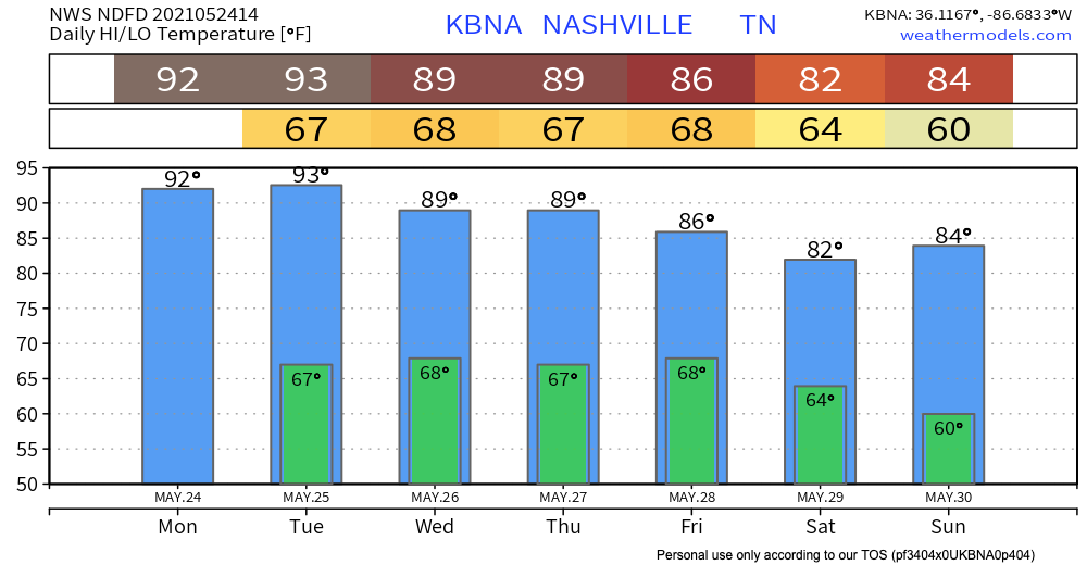
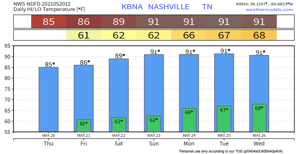
Warm and Humid Thursday
The remainder of today won’t be as warm as the early part of this week, but don’t get too comfortable… the rain from yesterday made sure to hang around just long enough to make it nice and muggy.

The remainder of today won’t be as warm as the early part of this week, but don’t get too comfortable… the rain from yesterday made sure to hang around just long enough to make it nice and muggy.

Rain chances increase this afternoon into the evening. A thunderstorm or two is likely as well. No severe weather is expected with these scattered storms. The main threat with this line of storms are sub-severe wind gusts, so no major scares here.
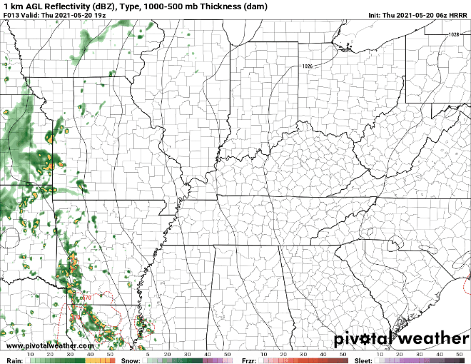
Small chance of some isolated showers today as we heat up. The HRRR shows some little rainy spots around the area. Bet against rain, plan on sweating instead.
Downpours, likely containing lightning, show up on the HRRR model around lunchtime Wednesday continuing through early afternoon.
Today is going to be, if the title didn’t give it away, hot. And also dry.
We’re currently under an advisory until midnight for the ozone levels at the surface. High concentrations of ozone can be unhealthy. The code orange means that although the general public probably won’t be affected, people with respiratory diseases like asthma, or people who spend a lot of time outdoors, such as marathon runners or construction workers, should try to limit their outdoor physical activity, especially during the middle of the day when the sun is the strongest.

Today is shaping up to be just more of the same, warm and sunny. The warming trend will continue throughout this week.
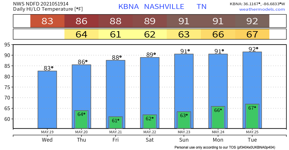
We could see some relief from a cold front by the latter part of the week, but don’t count on a confident ETA this far out.
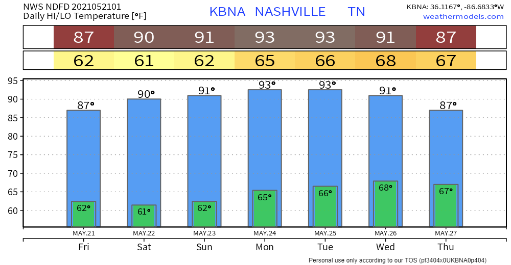
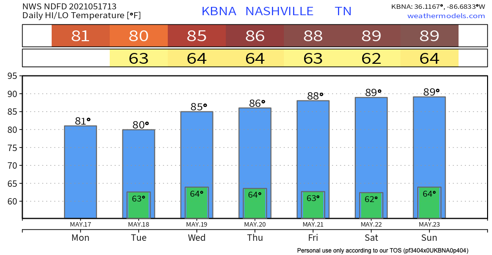
Temperatures are on the rise, and will continue to do so throughout the weekend. Above average temperatures are expected and there is a possibility for record highs, specifically on Sunday.
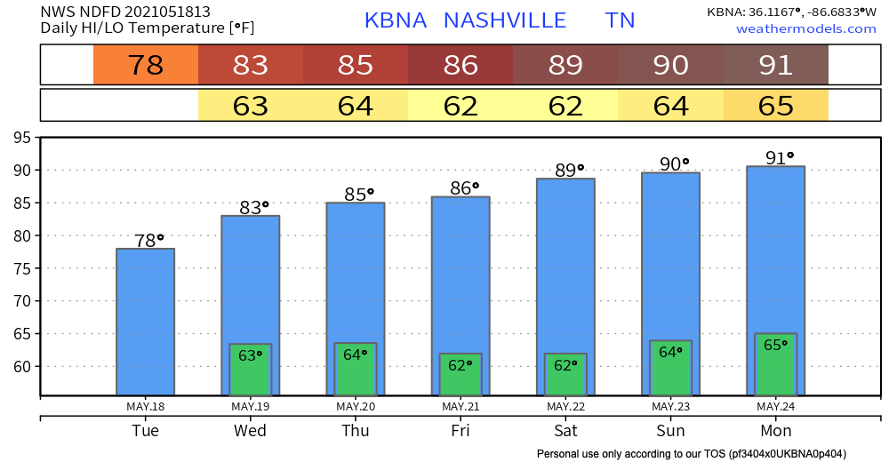
That unbreathable humidity reminiscent of the Tennessee summer will not yet be in full effect, making more comfortable to be outside than say, Late July.
Nothing major to talk about weather wise for our area today.
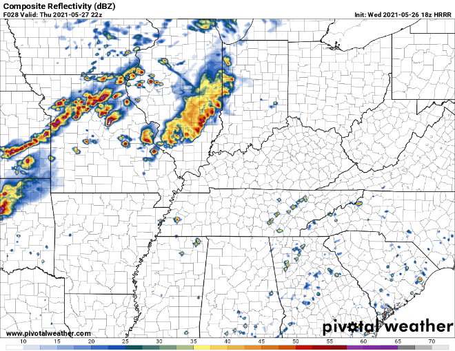
The HRRR shows all rain occurring well to our west, so you can expect a warm and dry Thursday.
The only thing to forecast for Friday is lots of sunshine.
Summer is definitely on its way this week, but today will be a mostly cloudy day. The HRRR through midnight tonight shows a mostly dry day, but a light shower could pop up this morning. Nothing concerning, but maybe keep a small umbrella in your car if you’re wearing a nice outfit.
Expect a few showers here and there early this afternoon.
The HRRR thinks a few showers will develop and slide south to north this afternoon. The Euro model agrees. Look light rain chances to end tonight.
It’s a calm start to the week with not much to worry today. Music to your ears right?! Cloudy skies today won’t produce any rain for your Monday just some heat!
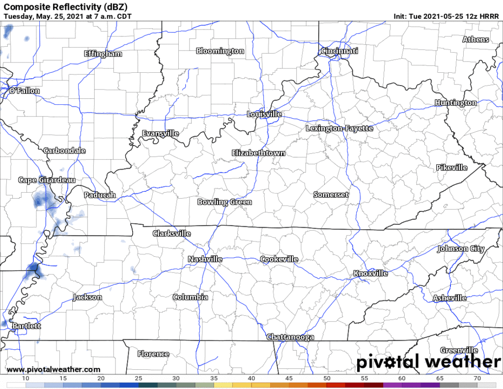
There is rain potential on Tuesday but nothing detrimental to your day. The rain might start to trickle in some Tuesday morning but if there are some drizzles, it would be more so during the mid to late afternoon. Clouds stay tomorrow with increased wind speeds up to 10 mph. Overall, Tuesday’s weather is nothing that keeping an umbrella in your car won’t fix! Not enough rain for a rainout. No lightning or other worries.
You must be logged in to post a comment.