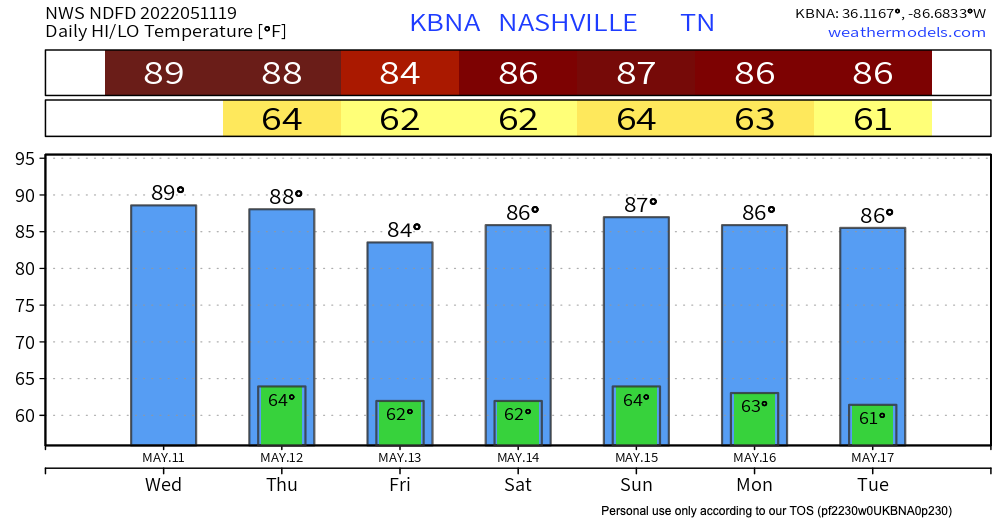
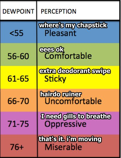
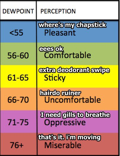
No record breaking heat today (we’d have to make it to 92°; that record was set many, many years ago in 2018). Mid 80’s with low 60’s dewpoints = you’ll be a bit uncomfortable.

No record breaking heat today (we’d have to make it to 92°; that record was set many, many years ago in 2018). Mid 80’s with low 60’s dewpoints = you’ll be a bit uncomfortable.
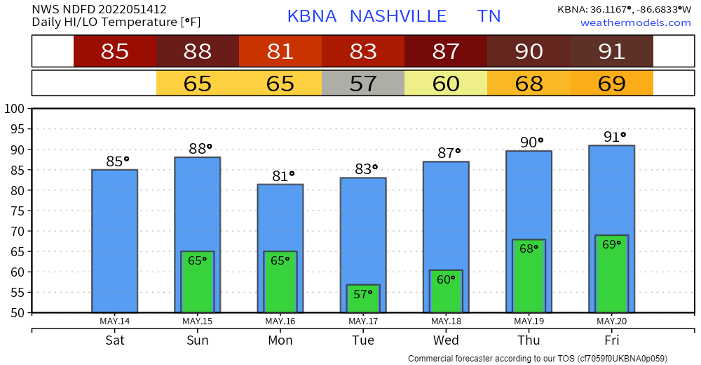
Happy Friday! Today looks like a great weather day with only a slight chance of passing showers. An overnight front showed up and is doing its best to limit dew points to below 60º. It’s hard work, but so far we’re winning the fight against the moisture.

When I started looking at data to write this blog I was hoping I’d see a gradual cool down and a return to more spring like temps.
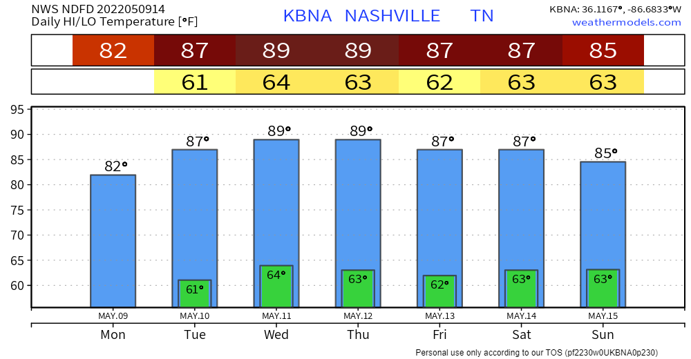
The we’ll see 90º today and upper 80s on Friday with 60º dew points for the entire forecast period. That’s a recipe for hot and sticky feels when outside.
I’ve always loved the rhythm of the seasons in Middle Tennessee. The cold, the heat, and the in between. Right now is the in between. Mornings are comfortable, but sunburns are on tap in the afternoon.
It was summer the last time it’s been as humid as it’s going to be later today and Wednesday.
Tell your friends “relative humidity” is useful for fire danger but dewpoints tell the truth:
Quick References:
Weather changes constantly.
Follow @NashSevereWx on Twitter for any changes to this forecast.
Live coverage during tornado and severe thunderstorm warnings:
Look good.
Support the mission.

This GIF this works today.

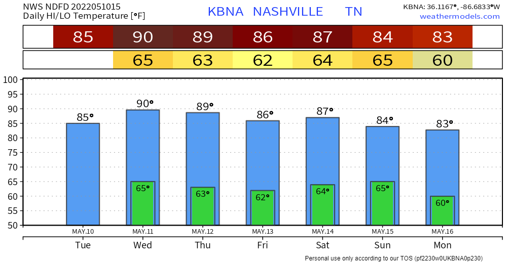
Momjeans not ideal Tuesday when the dewpoint gets into the low 60°s Tuesday with an afternoon high 88°.
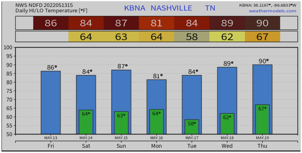
91° Wednesday would break the May 11 daily record (90°) set all the way back in 2016.
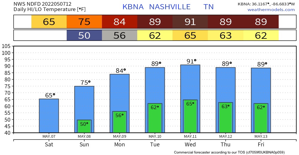
It’s going to be cooler today due to some clouds and a front that moved in last night. Today’s high will be around 65 and for the low, we will reach down to the upper 40s.
The HRRR shows no measurable rainfall, but expect drizzle to continue today.
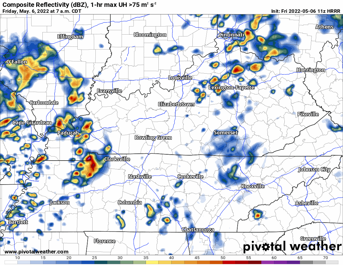
Last night almost all of us saw gusty winds and heavy rain. We were fortunate severe weather mostly avoided our two counties. However, those winds were legit.
Today, we’ll see more rain but not the severe chances we had yesterday.
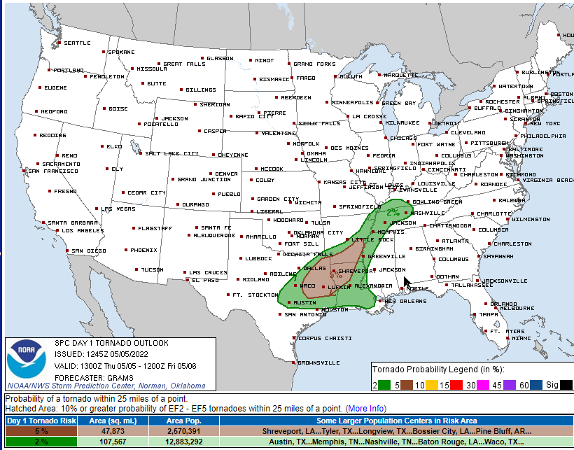
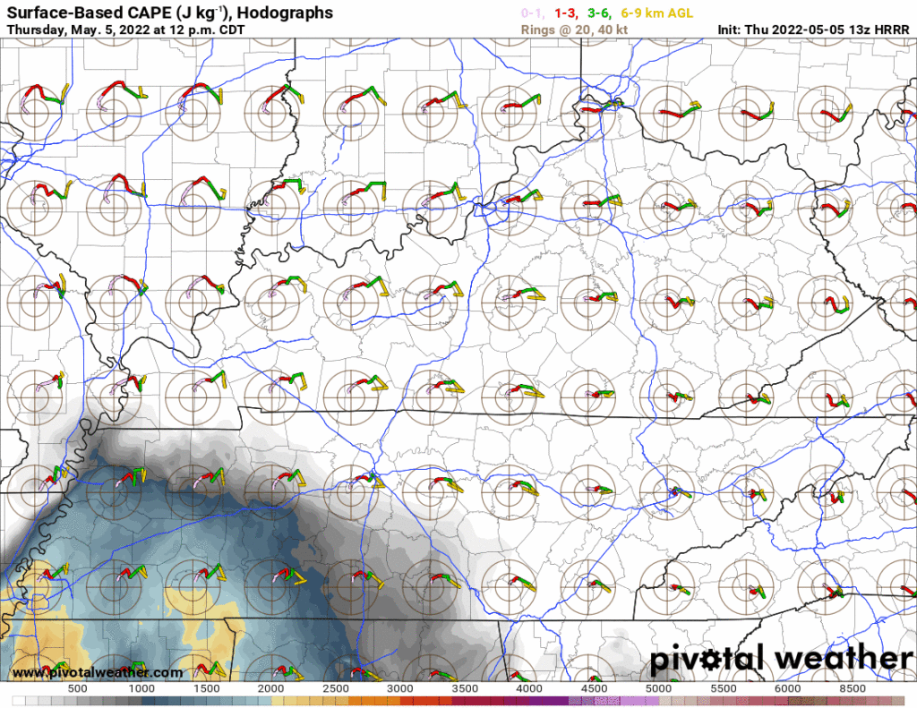
Moist, unstable, storm powering air will lift north into Middle Tennessee this afternoon:
Storms approaching from the west will tap this power source. Heavy rain, lightning, and severe weather are all possible later this afternoon into the early evening.
You must be logged in to post a comment.