

This GIF this works today.

Momjeans not ideal Tuesday when the dewpoint gets into the low 60°s Tuesday with an afternoon high 88°.
91° Wednesday would break the May 11 daily record (90°) set all the way back in 2016.
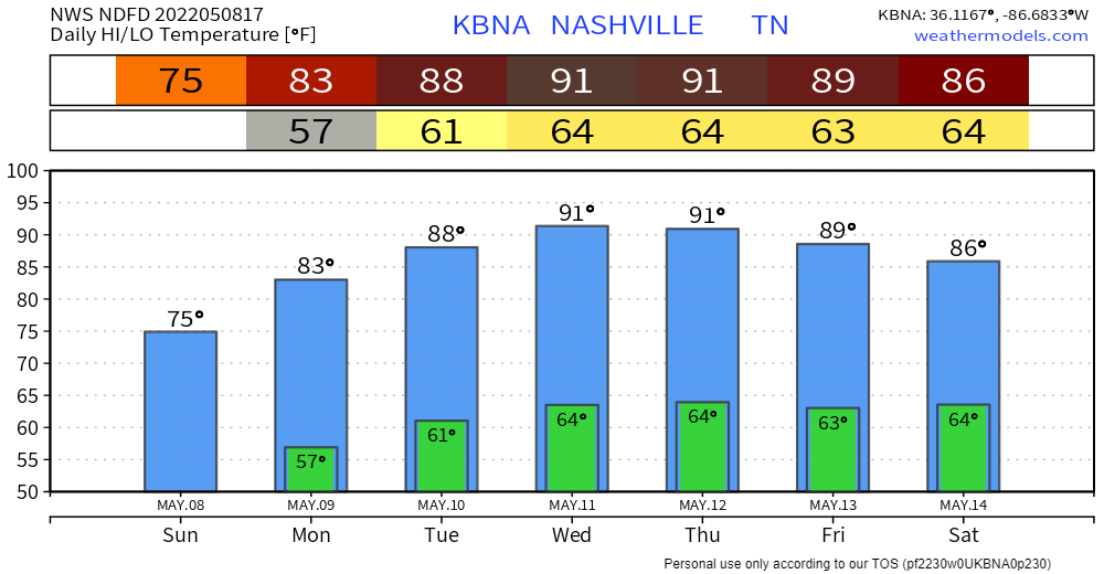
91° Thursday would be close to the May 12 record (92° in 1902). Humidity will drop a bit Weds so even tho not as humid as Tuesday upper 50°s dewpoints are still CHEEKS.
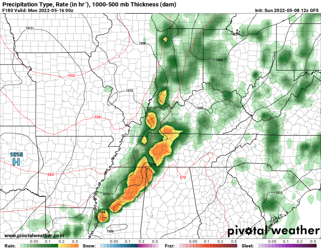
Rain may pop off Saturday afternoon. Models think rain (storms?) Sunday is (are) more likely. Here’s Sunday afternoon on the GFS model:
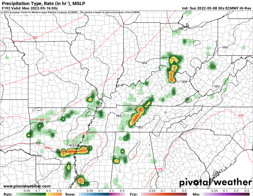
And the Euro Sunday afternoon.
Should you “trust” the GFS and Euro model output exactly one week from today?

Quick References:
Weather changes constantly.
Follow @NashSevereWx on Twitter for any changes to this forecast.
Live coverage during tornado and severe thunderstorm warnings:
Look good.
Support the mission.
We are 100% community supported. No ads. No subscription fees. Keep it free for everyone.
Categories: Forecast Blogs (Legacy)
You must be logged in to post a comment.