
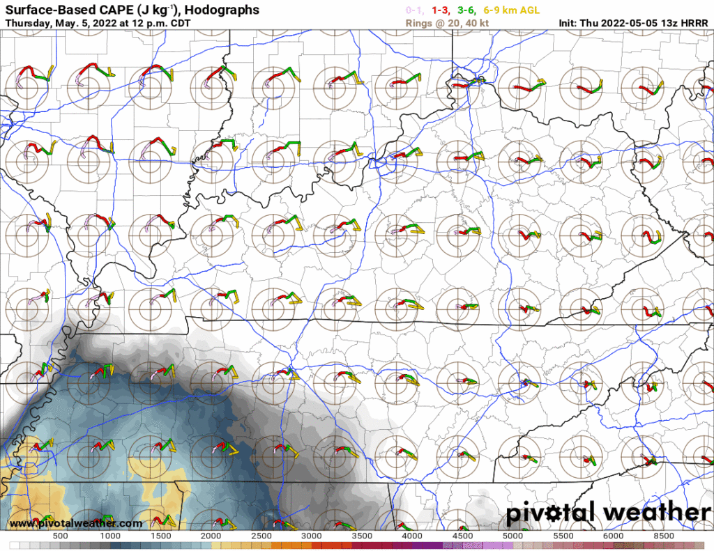
Moist, unstable, storm powering air will lift north into Middle Tennessee this afternoon:
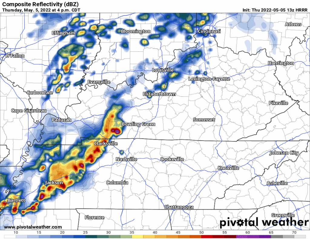
Storms approaching from the west will tap this power source. Heavy rain, lightning, and severe weather are all possible later this afternoon into the early evening.
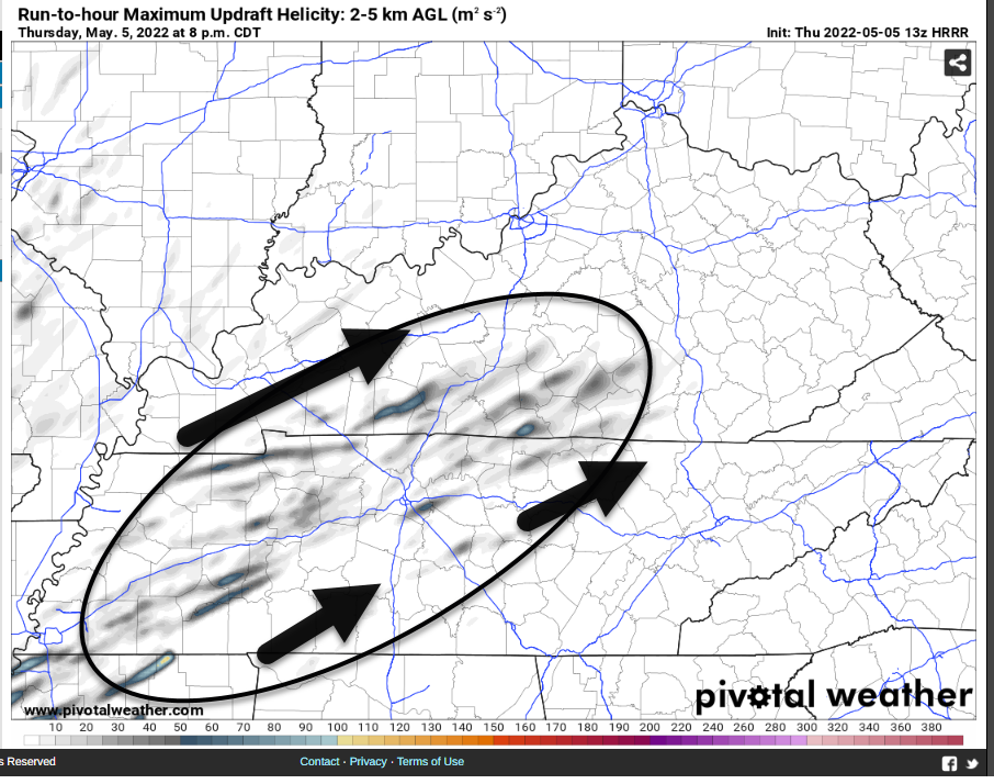
Storms suggest “updraft helicity” will be present, indicating potential for supercell or multicellular storm structures capable of rotation. Rotating storms are efficient damaging wind producers. Sometimes they can make hail, even tornadoes if all the right conditions align. HRRR below shows several updraft helicity swaths locally late this afternoon and early tonight.
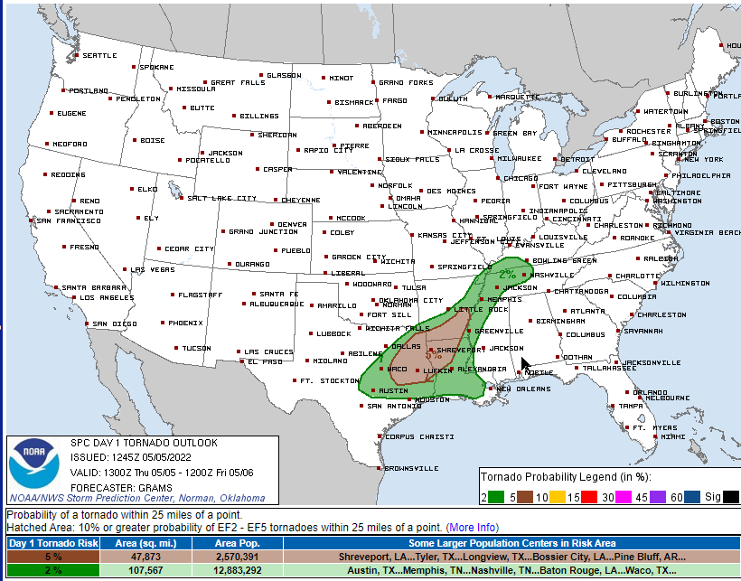
Many storms rotate, but few rotating storms produce tornadoes. Shear doesn’t look alarming for tornadoes. STP values range from 0.5 to 1.5 locally, also not alarming. HRRR model soundings show lack of low level southerly winds which would also reduce tornado fears. But, there’s still a low-probability tornado risk. SPC puts the probability of a tornado within 25 miles of you at 2%. Damaging straight line winds (15%) and hail (5%) carry higher probabilities.
Then, later tonight, heavier rain will move through. Late afternoon/early evening storms should consume storm fuel, leaving very little for the rain to tap to convert them into strong or severe storms. Therefore the severe concern today is for late afternoon/early evening, not late tonight. Rain may be locally heavy for some (1″ or more), but most will see less. Well short of what it would take to issue Flash Flood Watches or anything like that. But I suppose a few local spots may briefly see too much. Not a big concern right now.
Storms will freckle the radar Friday morning through the afternoon, intermittently and unevenly distributing downpours and lightning. There is no ETA for any outdoor event Friday! Check out how scattered they are on the HRRR model:
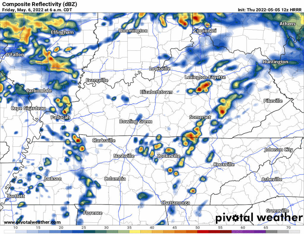
If I had to bet on a most likely storm time it would be lunch/early afternoon. Storm fuel will return and we may even see a few strong/severe storms during that time. HRRR model data and SPC outlooks remove tornado concerns, but we may see lightning and maybe a few strong/severe straight line winds or hailers with these. Notice storm coverage tapers off as we approach Friday night.
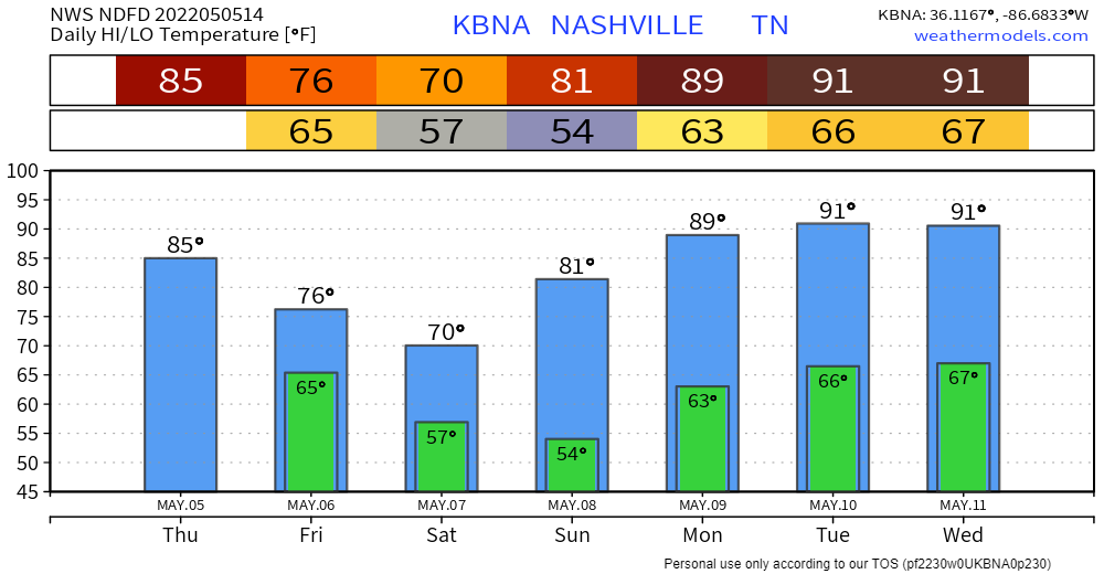
Beautiful weekend ahead, then we’ll be near or above 90° at least from Monday through Wednesday.
Quick References:
Weather changes constantly.
Follow @NashSevereWx on Twitter for any changes to this forecast.
Live coverage during tornado and severe thunderstorm warnings:
Look good.
Support the mission.
We are 100% community supported. No ads. No subscription fees. Keep it free for everyone.
Categories: Forecast Blogs (Legacy)
You must be logged in to post a comment.