
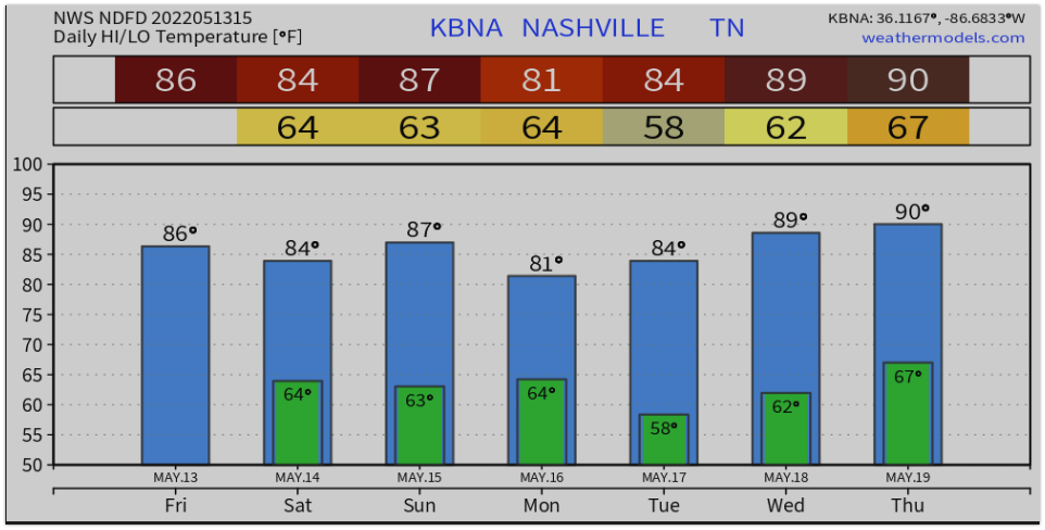
Happy Friday! Today looks like a great weather day with only a slight chance of passing showers. An overnight front showed up and is doing its best to limit dew points to below 60º. It’s hard work, but so far we’re winning the fight against the moisture.
Tonight, things should stay cool and comfortable.
Steeplechase

A Nashville tradition returns (Along with its traditional equal chance of sunburns and muddy shoes).
The forecast for Saturday at Percy Warner Park is mostly sunny and hot. Temps will likely be in the mid to upper 80’s. There are a few isolated chances for rain, and some models like our rain chances more than others. Let’s dive in.
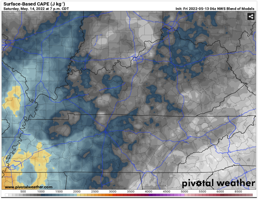
Surface based cape (storm fuel) will roll in overnight and prime the atmosphere for a decent thunderstorm should one bubble up.
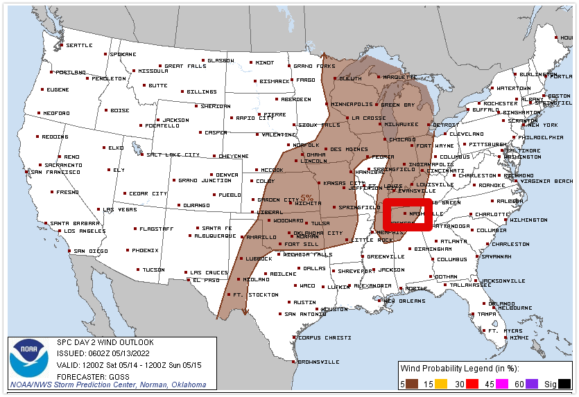
The storm prediction center has outlooked us for a 5% chance of a damaging wind and hail event.
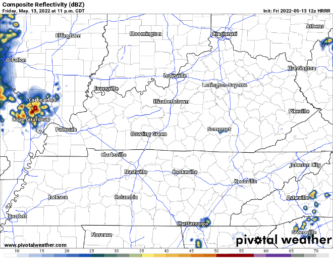
But the chances for storms occurring are generally low. Below, the HRRR isn’t impressed and at this range before an event, that’s a good sign.
Other models disagree and have rain dotting the simulated radar early in the morning, and others later in the day.
Bottom line. Be prepared for sun and rain. Its steeplechase after after all. We’ll keep an eye on the radar far from the festivities this year.

Sunday and Beyond
The GFS model and this morning NWS Nashville Area Forecast Discussion mention a line of storms the could move in from the west Sunday evening. The timing and severity here are not clear at this point. The system brining that storm potential will also cause a slight drop in our temps.
Have a great weekend!
Quick References:
Weather changes constantly.
Follow @NashSevereWx on Twitter for any changes to this forecast.
Live coverage during tornado and severe thunderstorm warnings:
Look good.
Support the mission.
We are 100% community supported. No ads. No subscription fees. Keep it free for everyone.
Categories: Forecast Blogs (Legacy)
You must be logged in to post a comment.