
It was summer the last time it’s been as humid as it’s going to be later today and Wednesday.
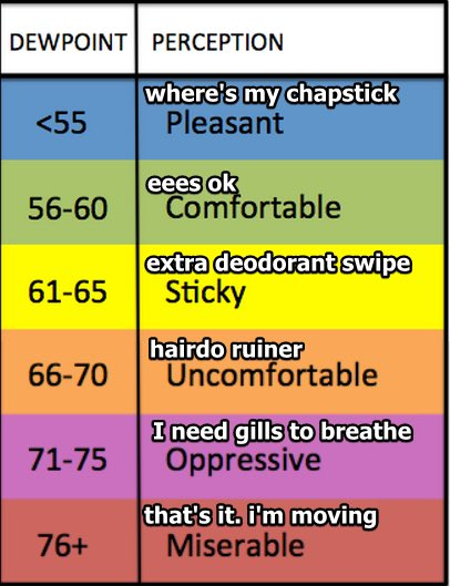
Tell your friends “relative humidity” is useful for fire danger but dewpoints tell the truth:
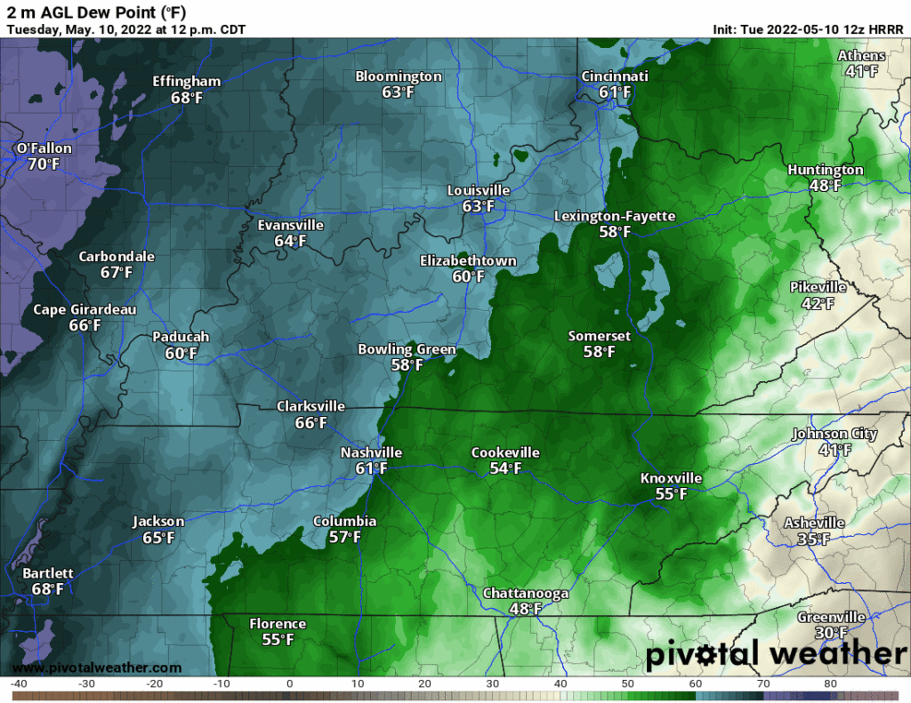
Dewpoints from noon today to midnight Wednesday gonna stay in the mid 60°s. Swamp seen on HRRR below, at least we’re not near St. Louis?
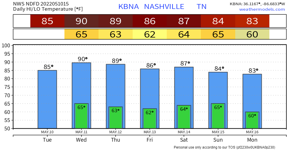
Temps climbing closer to 90° Weds. Probably won’t break a record high Weds because of cloud cover. Few degrees short, yay?
We will “have to keep an eye out for the potential of an isolated shower during the day on Wednesday” (NWS-Nashville) but the odds of that are super low, you’ll have to be really special to win/lose the shower lottery.
Dewpoints drop from the 60°s Wednesday into the mid 50°s Thursday through the weekend, so kinda actually pretty good.
Scattered afternoon showers/storms Friday should be east of us, but they may develop here locally Saturday afternoon.
“A surface front will swing through the area ahead of an upper trough sliding through the Midwest on Sunday. This will give us the greatest rain chances in our area Sunday afternoon.”(NWS-Nashville). Doesn’t look like a total washout or anything.
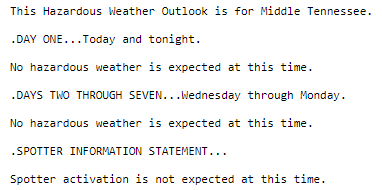
No hazardous weather on the horizon. Swampmidity doesn’t count tho.
Quick References:
Weather changes constantly.
Follow @NashSevereWx on Twitter for any changes to this forecast.
Live coverage during tornado and severe thunderstorm warnings:
Look good.
Support the mission.
We are 100% community supported. No ads. No subscription fees. Keep it free for everyone.
Categories: Forecast Blogs (Legacy)
You must be logged in to post a comment.