
Little windy today, no big deal. Locate chapstick: low 40°s dewpoints.
Ian should be a tropical depression in mountains of east NC Saturday afternoon.
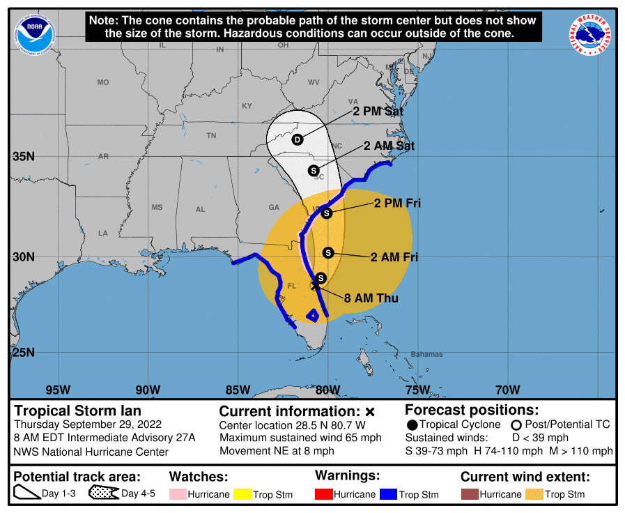
Probably too far east to bring us rain this weekend.

Little windy today, no big deal. Locate chapstick: low 40°s dewpoints.
Ian should be a tropical depression in mountains of east NC Saturday afternoon.
Probably too far east to bring us rain this weekend.
Marginal fire danger today. Gusty winds and low relative humidity may spread outdoor fires. So maybe don’t burn things today.
Ian won’t bring us wind, tornadoes, or flooding. Right now it looks like it might not bring us rain.

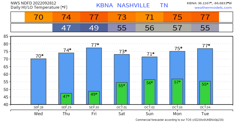
Morning jackets needed with lows in the 40°s. Roof frost is appearing in locations that often get way colder than the official BNA low.
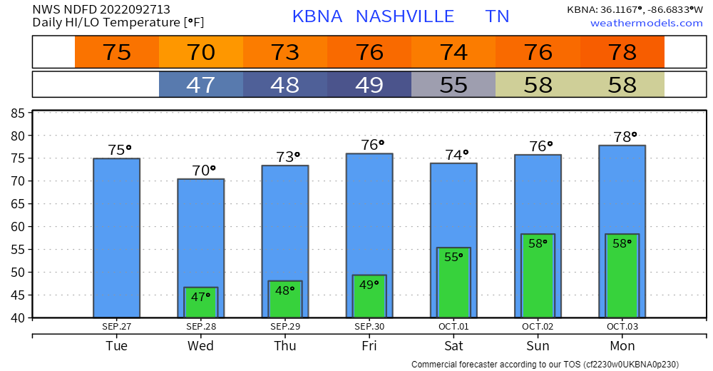
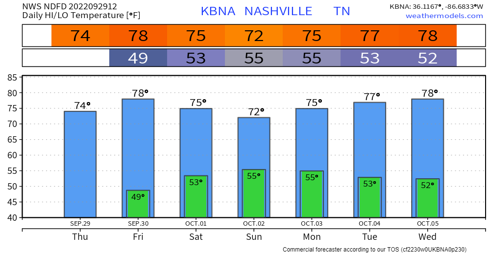
Warmer this weekend as Ian moves inland.
Ian
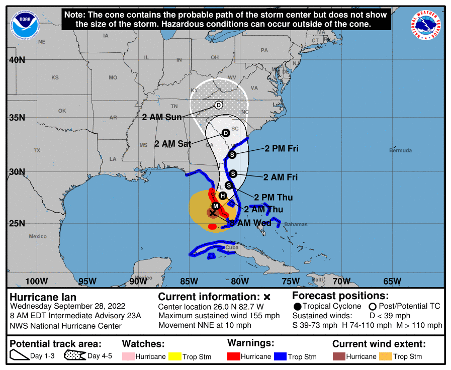
Ian will become a major hurricane as it approaches Sarasota/City of Tampa midweek. We are not a landfalling hurricane source so follow @NHC_Atlantic and noaa.gov/ian for the latest forecasts.

Brushfires could spread.
Locate your morning jacket, fam.
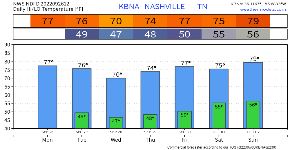
Ian’s after-landfall, inland path is unknown. One set of models brings its remnants into Middle Tennessee this weekend. Rain the only impact.

Rain today should miss us.
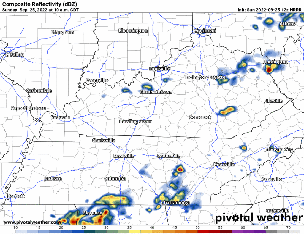
South and east of us according to the HRRR model 👇🏽.
No promises but activities today look good.
Maybe don’t burn things tomorrow.
Where the ground is dry, when relative humidity drops, and where wind is picking up, you should not burn things. Fire loves dry ground, winds, and low relative humidity. This will be Monday, which “could bring some marginal fire danger.”

Rain is on the Saturday morning radar. This 👇🏽 is from 7:30 AM. See this for an updated image.
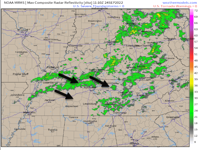
Some of this rain is not reaching the ground. Most of it is.
The rain is light. I’m bringing a rain jacket to rollyball fields this morning.

When you run a poll the day after it was 100°:
I’m going to rerun this thing in late winter after a cold snap to see what happens.
FWIW (nothing) I’m team summer, my feet never get warm in the winter.
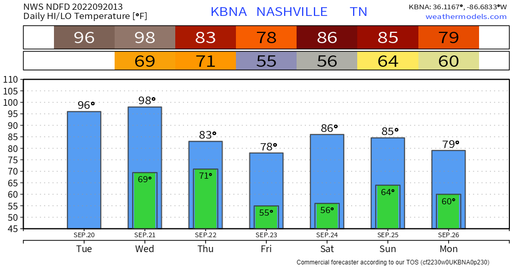
High today only 81°.
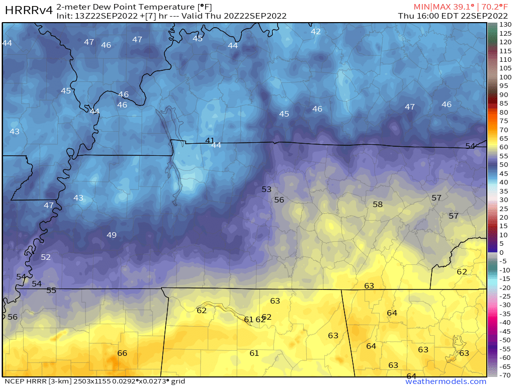
It’s still a bit humid right now. This afternoon, a cold front will sweep away yesterday’s humidity 👇🏽
A few light showers may get caught up in the airmass change today, but they’ll be of little/no consequence. HRRR model 👇🏽.
97° is the record high September 21 temp. We should break this record. The official forecast high is 99°.
(Some were asking if we would hit 100° but models aren’t so sure we’ll get that far over 97°. Clouds may slide over the official observation sight. The heat making ridge may be weakening just a bit).
The record high for today /checks calendar/ September 20 is 97° (2018). 96° is forecast.
Tomorrow the record is 97° set in 1955. We are forecast to break that record (98°).
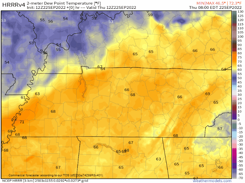
Humidity should be higher than previous forecasts. Mid/Upper 60°s dewpoints will drive the heat index to 100° today and 99° tomorrow.
You must be logged in to post a comment.