

Morning jackets needed with lows in the 40°s. Roof frost is appearing in locations that often get way colder than the official BNA low.
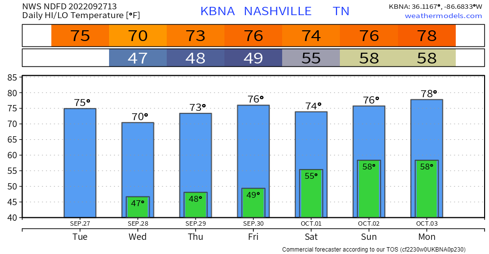
Warmer this weekend as Ian moves inland.
Ian
Ian will become a major hurricane as it approaches Sarasota/City of Tampa midweek. We are not a landfalling hurricane source so follow @NHC_Atlantic and noaa.gov/ian for the latest forecasts.
Ian might bring us a little rain, with
- no flooding,
- no wind,
- no hail,
- no tornado threat.
The WPC forecast 👇🏽 has rain missing us just to the east this weekend:
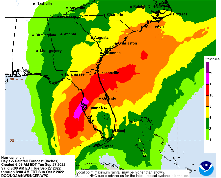
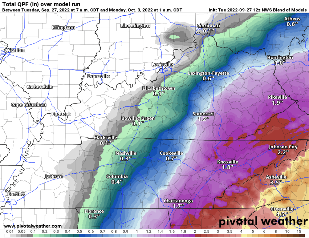
National Blend of Models 👇🏽 has a little rain in here Saturday afternoon/night. I prefer the WPC forecast 👆🏽 over the NBM model 👇🏽. Both will be tweaked in time. There’s still uncertainty exactly how far east Ian’s rain will reach.
Dry stretch may be incoming. Euro ensemble data has 3″ of rain total through the first week of November. That’s … not a lot.
Quick References:
Weather changes constantly.
Follow @NashSevereWx on Twitter for any changes to this forecast.
Live coverage during tornado and severe thunderstorm warnings.

Look good.
Support the mission.

We are 100% community supported. No ads. No subscription fees. Keep it free for everyone.


Categories: Forecast Blogs (Legacy)
You must be logged in to post a comment.