

Brushfires could spread.
- Low relative humidity and winds 10 to 15 MPH expected today and tomorrow.
- These conditions can spread fires, especially where little rain has fallen lately.
- But the concern is low.
- NWS-Nashville is monitoring. They have not issued any warnings (called Red Flag Warnings). Winds aren’t quite strong enough to raise serious concerns. And it may not be dry enough.
- We will update you on Twitter if this changes.
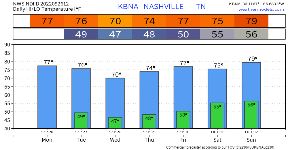
Locate your morning jacket, fam.
Ian’s after-landfall, inland path is unknown. One set of models brings its remnants into Middle Tennessee this weekend. Rain the only impact.
- By midweek Ian should be major hurricane moving along Florida’s west coast – that’s the Gulf side.
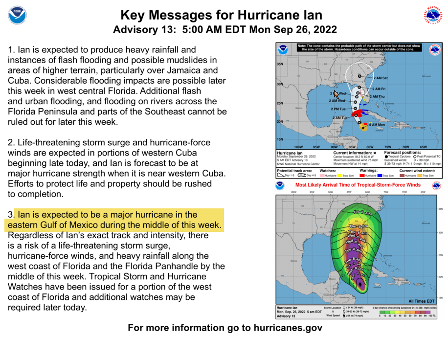
- Ian could take a western or eastern path. Models are split. The Euro takes it west – that would mean weekend rain for us. The GFS and other models take it east – that would miss us.
- The “worst case” for us is not bad – we get needed rain this weekend. Ian will be sheared apart and disorganized if it makes it to Middle Tennessee. Neither strong winds nor flooding are a Middle Tennessee concern at the moment.
- For the latest on Ian follow the National Hurricane Center. Read their forecasts, not just one model.
Quick References:
Weather changes constantly.
Follow @NashSevereWx on Twitter for any changes to this forecast.
Live coverage during tornado and severe thunderstorm warnings.

Look good.
Support the mission.

We are 100% community supported. No ads. No subscription fees. Keep it free for everyone.


Categories: Forecast Blogs (Legacy)
You must be logged in to post a comment.