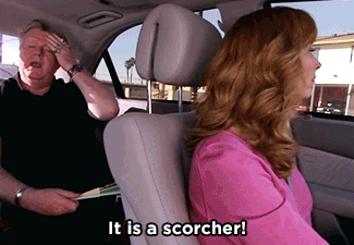
It’s hot today but not sure it’s a “scorcher.”
We wrote “Sweaty Not Wetty” last night only to wake up this morning to HRRR model runs popping off isolated late afternoon/early evening downpours and thunderstorms:

It’s hot today but not sure it’s a “scorcher.”
We wrote “Sweaty Not Wetty” last night only to wake up this morning to HRRR model runs popping off isolated late afternoon/early evening downpours and thunderstorms:
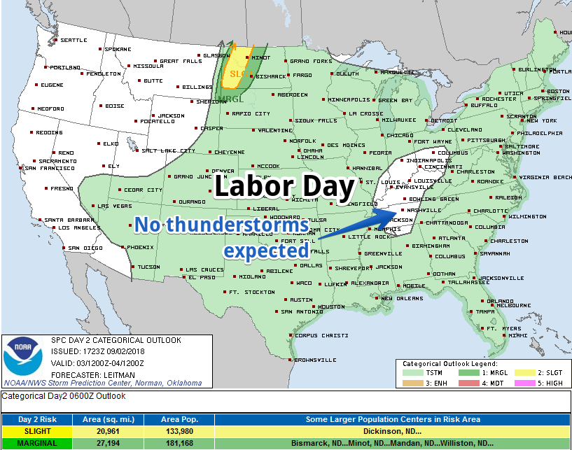
The Storm Prediction Center does not think we will see Labor Day thunderstorms:
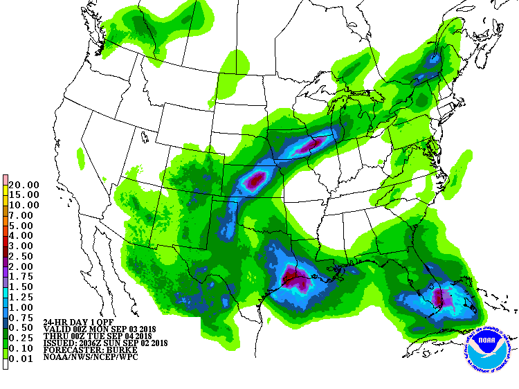
The Weather Prediction Center forecasts for us no Labor Day rain:
NWS-Nashville agrees, figuring only a 10% probability of precipitation (black arrow) and betting no rain will actually hit the pavement (red arrow):
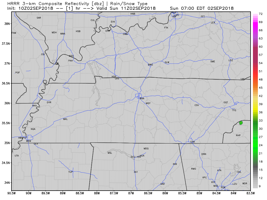
It’s possible an isolated shower or storm will pop up this afternoon. The HRRR model thinks so:
As usual for summer, shower/storm locations are unknown. Buy a lottery ticket and hope for the best.

Happy First Day of September!
Meteorological Fall
If you follow the meteorology community on social media, you may see the term “Meteorological Fall” thrown around today. This refers to the beginning of what are considered the “fall months” of September, October, November. Not be confused with the fall season which begins on September 22! Fall temps are still out of reach.
Ok, everyone on 3… 1, 2, 3, Summer! Time! Pattern! Today is another day in the hot soupy mess. Temperatures will be approaching 90º for a high today with dew points in the 70º range. It will be hot, even in the shade today.
Clouds will be pretty widespread today, keeping high temps in the upper 80s. Dewpoints are oppressive, in the low 70s, a normal for late-August.

Morning showers over Nashville left our atmosphere with plenty of moisture and instability that could kick off afternoon showers and storms. Any storms that go up aren’t expected to reach severe levels.

The sweat machine rolls on today… expecting highs in the low 90s today with dew points in the 70s (oppressive range).
The upper ridge (high pressure) that has brought us the hot and humid weather the past several days will begin shifting eastward as weak cold front moves southward into the Tennessee Valley, opening the door for rain.
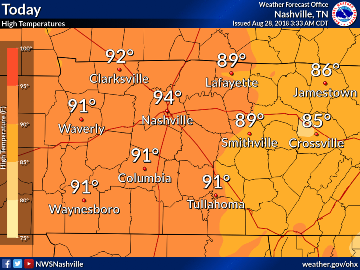
High temps will climb into the low/mid 90°s today. Dewpoints continue to stay within the low 70°s making temps feel closer to 100°.
We could see a popcorn shower/storm or two over Nashville today. The HRRR model shows storms going up during the hottest time of the day. You could see a quick downpour and hear a few rumbles of thunder, but that’s pretty unlikely. Showers should be scattered far and wide.
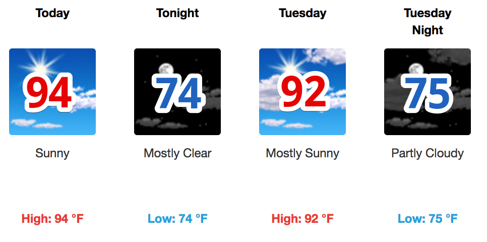
Temperatures will increase today, tomorrow, and Wednesday, stopped only by the arrival of clouds and rain beginning sometime Wednesday. Expect high temperatures to be in the low to mid-90s with morning lows in the mid-70s.

This morning, the HRRR model predicted this afternoon’s showers and thunderstorm, which poked through high pressure like a hernia through a tummy.
If you were north of the 24/65 split, near Skyline and Madison and Goodlettsville, you could not ignore it. It tossed lightning and prompted NWS-Nashville to issue an Areal Flood Advisory and a Significant Weather Advisory.
You must be logged in to post a comment.