
The sweat machine rolls on today… expecting highs in the low 90s today with dew points in the 70s (oppressive range).

The upper ridge (high pressure) that has brought us the hot and humid weather the past several days will begin shifting eastward as weak cold front moves southward into the Tennessee Valley, opening the door for rain.
Higher coverage in showers and storms is expected today when compared to what we have seen in recent days.
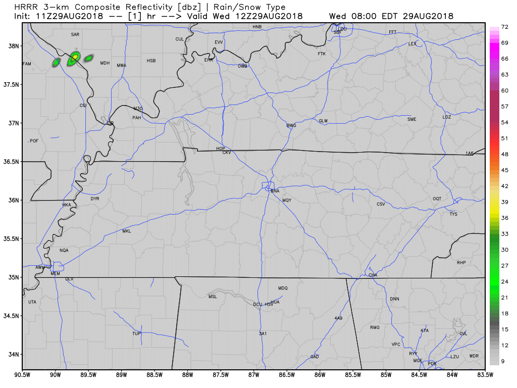
This morning’s run of the HRRR model (below) shows exactly that. Still keep your afternoon plans… just introduce a Plan B if one of the showers moves over your area.
Timing on any storms remains unclear, but as usual in the summer, they’re more likely in the afternoon. Rainfall totals still look to be under a half of an inch.
Quick Heat Relief Thursday…Because Rain/Storms
Rain and storms are most likely Thursday. Models are still unceratin on the timing, however NWS-Nashville shows rain is likely to occur during daylight hours, but it won’t be an all-day (or even a most-of-the-day) event. Rainfall totals will be under one inch through Friday’s evening hours.
Severe weather is not expected, but you may have to shelter from lightning.
A quick return to the daily afternoon summertime pattern is expected as we roll into the holiday weekend. Stay tuned to the evolving forecast on Twitter, @NashSevereWx!

Categories: Forecast Blogs (Legacy)
You must be logged in to post a comment.