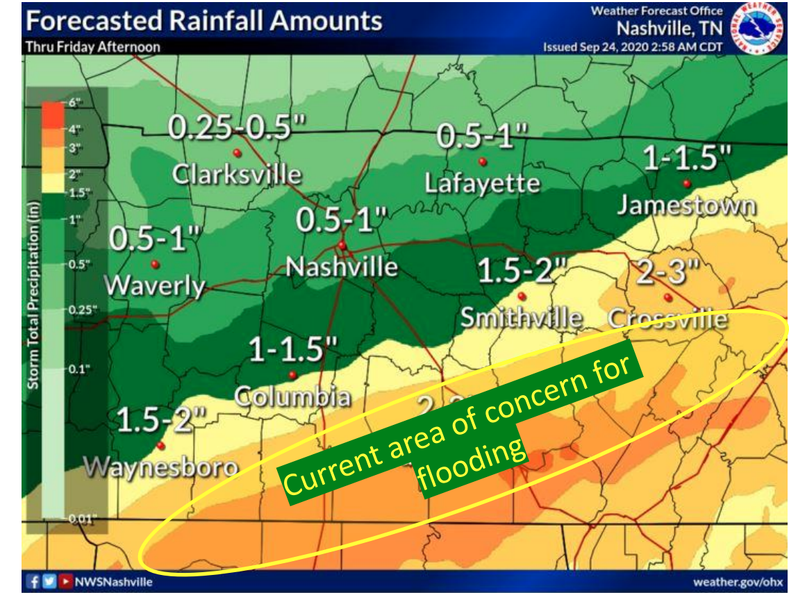
Post Tropical Depression Beta is now in central MS.
Beta’s northeast side is producing heavy rainfall in Middle Tennessee.
The north edge of that rain is cutting through our counties. More rain south, less rain to the north.

Post Tropical Depression Beta is now in central MS.
Beta’s northeast side is producing heavy rainfall in Middle Tennessee.
The north edge of that rain is cutting through our counties. More rain south, less rain to the north.
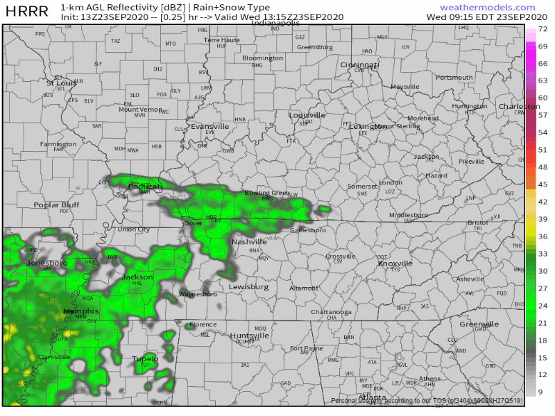
Step outside and you’ll feel a few sprinkles.
The HRRR model predicts more off and on light showers through the afternoon and evening.
Around a tenth of an inch of rain is expected. Probably not enough to rain out outdoor activities, but you may want an umbrella or rain jacket.
At 8:31 am this morning, we officially made it to the end of summer.
Not very “2020” of Mother Nature, but our temperatures will be below average today!
On the autumnal equinox, there are nearly equal amounts of daylight and darkness. Sunrise in Nashville is at 6:35 am, and sunset is 6:43 pm. The amount of daylight is getting smaller as winter inches closer…
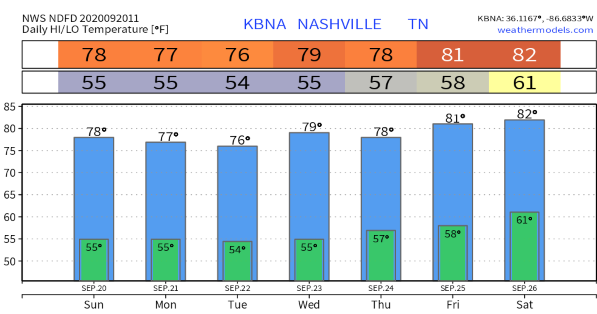
Kicking off our week by continuing our trend of high temperatures in the 70s and a lot of sunshine until mid-week.
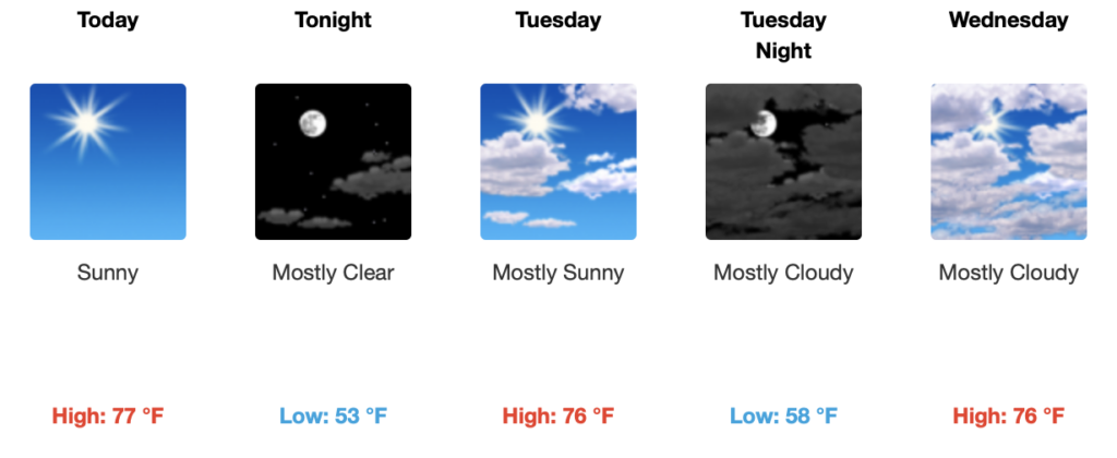
We’re slightly below average in terms of high temperatures, but not by a lot. Normal highs for this time of year usually range in the low to mid 80s and for the past few days, our highs have been in the mid-upper 70s.
Today will be the opposite of a week ago.
Last Sunday:
Fall-like temperatures continue today along with mostly sunny skies. High temps shouldn’t exceed 80.

Fall officially starts Tuesday! As you can see by the graphic, the lowest temps this week will be on Tuesday. So festive.
It’s going to feel great today!

Highs will be near 76° with a nice breeze and clear skies!
Temps will drop into the lower 50s tonight. If you have any outdoor plans, you might want to grab a light jacket!
Three of the best words in weather.
A few clouds this morning will give way to a mostly sunny afternoon. High temperatures will reach 75º.

The wind may pick up a bit, but nothing a little kite flying can’t take care of.
Tropical Depression Sally will pass east of us today. Winds rotate counterclockwise around Sally. As Sally passes east, our east wind will shift into a cooler, drier north wind.
Today’s north wind will continue into the weekend. Friday temperatures will drop humidity and temps, with afternoon highs in the mid 70’s.
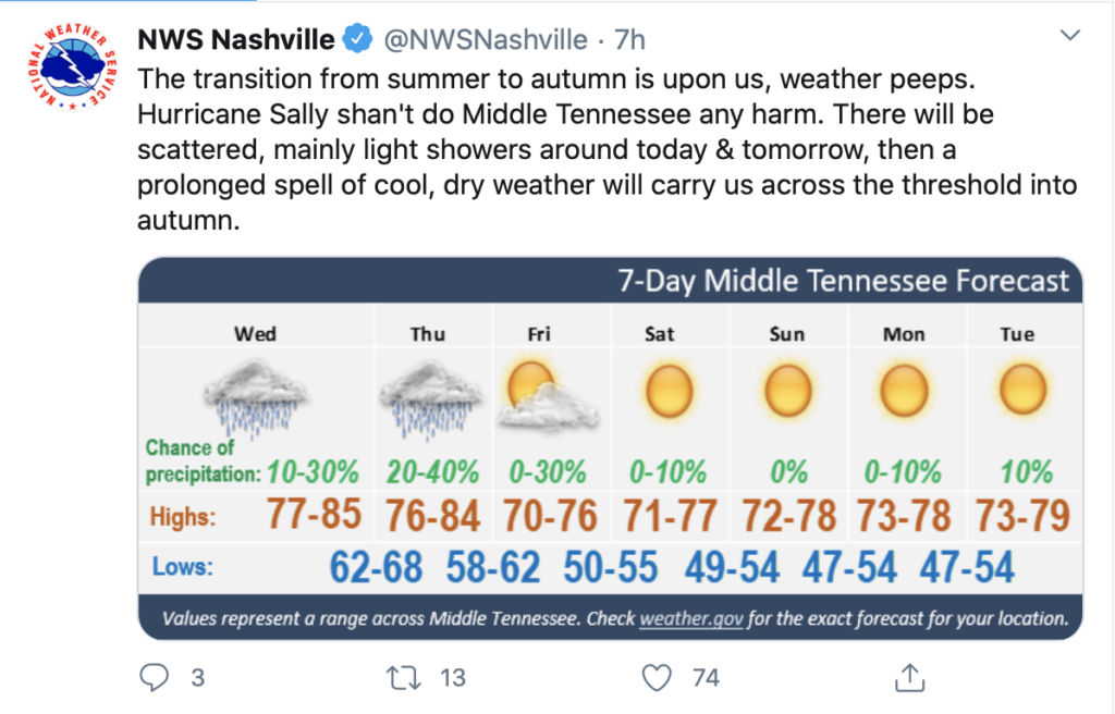
Hurricane Sally made landfall as a Category 2 hurricane after churning the Gulf Coast this past week. Maximum sustained winds of 100 MPH brought heavy winds and catastrophic flooding to the coast area like Gulf Shores, AL, and Pensacola, FL

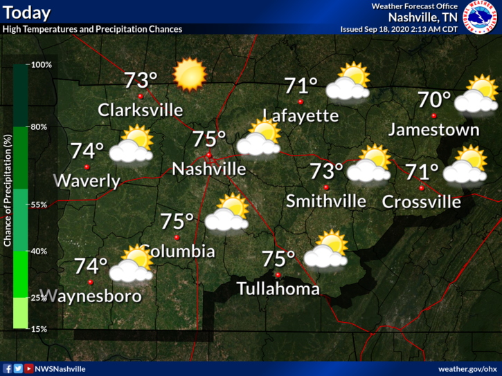
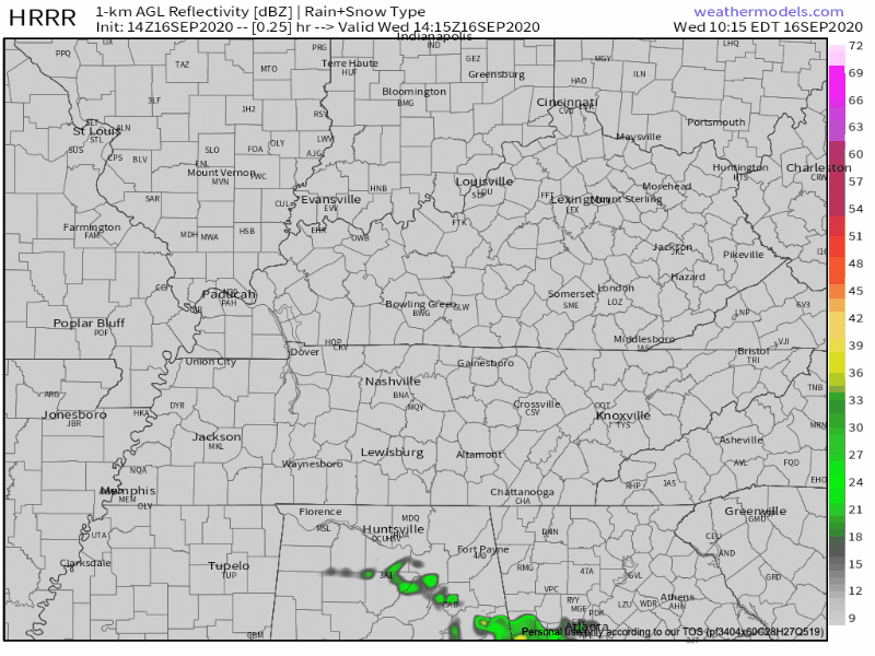
A few scattered showers may sneak into Middle Tennessee this afternoon. The HRRR model thinks this is unlikely, though.
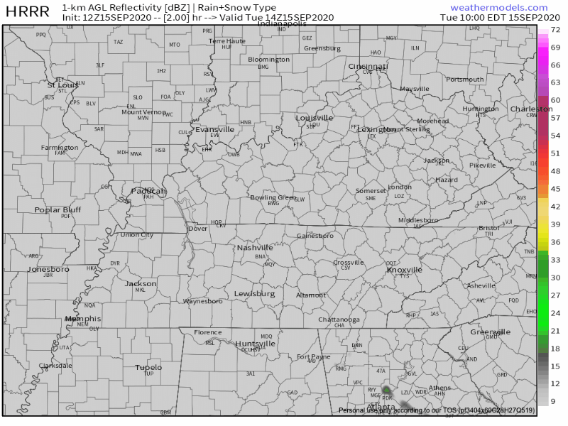
Pretty scattered if you ask me… If anything materializes, it will be in the afternoon.
You must be logged in to post a comment.