Scattered Storms; Rain Event Starting Wednesday; Tropical Depression Four

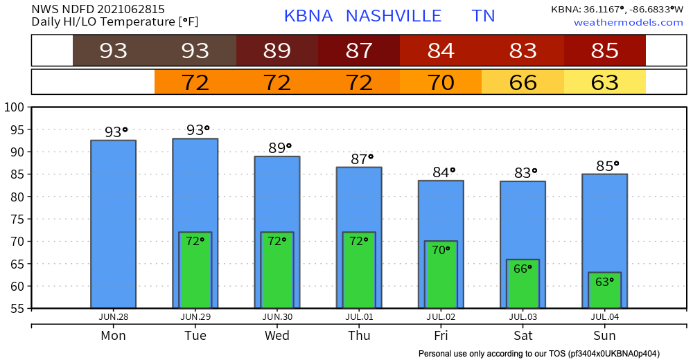
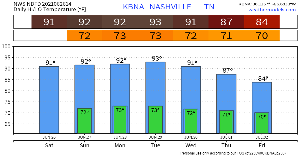
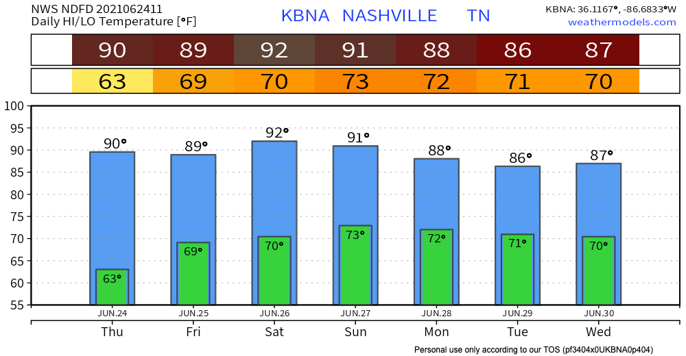
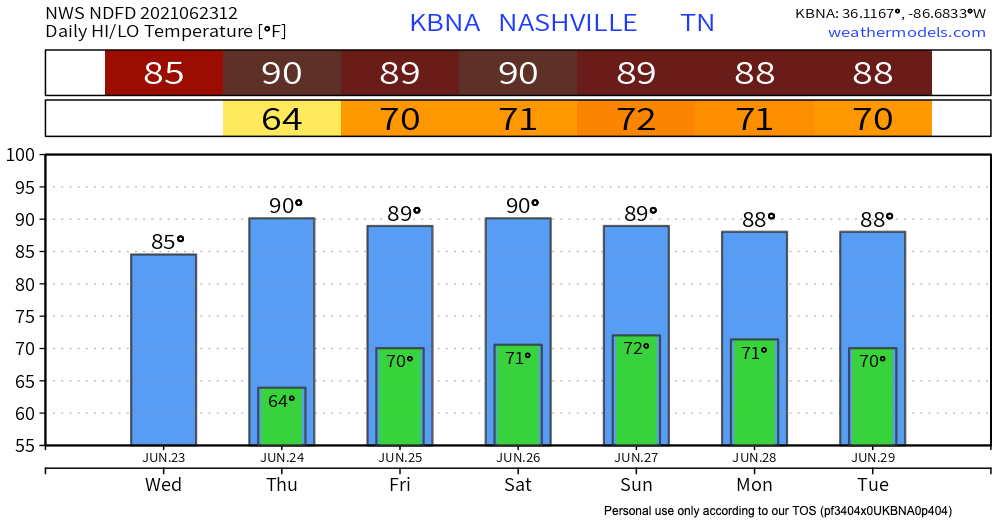
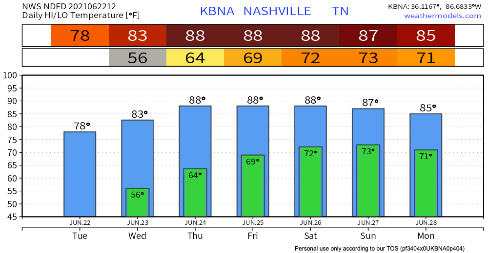
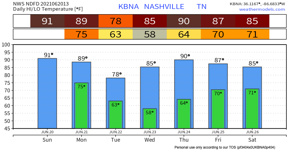
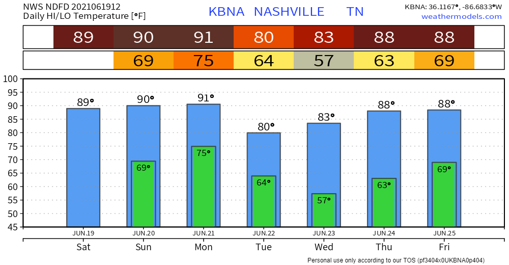
Expect a few pop up showers and lightning storms starting this afternoon. Some storms stay into the night but most fade away with the heat of the day.
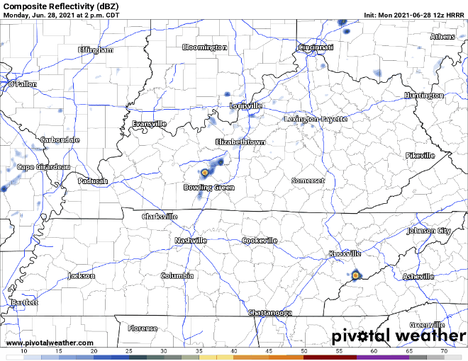
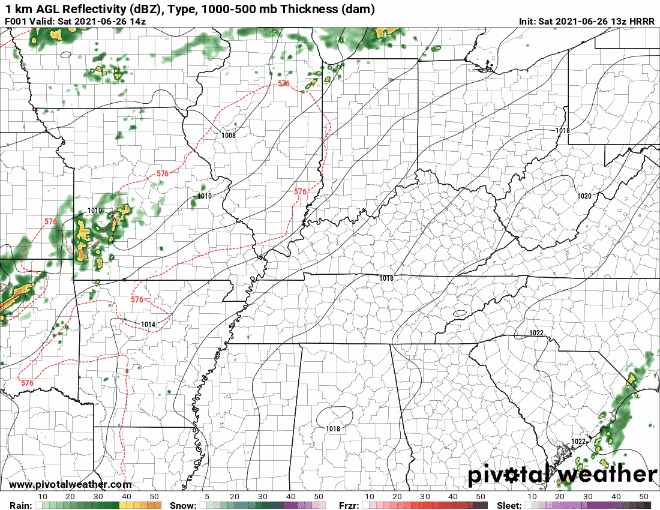
Hot. Humid. Popups. Then, Late Week Rainer.

Dewpoints approaching 70° this week. A cold front (ETA Saturday-ish) will rescue us. Until then, sorry hair.

Isolated afternoon showers may be somewhere in Middle Tennessee today. It’s unlikely one will isolate on you. read more

Heat Building, Rain Chances Increase Early Next Week

Rain is holding back to the west of us and is expected to stay there today. This should keep us dry. HRRR model:

Those out at local events today will notice temps warmer than yesterday as well as a bit more humidity, but nothing overly oppressive. Great weather for the Steeplechase event today as well as the Blackberry Jam Music Festival in Franklin. read more

Rain-Free Start To the Weekend

Rain chances continue to dwindle for the rest of today and tomorrow–models are tending drier with each run. All the atmospheric features that were expected to bring rain are moving farther to the north and west of us. More cloud coverage today but not much else. read more

Keeping it Dry ... For Now

Temps have risen from earlier this week, so today is going to be hot. Dewps have risen too, but not to apocalyptic levels. It will feel sticky, not like you’re drowning. No rain today.

Dry trend should continue Friday. HRRR shows no rain in our area. Friday overall should be very similar weather wise Thursday. read more

One More Pretty Day

Today will be the same as yesterday – slightly higher but not sweltering temps, low dewps, light wind. You can thank the low pressure trough spinning in east winds.

Unfortunately, the trough will head east Thursday and our winds will turn south. That means temps and dewps will rise. read more

Sunny and 70s!

The rain and storms have made their way to our East, and what’s left is some mild temperatures and low dewpoints.

How long will it last?

Two days. The surface high that’s providing these awesome temps will be here through Wednesday, but then a low pressure system moves in to raise humidity into extra deodorant swipe/hair probs levels. read more

Storms Today: Hazards, Timing

A cold front moving east will collide with our humid airmass to bring activity delaying lightning, heavy rain in some spots, and — potentially — damaging straight line winds.

What to Expect:

We do not expect tornadoes. We’re excluded from SPC tornado outlooks and NWS-Nashville forecasts and graphics. This is because forecast data (see below) does not indicate a tornado-hospitable atmosphere as storms arrive. read more

Dry Father’s Day; Front Brings Rain, Storms, Maybe Rainouts Monday

We Gift You No Rain for Father’s Day

Today is going to be hot and humid. Dewps will hover in the upper 60’s. Thank Claudette-related tropical air for all the moisture in our area.

We aren’t getting Claudette’s rain, tho. Claudette never intended to visit Tennessee. It’s speeding away. read more

Muggy + Hot This Weekend; Rain (Storms?) Likely Monday

Typical summertime heat and humidity this weekend, with dewpoints in the upper 60’s, even creeping up into the low 70’s on Sunday and Monday. That’s a lot of humidity, common for this time of year. read more