
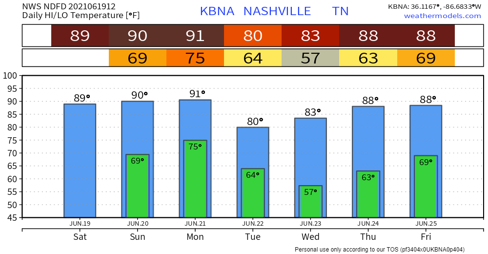
Typical summertime heat and humidity this weekend, with dewpoints in the upper 60’s, even creeping up into the low 70’s on Sunday and Monday. That’s a lot of humidity, common for this time of year.
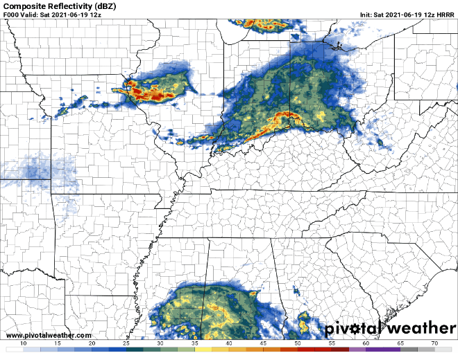
HRRR shows us dry throughout Father’s Day weekend, but cannot totally rule out a stray shower. Notice the tropical system is expected to miss us to the southeast this weekend.
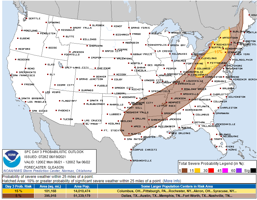
Storms, Heavy Rain Possible Monday
The Storm Prediction Center has Williamson and Davidson counties outlined in a 5% chance of severe weather within 25 miles – with the main threats being damaging winds.
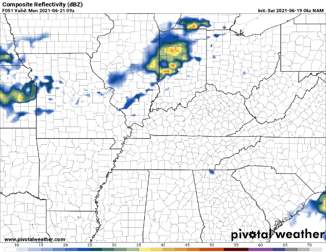
The NAM below shows showers/storms moving into our region Monday evening. It is way too early to be nailing down any sort of an ETA, just know there is a chance of severe weather Monday afternoon throughout the night. The Euro has the rain moving in a bit earlier than this. More details on this in the coming blogs as details become more clear.
Forecast soundings show a classic “speed shear” event. That means damaging winds are the concern. The winds do not turn with height, so there is no reason (right now) to be worried about tornadoes.
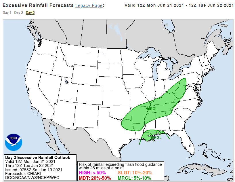
Flash flooding is a low-probability threat. WPC puts that between 5% and 10% Monday.
After the rain Monday-Tuesday, temperatures and dewpoints drop to a more comfortable level for a few days before getting back up to more “summerlike” later in the week.
Categories: Forecast Blogs (Legacy)
You must be logged in to post a comment.