
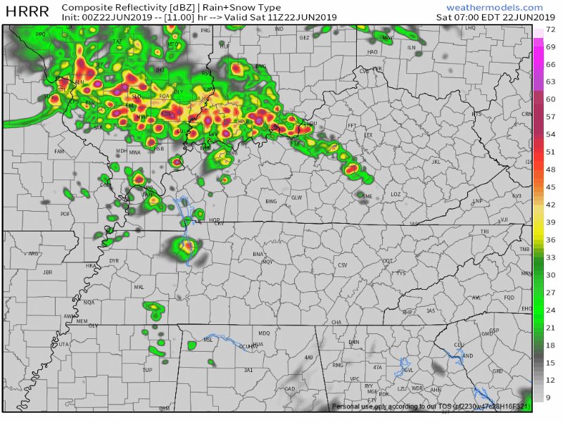
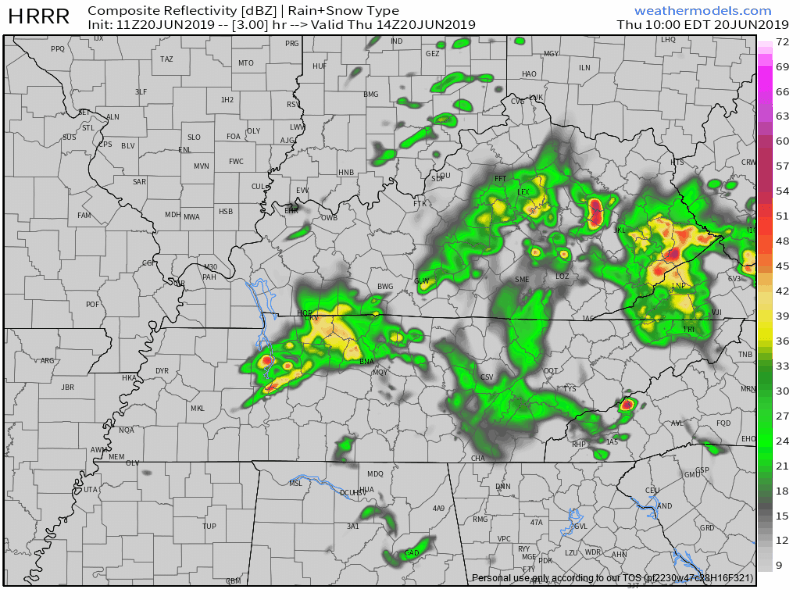
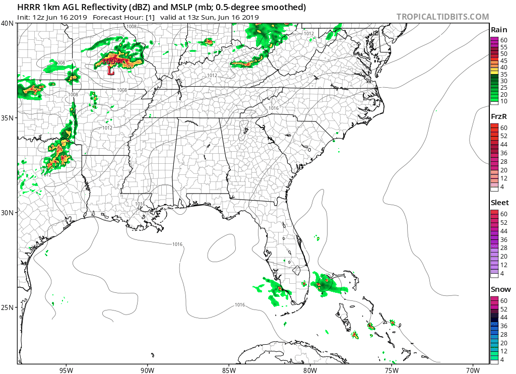
SATURDAY MORNING STORMS
More storms
are incoming this morning; we’re live tweeting them again.
Damaging winds are the main concern. Storms should intensify at least a little as they cross into Tennessee from Kentucky.

More storms
are incoming this morning; we’re live tweeting them again.
Damaging winds are the main concern. Storms should intensify at least a little as they cross into Tennessee from Kentucky.
At 853 PM.
No more severe weather expected tonight.
Just some light rain.
My fave photo of the night:
@NashSevereWx @NWSNashville @FOXNashville @WKRN pic.twitter.com/CgtEwG5Bq9
— David Howe (@DHdeeder) June 22, 2019
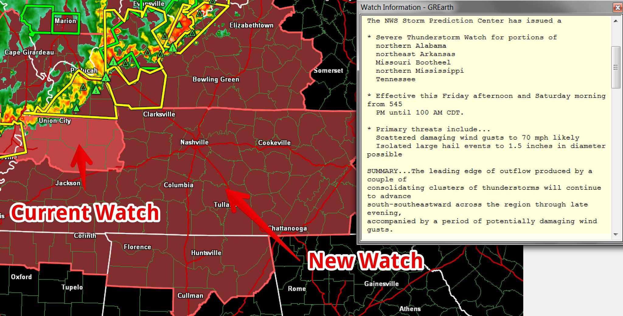
A Watch means conditions are favorable for severe thunderstorms.
A storm system is expected tonight, coming in a large line down I-24 from Kentucky.
Do not get hung up on Williamson County’s exclusion. A second Watch may be needed, to include Will Co., if storms stay severe tonight as they cross the KY/TN line.
There is a lot of uncertainty in the forecast from today into the weekend. I will do my best to convey that information, so bear with me. This is a difficult and lengthy forecast.
Editor’s Note: Yes, it’s a difficult forecast. Simple crap app clipart doesn’t do it justice.
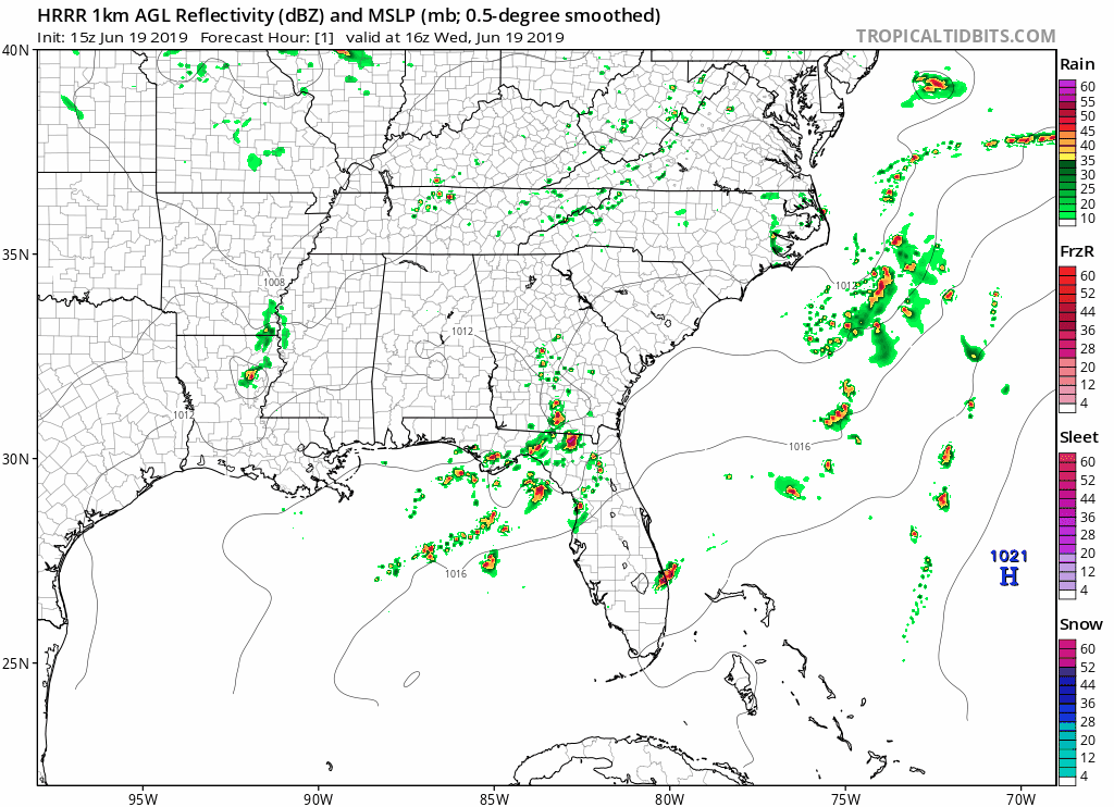
That was quite the evening of severe storms last night.
North Nashville storms before 8 AM should drift north and out of our area.
Later this morning,
further development in west TN and persistent [model] guidance suggests that more scattered [storms] will continue from mid morning through the early afternoon…especially for locations along and north of I-40. This will be monitored over the next few hours, but the severe threat should generally remain low. . . . Most of us will dry out by mid afternoon and early evening, remaining dry through the first half of Friday. (NWS-Nashville).
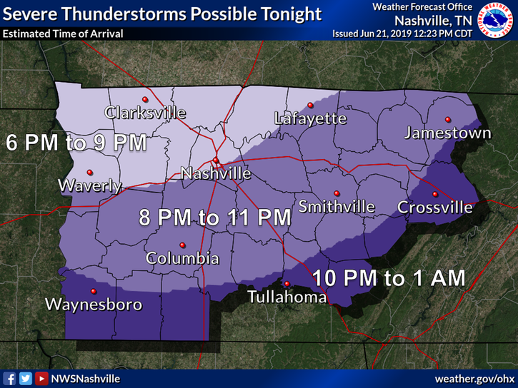
Today we will see some rain and thunderstorms, some possibly severe.
Looks like two rounds.
The first round, early evening, but we aren’t sure about that.
The second round, later tonight, we’re more confident this will happen.
I really hope you all aren’t sick of the rain, because there’s more to come.
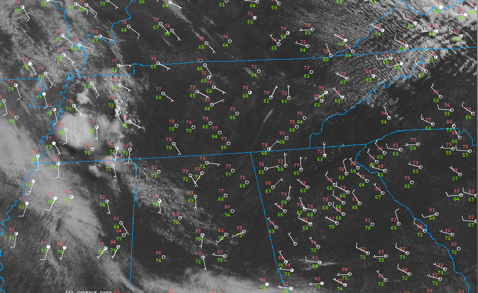
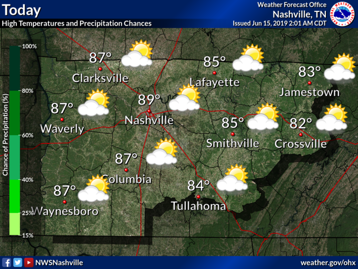
Scattered showers and a few thunderstorms will be moving in to the area from the southwest this morning and into the afternoon. The rain won’t keep our temperatures from climbing to a very muggy 84° for the high.
June is back, a hard adjustment after last week. That’s weather for you.
Dew points (humidity) are rising, and so are rain chances.
Today is only the beginning of an active weather week.
Our high should reach around 88°F by mid afternoon. Meanwhile, clouds should increase, swelling and growing into the afternoon. With it, the chance for rain.
Temperatures will reach a high of 91° with a dewpoint of 70°, so be sure to put on an extra spritz of hairspray and swipe of deodorant. The heat index will run into the mid 90s in the shade, hotter in sunlight.
Today should make for a nice day, though warmer temperatures and 60° dewpoints return.
Note that winds will hang around 10-15 MPH and gusts could reach as high as 25 MPH.
The chance for rain returns Sunday.
You must be logged in to post a comment.