
That was quite the evening of severe storms last night.
North Nashville storms before 8 AM should drift north and out of our area.
THURSDAY – FRIDAY MORNING
Later this morning,
further development in west TN and persistent [model] guidance suggests that more scattered [storms] will continue from mid morning through the early afternoon…especially for locations along and north of I-40. This will be monitored over the next few hours, but the severe threat should generally remain low. . . . Most of us will dry out by mid afternoon and early evening, remaining dry through the first half of Friday. (NWS-Nashville).
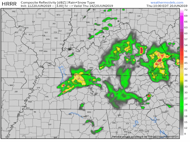
HRRR and NAM3 models predict a few more waves of rain/storms, but nothing of concern. Here are both models from 8 AM to 8 PM Thursday:
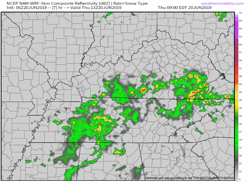
The Storm Prediction Center excluded us from its Thursday severe outlook. You may encounter lightning but otherwise we should be gradually clearing out by late afternoon.
More storms on the way Friday. Question is when.
FRIDAY
A MCS (mesoscale convective system) is science for (warning: I’m about to strip it of its sciency techy stuff so relax weather nerds) a cluster of strong thunderstorms moving together. Usually damaging straight line winds with lots of lightning and heavy rain are the main impact of an “I-24 special” MCS.

When’s it getting here?
Models disagree. Of course they do!
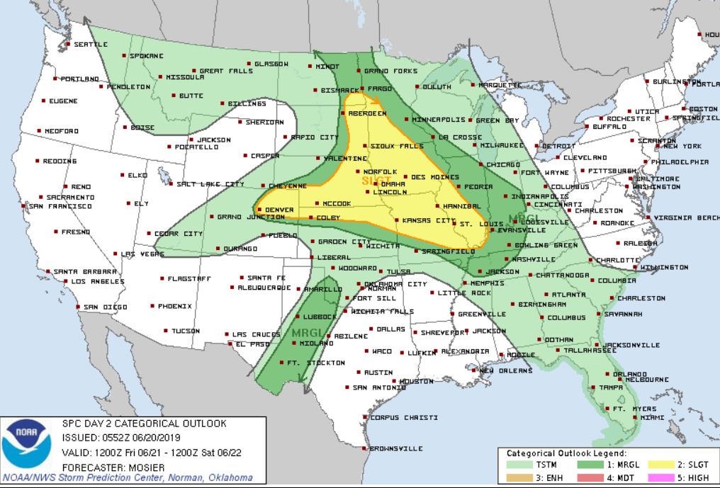
00z GFS/EURO guidance are not in agreement for Friday, with the GFS wet and the EURO almost completely dry. A warm front will be slowly pushing northeast through the Mid State, providing the focus for rain and storms to develop. With increasing instability along and west of the front, SPC has included the northwestern third of our CWA in a marginal risk for severe weather. (NWS-Nashville).
Not discussed above, the NAM3 model below shows the MCS flying down I-24, arriving here mid-afternoon Friday:
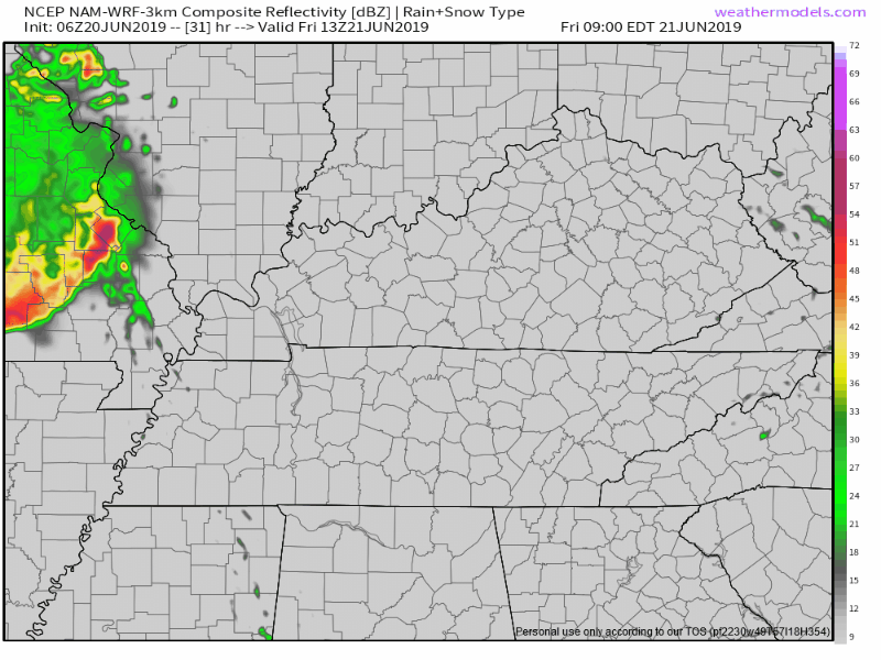
The timing of this MCS is the main uncertainty.
However — again — the EURO doesn’t think that will happen Friday afternoon. It thinks it’s coming about 12 hours later, in the middle of the night overnight Friday into Saturday morning.
This frustrating. Hoping the HRRR model 0z run (arriving soon) will shed light on it. If I had to bet, I’d bet against the NAM3’s Friday afternoon MCS arrival, but I would not bet much.
We are included in the SPC “Day 2” severe weather outlook for Friday. This should cover us for a severe wind event in case we have that mid-afternoon MCS, and it also covers us for what may be late night storms stretching into early Saturday morning.
LATE NIGHT FRIDAY INTO EARLY SATURDAY MORNING
There is a signal, now in the GFS and ECMWF, that a complex of storms will race south into our area Saturday morning. SPC has mention of a potential MCS and has included northern and eastern portions of our CWA in a marginal risk…still highlighting quite a bit of uncertainty in regard to convective development and evolution. (NWS-Nashville).
So, yeah, that MCS may get here in the middle of the night Friday evening into Saturday morning.
But we don’t really know and neither does your crap app.
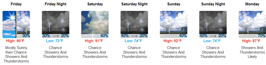
THE WEEKEND & BEYOND
Otherwise, scattered storms {Saturday} during the afternoon will taper off after sunset. Rain and storms will be maximized Sunday afternoon and especially Monday afternoon/evening as a longwave trough pushes across the OH/TN valleys. We will be on the mend Tuesday and finally have a dry day Wednesday. (NWS-Nashville)
Low 70° dewpoints Saturday, Sunday, and Monday mean oppressive humidity; those in direct sunlight will bake, with the “feels like” temp easily reaching close to or at 100° each afternoon. However, clouds are expected to keep high temps under 90°, which would be nice.
The comic strip look yikes tho:

Categories: Forecast Blogs (Legacy)
You must be logged in to post a comment.