Hot and Humid This Week, Starting Tomorrow through Friday

For the second week of September, it is going to be quite hot – so bear with me. Summer will eventually end, just not this week.

EDITOR’S NOTE:

Monday

We will be reaching into the mid 90°s for our high today. Bleh. Thankfully dewpoints are in the low 60°s. read more

Hot Today & Monday. Humidity Returns Tuesday, Heat Index Will Approach/Exceed 100° Rest of the Week

Today will be like yesterday. A bit hotter, closer to 90°. Clouds may roll in this afternoon, but no rain.

Alert radar watchers may see rain coming down I-24 this afternoon. Expect it to nerf before it gets here, except maybe provide clouds. The HRRR model illustrates this: read more

Next Week, We Take a Collective, Involuntary Steam Bath

SATURDAY

At 8:25 AM, BNA’s temp was 68°, dewpoint 63°. Last night, a north breeze blew in drier air, so today we get a slight break in humidity, with a high temp around the mid 80°s. No rain, no problems. read more

Nice This Weekend, Hot And Humid Next Week

Friday

Another hot and humid one in store for us today to end off the work week.

We’ll be up to a toasty 90° this afternoon for the high. Dewpoint values continually get higher as the day goes on, reaching up to near 70° by later this evening while everyone is out enjoying some Friday night football. read more

Ode to Corn Dog 7 | Friday Night Lights: Humid | Decent Weekend | Where’s the Rain?

The smell of corn dogs got caught in the lunchtime air in the Gulch.

Possible it was just me, and I was smelling a mix of construction stench, bachelorette boots, my upper lip, scooter tires, and restaurant exhaust. That this combination makes a corn dog smell is either a local/personal olfactory indictment or some pedal taverner features a corn dog and whiskey cruise which sounds amazing. read more

Very Isolated Showers/Storms Possible this Afternoon; Cooler Thursday; Nice Weekend Expected

Today

As of 8:12 AM, you can see some valley fog! It is very apparent to our east along the Appalachians. You can also see temperatures (in red) and dew points (in green.)

Any fog should mix out as the sun heats up the surface and convection begins for the day. read more

Calm Rest of the Week; Cooler Temps/Lower Dewpoints Arrive Thursday; No Hurricane Dorian Impacts Here

Today

The great weather continues.

Dewpoint temperatures will linger in the mid-60s, leading to some stickiness in the air.

Calm Rest of the Week

So far, the weather seems uneventful for the remainder of the week:

Wednesday: Cold front moves through. One more day of almost oppressive humidity with a dewpoint of 70°. Could see some rain, but that looks unlikely. read more

Dry and Sunny Week Ahead; Not Much More Than That

Labor Day

The sun sticks around with us again for Labor Day! We’ll probably stay clear of any showers here in Middle Tennessee, with a bit of an increased rain chance off to our East.

It’ll be a little sticky out as well, dewpoints in the upper 60s-low70s. High of 91° this afternoon. read more

Mostly Sunny and Dry Week Ahead; Cooler Temps and Lower Humidity Thursday

Sunday

Looks like we have a great day in store for us.

You may feel some stickiness in the air thanks to dewpoint temps in the mid-60s.

Rain? Unlikely, but showers have recently been popping up on the HRRR model: read more

Hurricane Dorian. Rising Temps & Humidity. Rain Chances. The “Meteorological Fall” Scam.

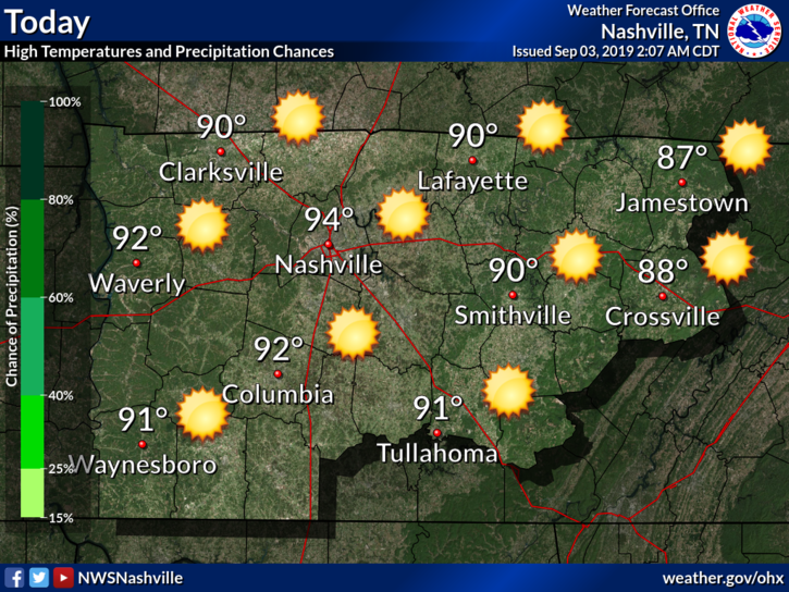
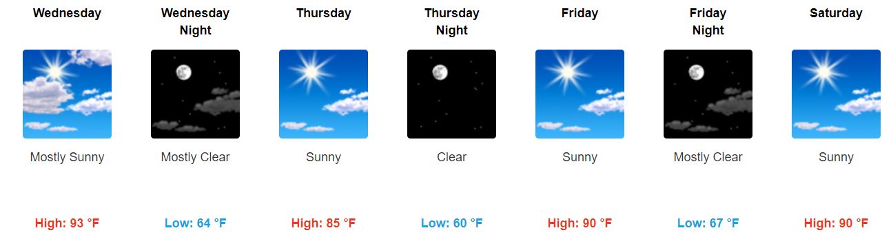
TEMPS, HUMIDITY RISE EACH DAY THROUGH WEDNESDAY.

Saturday 91°.

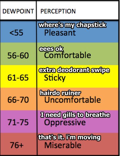
Sunday 92° but a bit sweaty, mid 60s dewpoints.

Monday 91°, upper 60s dewpoints.

Tuesday & Wednesday 93°, upper 60s dewpoints.

It’s still summer.

“METEOROLOGICAL FALL.”

Some nerd is going to tell you tomorrow is the first day of fall, “meteorological fall.” I usually side with meteorology nerds BUT NOT THIS TIME, TREVOR, there is nothing “fall” about September 1. Meteorological Fall is Fake Fall. It’s useful for climate stats but nothing else. read more