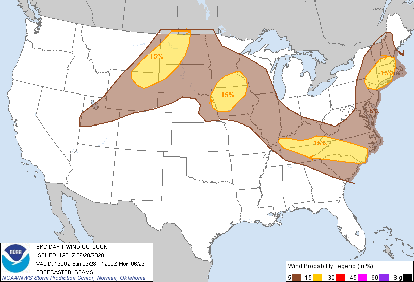
Storms are ongoing in Kentucky as I write this. Those storms will miss us, but they may send south cold air which can trigger us some rain and thunderstorms this afternoon. It’s iffy tho, let’s dive in:

Storms are ongoing in Kentucky as I write this. Those storms will miss us, but they may send south cold air which can trigger us some rain and thunderstorms this afternoon. It’s iffy tho, let’s dive in:
Saturday
Current weather conditions consist of overcast skies and showers in the vicinity.
You can expect more rain and storms later today as instability and rising air become more favorable. Some storms could potentially be strong bringing gusty winds. The primary timing of these storms will be from 3pm tp 8pm. In the latest AFD, the weather service mention a possibility for gust winds late in the day. Some may be up to 35mph.
You heard it here first – rain, rain, and more rain.
Today may be our last day to see the sun for a few days, as we settle with partly cloudy skies and temperatures in the upper 80s this afternoon.
Mostly sunny today. Rain should stay to our south, but we can’t rule out a stray shower or thunderstorm popping up in your neighborhood.
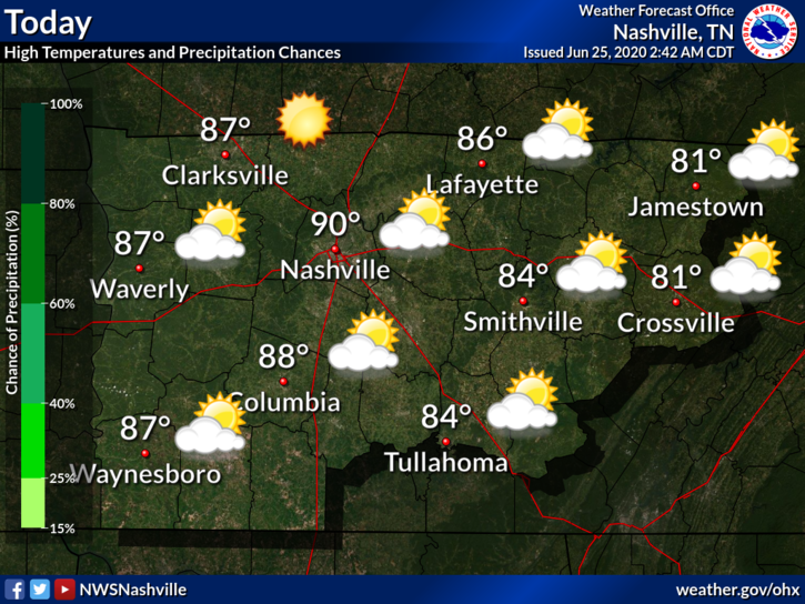
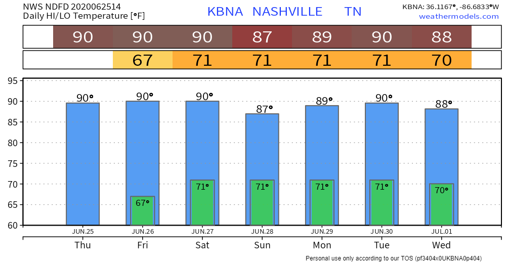
Highs will be near 90°. The dewpoint will drop from the mid 60 this morning into the low 60s this afternoon.
Today
Up to 87 today, but reduced humidity compared to yesterday.
A few pop-up showers will be around, but you probably won’t get one. Maybe a few of you will. One could sprout between 1pm-10pm. A thunderstorm is possible, but unlikely.
Tuesday, Rain will Taper off by Early Afternoon
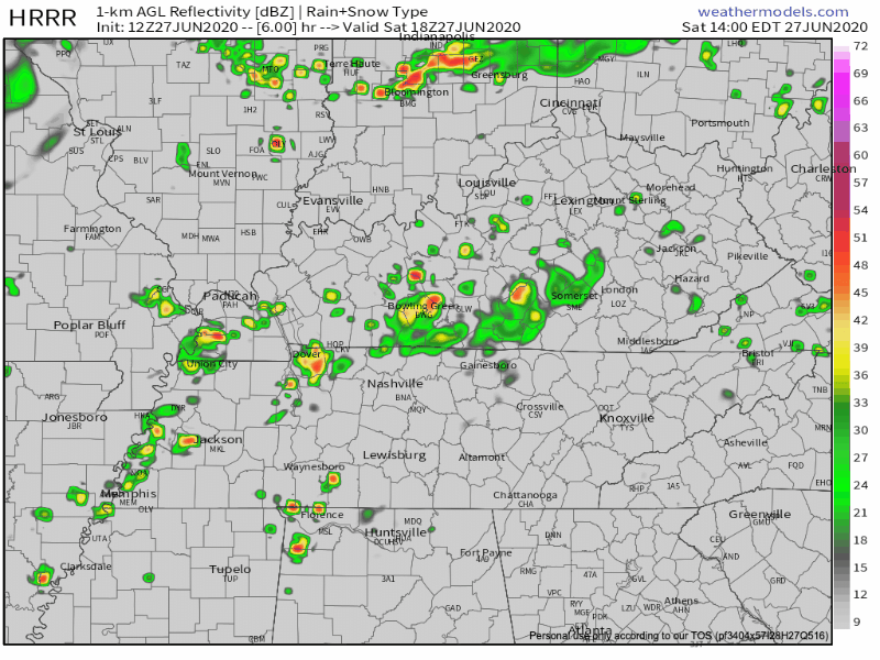
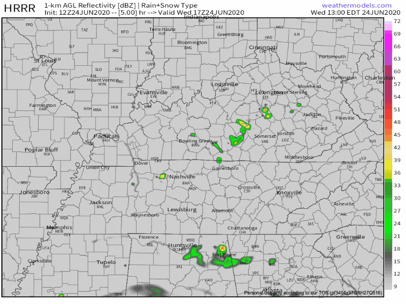
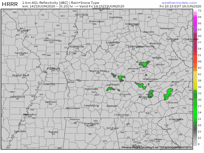
Here comes the cold front! It will bring a few scattered showers and thunderstorms to Middle Tennessee this morning. Most of the rain associated with this system fell before sunrise, though. Here’s this morning’s run of the HRRR model, through midnight tonight:
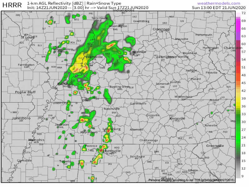
Storms Monday Afternoon–Some May Pack a Punch
It’s going to rain this afternoon. The HRRR is showing scattered showers becoming more widespread tonight.
Timing: The HRRR likes the most significant rain coming in two rounds: the first around 2pm and the second around 11pm. In between, there will be some scattered showers.
Rain with a few weak thunderstorms should as through lunch hour, lingering into the early afternoon.
HRRR model thinks rain and storms will hang around until sundown . . .
. . . but the HRRR model is probably overdoing it. Here’s why we think that.
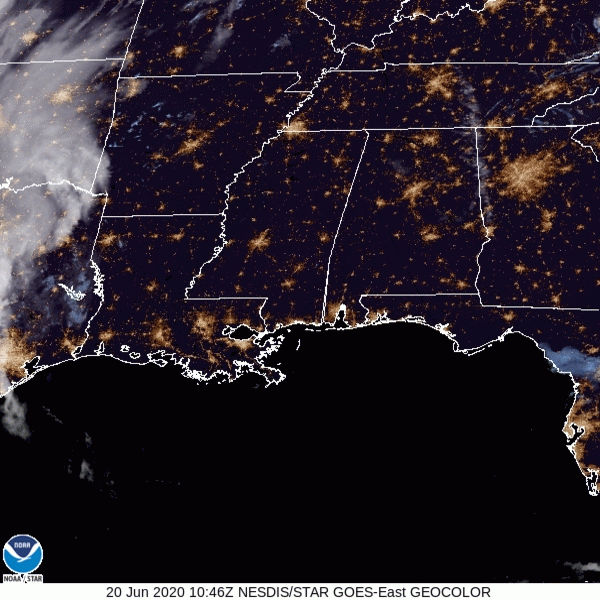
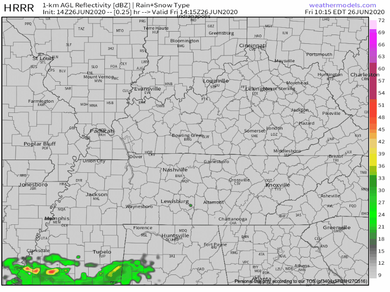
Satellite this morning showed clear skies. That’ll continue today (well, mostly):
Up to 93º this afternoon with summer-normal humidity.
Moisture will creep in this afternoon and pop off a few clouds, maybe even give us a shower or two, but the chances of this happening to you are pretty low.
Stormy activity heads our way into this afternoon. Spotty showers and thunderstorms with highs today in the upper 80s.
Between 1pm – 2pm is when we’ll see these storms start to fire up. We’ll be keeping a close eye on the radar this afternoon. Check @nashseverewx on twitter for the latest.
You must be logged in to post a comment.