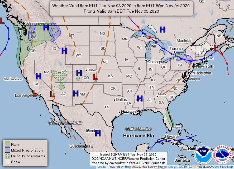
We Begin the Gradual Warm-up
Temperatures Tuesday will peak around 65º and cool off to the mid-40’s overnight.
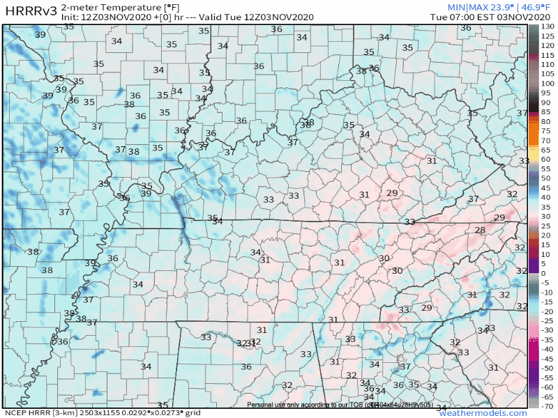
More about today: Clear skies. No rain.
My thoughts exactly!

This is what we like to see in weather-land:
A whole lot of nothing.

Temperatures Tuesday will peak around 65º and cool off to the mid-40’s overnight.
More about today: Clear skies. No rain.
My thoughts exactly!
This is what we like to see in weather-land:
A whole lot of nothing.
Nashville totaled 3.51 inches of rain in the month of October, almost 0.5 inches above normal.
A lot of tropical activity this past month which made for a wet October… October 10th being our wettest day at 1.15 inches.
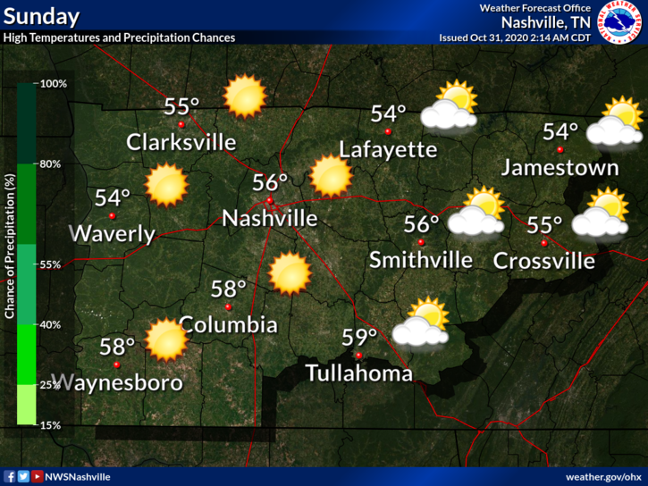
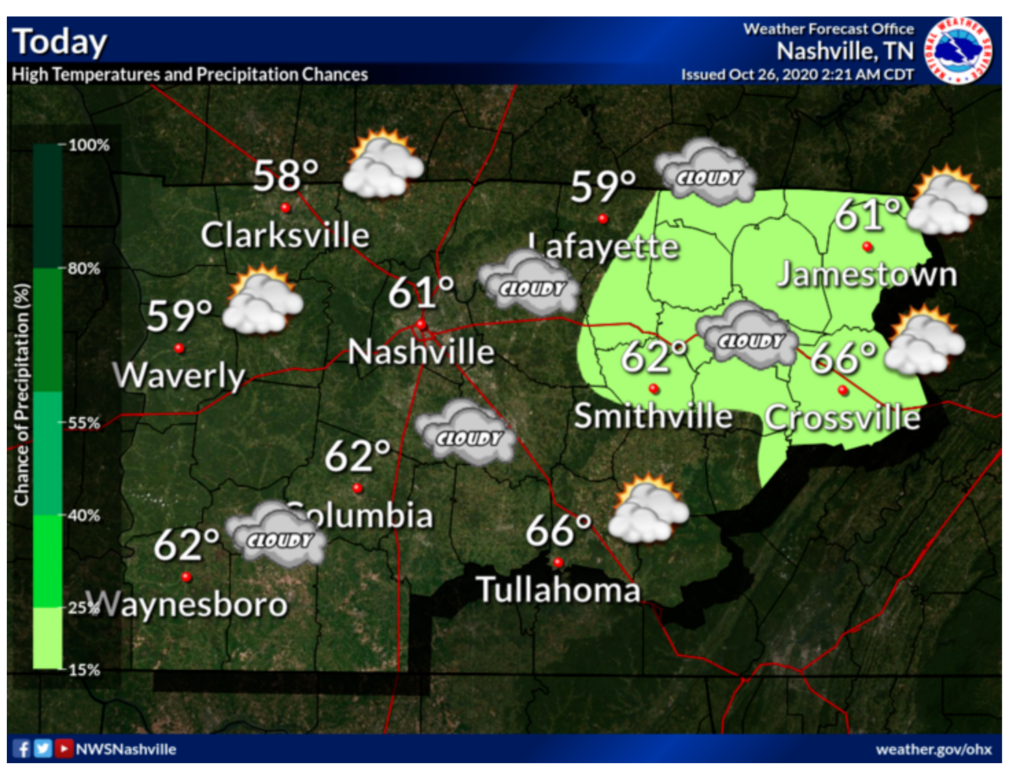
Our high temperature Sunday will come earlier than normal. We will reach the upper 50’s/60º by about noon, and then it’s all downhill from there.

You’ll feel the cold front coming through with winds gusting up to 28 MPH this afternoon, calming tonight.
Perfect last day of October. Expect sunny skies with a high of 64!
Temps should drop into the upper 50s during trick-or-treating.
Tonight will feature mostly cloudy skies with a low of 50.
A bit cooler Sunday with a high in the middle 50s. The big story will be the winds. Gusts around 30 mph are possible.
The cloudy, dreary week that we have experienced is coming to an end!
Clouds this morning will erode and leave a mostly sunny sky this afternoon. Still quite cool and breezy with a high of 54.
The hourly forecast for Friday Night Football is chilly.
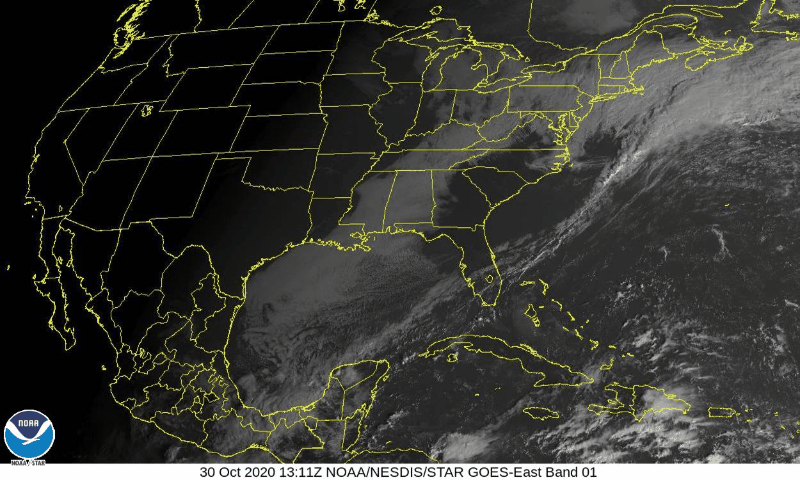
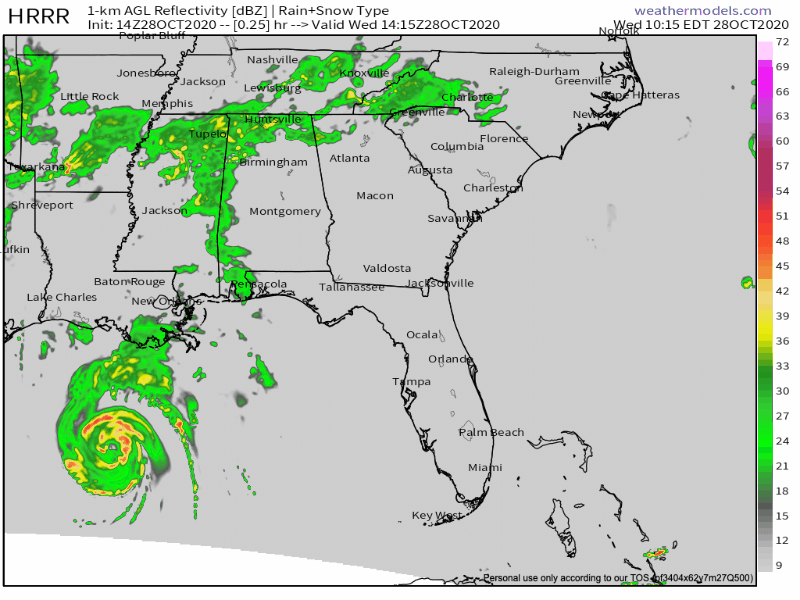
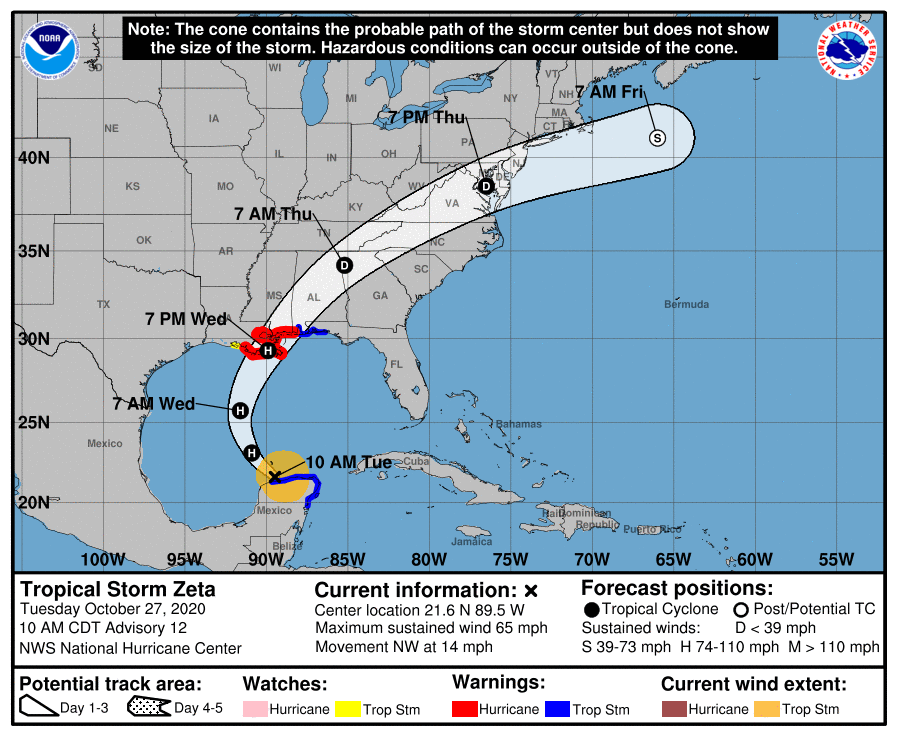
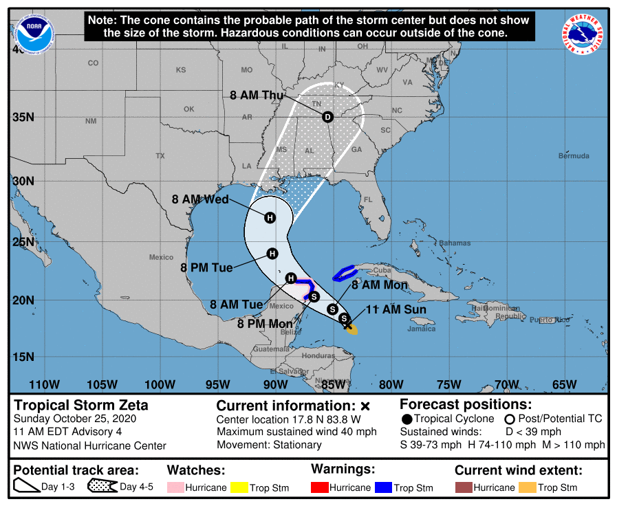
Zeta moved to our south last night, bringing us around an inch of rain and some wind. It has already quickly moved into North Carolina and Virginia this morning.
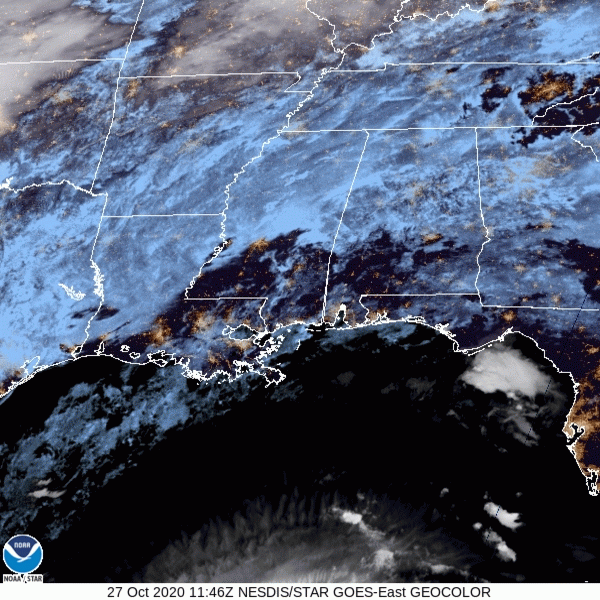
Here’s a cool satellite image showing the storm heading towards the northeast!
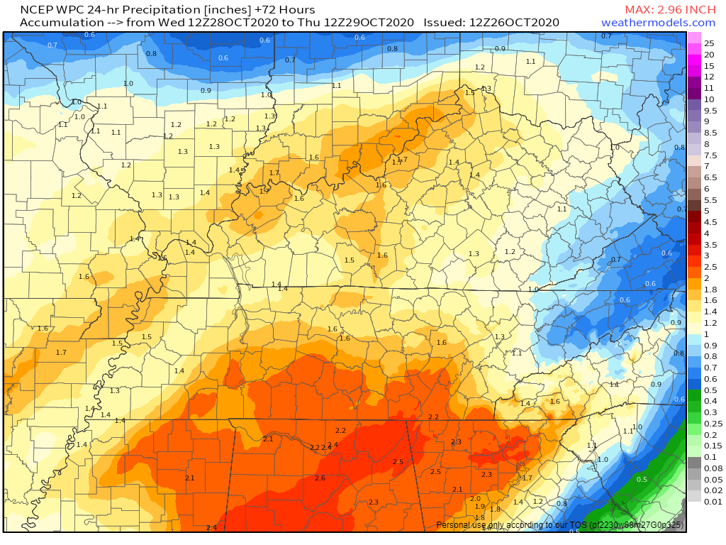
A Flash Flood Watch is in effect for Davidson and Williamson County starting at 1 PM this afternoon until 7 AM tomorrow morning.
Heavy rain will be possible today into Thursday, with amounts of around 2 to 3 inches expected across the area. Some isolated areas may see amounts exceed 3 inches, especially in the northwest and southern Plateau. Heavy rain may result in minor flooding this afternoon into the early morning Thursday.
Ick. Not the most pleasant weather in Nashville.
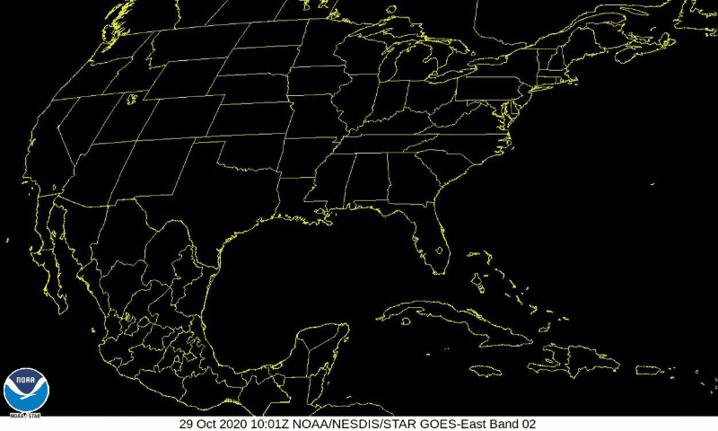
Satellite this morning looks like a thick layer of frosting is covering pretty much the entire Southeast and Midwest.
Breaks in the clouds aren’t looking too promising today. Embrace the gloominess that is the last week in October!
It’s a foggy, misty Monday morning. Seems about right, huh?
A slight chance for light rain/drizzle to continue for the morning, but otherwise cloud cover will stick around.
Highs are a bit cooler today at 61.
If you loved yesterday’s cool drizzle, today is also for you.
Green line close to the red line from this morning’s weather balloon means temps and dewpoints are in a serious, committed, long term relationship for today. Relative humidity 80% to 90% allows for drizzle.
You must be logged in to post a comment.