Monday Morning Snow: Current Thinking, High End Potential, & Low End Potential

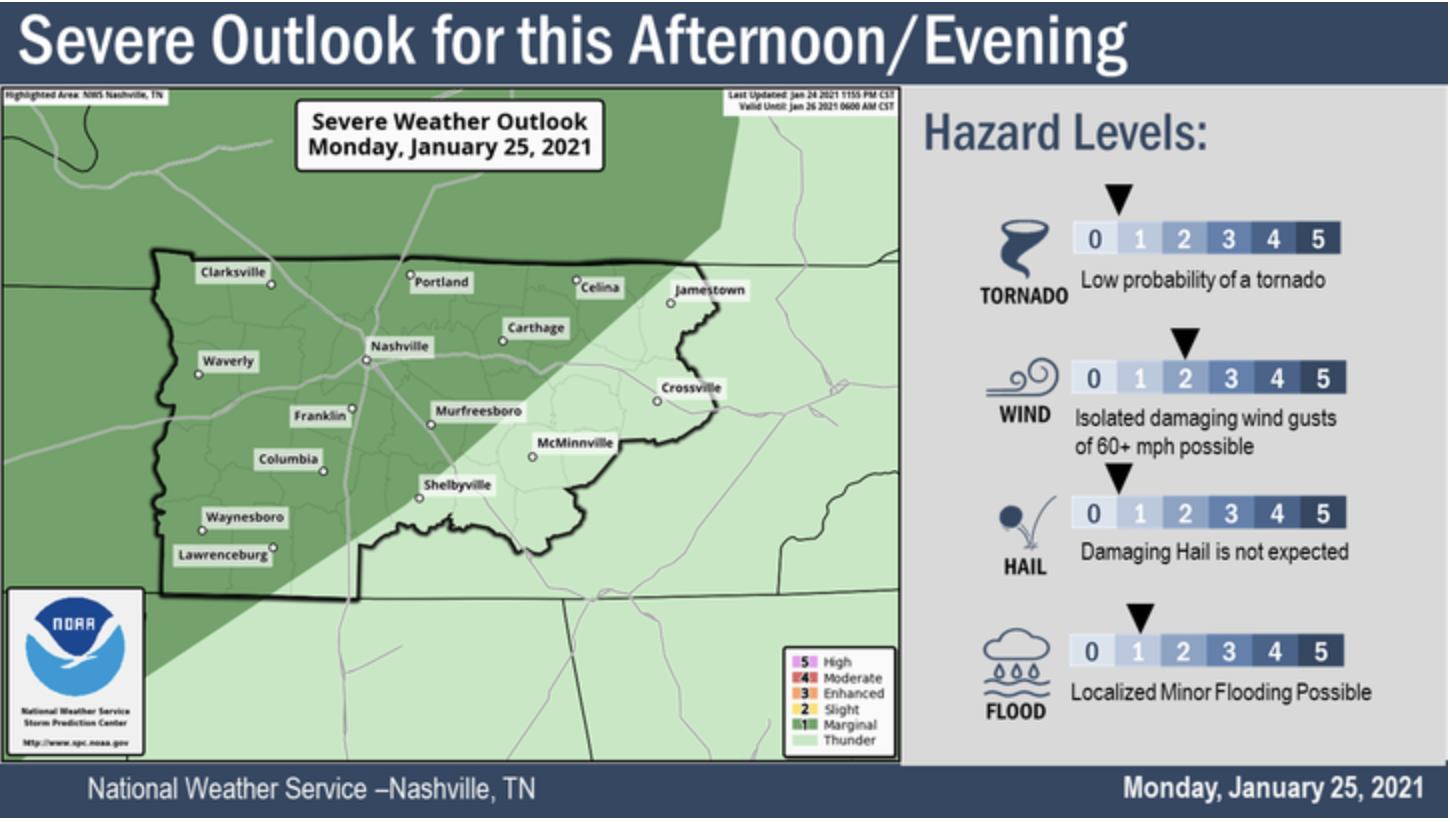
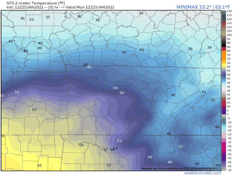
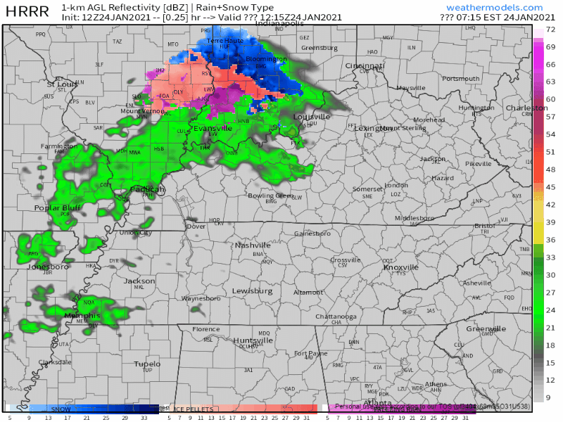
Models have been consistent. Snow incoming after midnight tonight. The HRRR model:

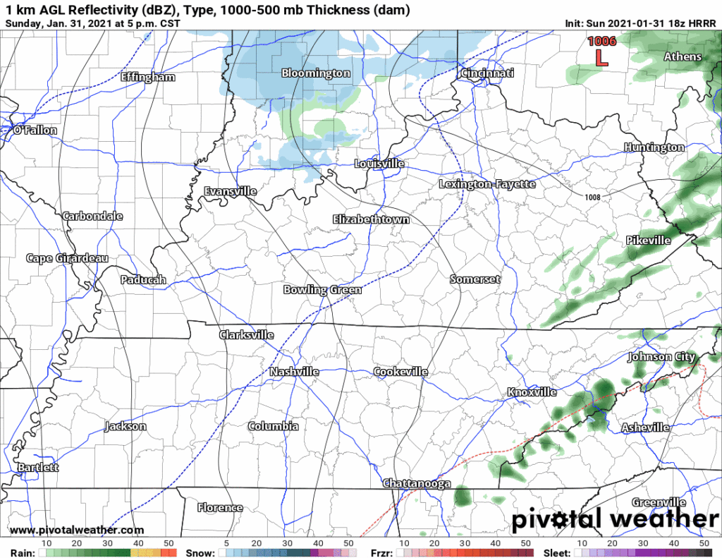
Falling snow, and accumulating snow, are two different things.

What We Think (right now)

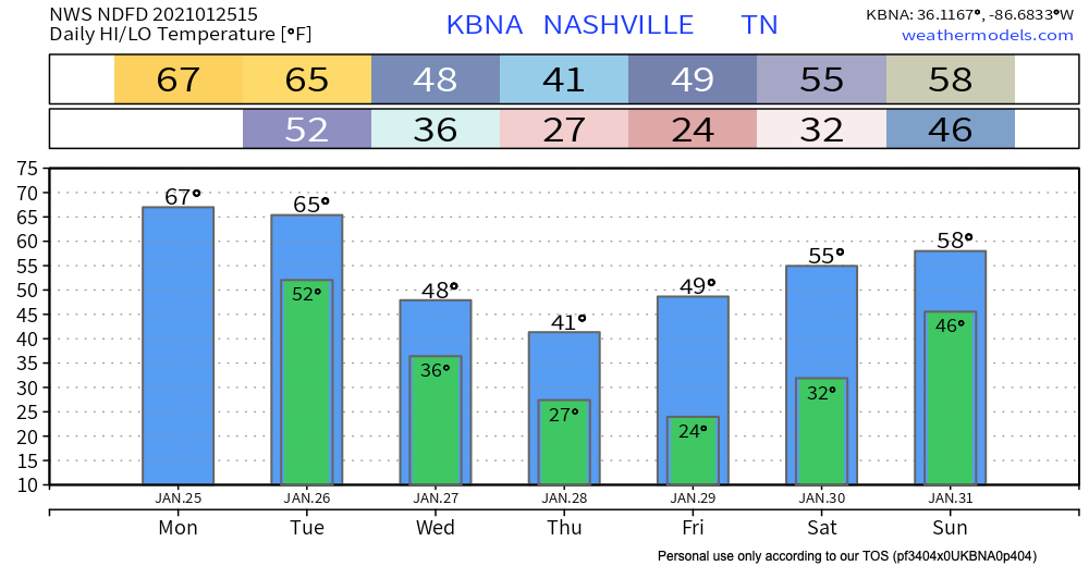
The current expectation is nothing to a half inch:

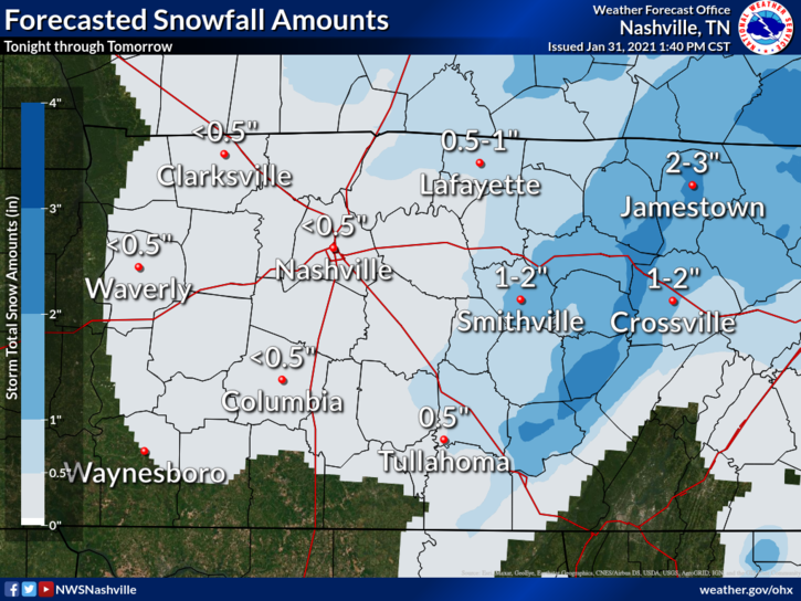
Snow falling is more likely than snow accumulating. read more

Cloudy Conditions Throughout Afternoon, Possible Rain/Snow Mix After Midnight. Clearing Skies Until Thursday.

Clouds Building Today, Some Light Snow

Rain stays to a minimum this afternoon for Nashville but we can expect some overcast skies into the overnight hours as well.

We top out in the upper 50s for today. Our chance to see some light snow will be closer to overnight tonight. read more

Will Winter Finally Make Its Presence Known With Groundhog Day Approaching?

Rain Chances Today

Radar from 9:40 CST shows precipitation sitting just off to our west. 

Radar is constantly updating, so for the most recent run visit https://nashvillesevereweather.com/radar/.

Once again, dry air near the surface will gobble up precipitation before it reaches the ground. See the large dry air slot (space between the red and green lines on the sounding) between the surface and 700mb? Yeah, you can thank the Dry Air Monster for that. read more

Weekend Update: Chilly Fire Weather, Soaky Rainer, Snow feat. the Notorious D.A.M.

Don’t Burn Stuff

Relative humidity will drop near/below 45% Saturday morning. That’s really dry for us. Fires may be uncontrollable because south winds will blow 10-15 MPH.

Smoldering smokesticks staying in your ride and not on the grassy median would be lovely thanks. read more

Rain Saturday, Flakes Sunday Night - Monday AM.

The U.S. West Coast is getting mudslides and epic snowfalls. It’s supercold in the northeast.

Here, not so much.

Saturday Afternoon Rain?

Models disagree about Saturday afternoon. Most think a rain wave will pass by but dry air will gobble it up the drops before they reach the ground. read more

Cold is the Word, More Rain This Weekend

It’s cold this morning.

A good reminder that we are in the core of the winter season.

Fortunately, we stay dry through Friday.

Weekend System

We should start Saturday on a dry note before this system moves in.

A surface low over Texas will move eastward throughout the day. read more

Bad News for Snow Lovers

Dry Air Monster Is Hungry Today

Precipitation is crossing over the Mississippi River as of 10:30am CST:

Radar imagery is constantly changing. For the most up to date data, visit https://nashvillesevereweather.com/radar/. The website will refresh every minute with the most current imagery. Also, stay tuned to @NashSevereWx on Twitter for updates (and some humor mixed in)! read more

Cold Rain or Snowflakes Wednesday Night

Most of the daylight Wednesday will be dry.

Around dinnertime or a little before, precip should be moving in. No storms. Cold rain most likely, and maybe some snow.

Euro Model (below) shows *maybe* a light rain/snow mix. read more

Storms Tonight, & About that Wednesday Snowflake on your App

Check out this warm front:

Temps and dewpoints will rise through the afternoon, as shown here by the GFS model:

This lifting warm front is associated with a surface low moving out of the Plains into the Ohio Valley. That low is going to drag a cold front across Middle Tennessee and set off another round of rain, and perhaps storms — some possibly severe. read more

Dissecting severe thunderstorm potential Monday late afternoon/evening.

Off and on rain will continue through Sunday afternoon into tonight. Light and nondisruptive, not a washout.