Showers Possible Tuesday-Wednesday, Storms Thursday?

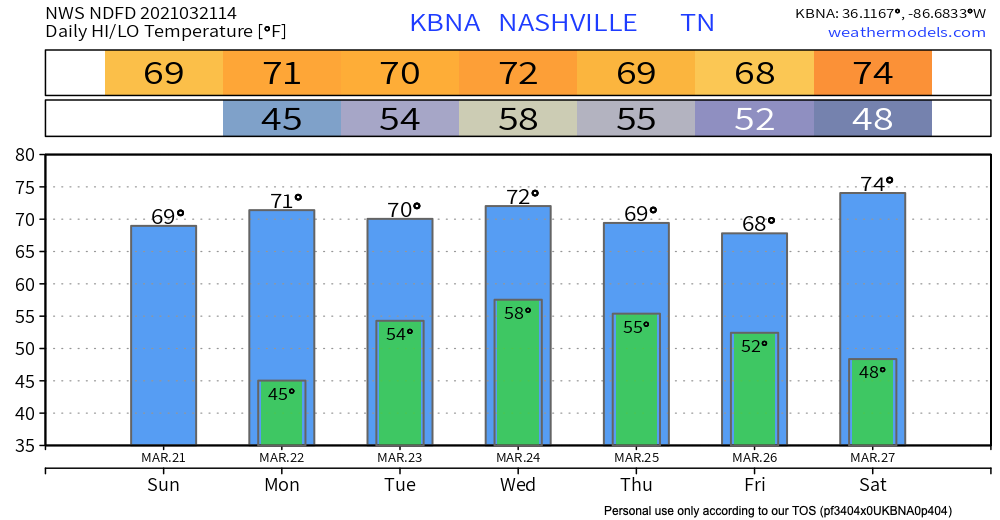
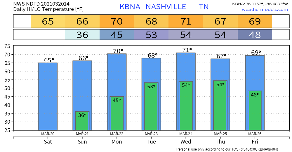
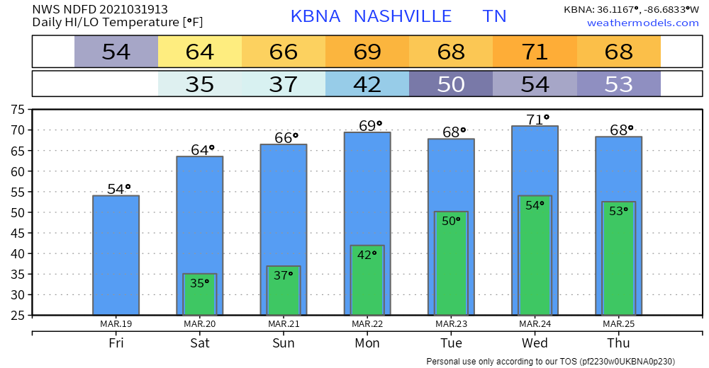
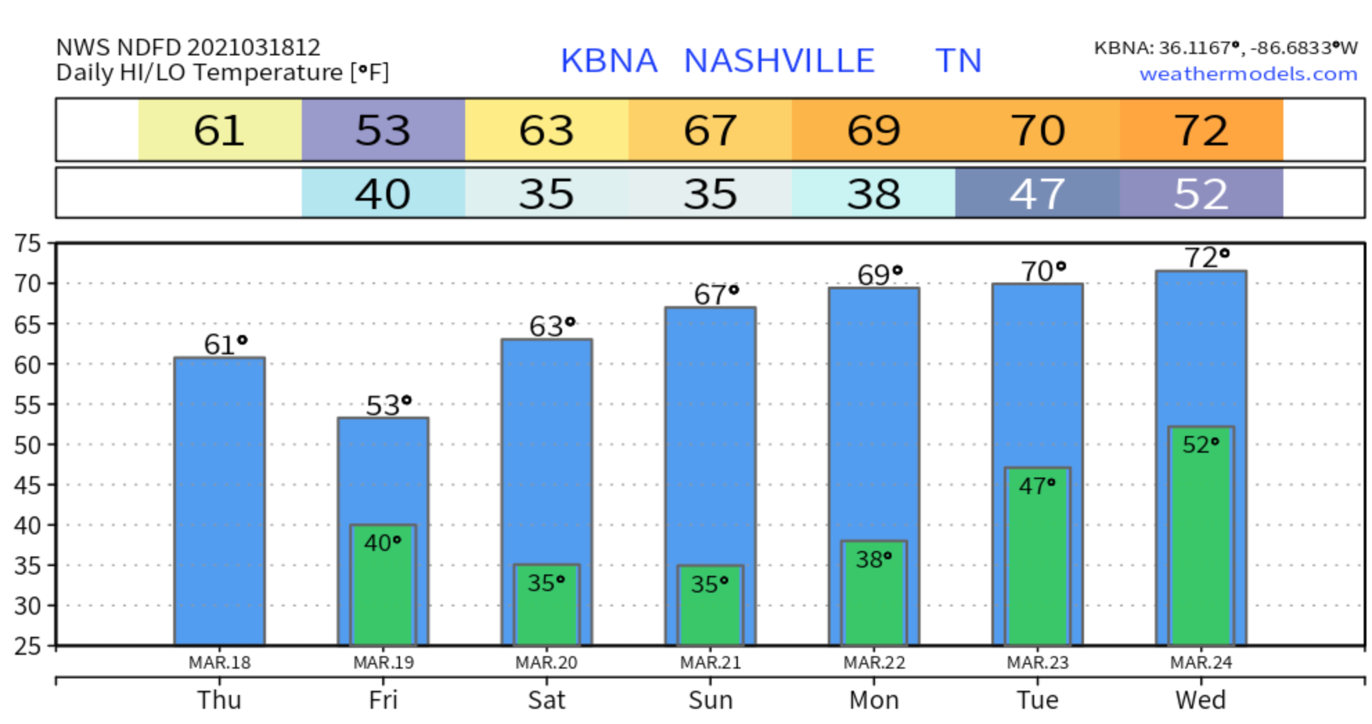
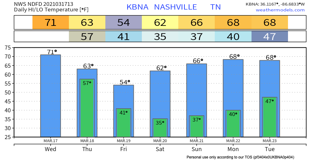
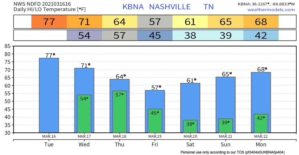
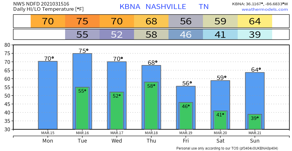
All these upper 60s-low 70s have us feeling:

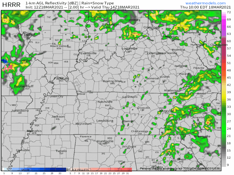
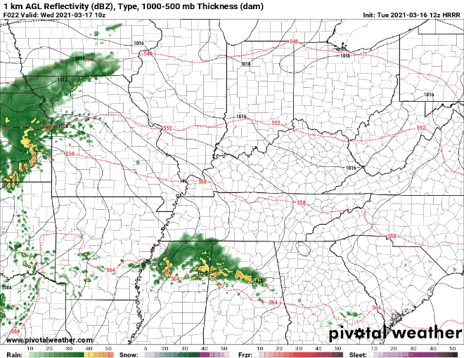
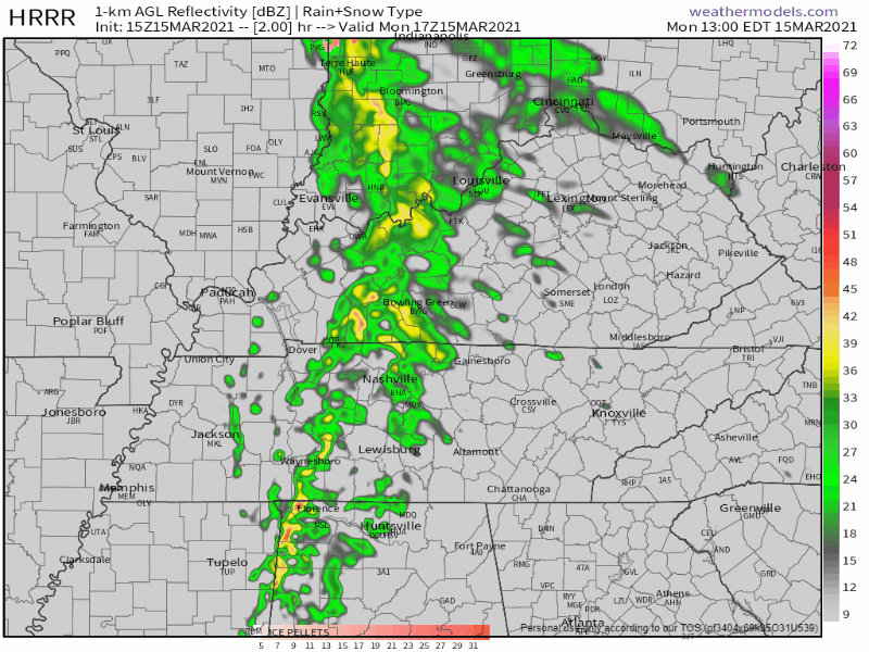
Few Showers Tuesday-Wednesday

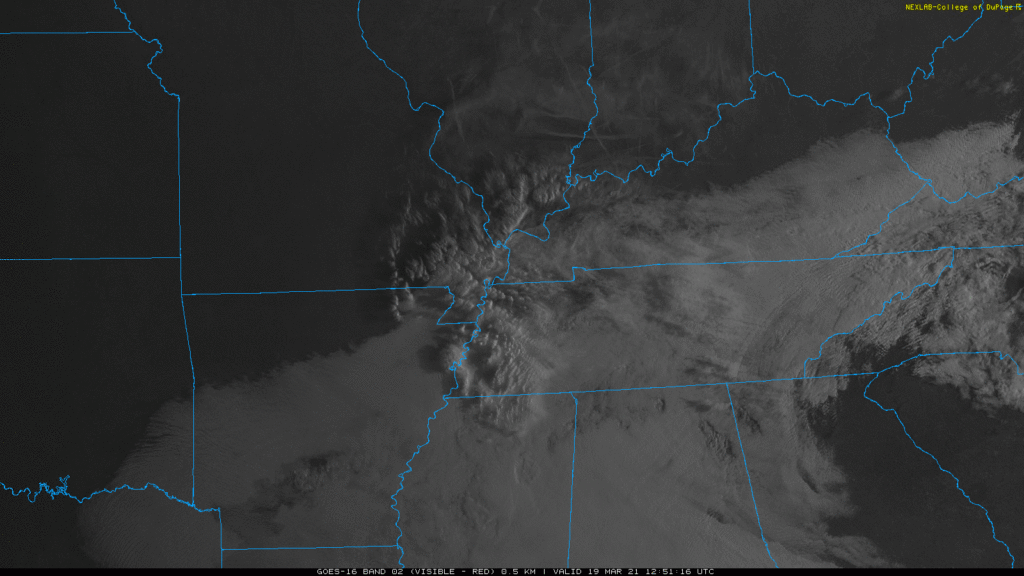
An upper level low will pass through the midwest Tuesday. This should spark some off and on rain Tuesday, maybe into Wednesday.

But the data isn’t giving any clues to timing. It’s possible all the rain misses your backyard. read more

Happy First Day of Spring!

March 20 marks the first day of spring in the Northern Hemisphere! Satellites caught something pretty cool this morning:

Editor’s Note:

Clouds will continue to move out this afternoon, giving way to beautiful skies. read more

Next Rain (Storms?) Event Mid-Next Week.

Chilly (maybe sprinkly at times) today until clouds clear. Image below from 9:21 AM. Clearing line may not arrive until late this afternoon. Therefore only 54°. Cold north wind.

Close to freezing around dawn Saturday and Sunday mornings. Then we warm up. read more

Few Rain Showers Today, Clearing Up for a Nice Weekend.

Severe Storms Possible Today into Tonight. Remain Weather Aware.

Two things before we get started.

First, we cover Davidson and Williamson Counties. A serious and very concerning severe weather outbreak is forecast to take place in Mississippi and Alabama today. For the purposes of this blog, we will only focus on our two counties. read more

Forecast Changes to Wednesday’s Severe Potential. Buy Coffee.

I am supposed to be at the gym.

I’m not because the forecast changed.

Macaulay Culkin 90S GIF by Home Alone

Earlier, there was question about whether a warm front would get far enough north “providing ample moisture for storms to feed on.” read more

Severe Storm Potential Wednesday: Risks, Timing, Uncertainties

We will likely see two round of rain/storms Wednesday.

The first round will move through during the late morning and early afternoon hours.

This first round will race ahead of the warm front trailing behind it, so while gusty winds are possible, tornadoes are not expected to accompany this activity. read more

St. Patrick’s Day Severe Storm Potential, We Got Thoughts

18z model runs (six of them, below) depict Wednesday’s severe event southwest of – but not including – Davidson and Williamson Counties:

This aligns with the 15% severe threat for Wednesday from the Storm Prediction Center. read more

Severe Storms Possible Wednesday

Lunchtime rain is moving out. Should be clearing this afternoon.

Rain/Wind Monday, & a Look at a Potential Severe Weather Event Wednesday

Substantial wind shear will be in place as a line of storms approaches Monday morning. ETA late morning/lunch. But instability should be near zero, reducing if not eliminating most/all severe storm concerns. Winds may still be strong (40 MPH or so) — and we cannot totally rule out a severe wind event — but there is no reason for a hail or tornado concern Monday. read more