
Today – High of 72
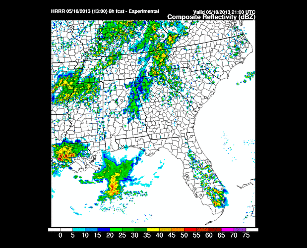
Expect off and on rain. This is what the HRRR thinks the radar will look like from 4pm to 11pm today.
The Hi-Res NAM thinks the radar does this between 10am today and 4am Saturday (each frame = 3 hours):
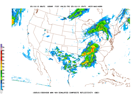
Notice how the models shut off the rain around mid afternoon, then sends in more late tonight. Other models are also doing this.
Saturday – 60/71
Most of the models are keeping the Saturday completely dry. The cold front should pass late tonight or early Saturday morning, clearing us out. Our NWS shuts off the rain spigot around 4am Saturday – any surviving shower should be of little consequence. We are forecast to wake up to about 0.8″ of rain having fallen since Friday morning. It’ll be wet at Steeplechase, but it should not be raining.
Models are picking up on rain developing ahead of an approaching secondary cool front Saturday night into early Sunday morning. The Hi-Res NAM actually sends the rain on in around midnight Saturday night (see below); others pull it way north of us or dry it out before it gets here. Any rain would probably arrive too late for anyone to really care. I am not worried about it. The NWS thinks it’ll be a dry passage, with a noticeable dip in temperatures.

Sunday – 51/64
Dry and cooler, courtesy of the cold front.
Categories: Forecast Blogs (Legacy)