
Today
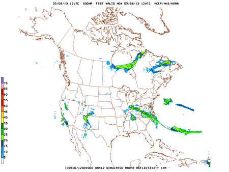
Although the morning rain moved out, models redevelop showers to our east this afternoon and early evening, and spin them in here. These isolated/scattered showers are approaching in an usual direction: east-to-west. We call these “Crazy Ivans,” a reference to The Hunt for Red October (where a Russian nuclear submarine – from the east – almost started a war by defecting to the west). If you don’t get it, relax, you’re better off for it (for those who’ve seen the movie or read the book, we know it’s also not a technically accurate phrase). It’s nerd humor.
Loop of Hi-Res NAM Monday 7 AM – Tuesday 7 AM:
When will this rain finally be gone? Not today, and maybe not tomorrow. It all depends on when this nuisance “cutoff low” finally drifts into Georgia and east Tennessee, then, ultimately, the Atlantic Ocean.
Tuesday
Patchy fog and a morning low of 45. The fog usually means a warmer day is coming. The sun will start to poke from behind mostly cloudy skies, warming us up nicely to 72. Fog is forecast to return overnight and into Wednesday.
Weather models disagree about our rain chances Tuesday.
Loop of Hi-Res NAM Tuesday 7 AM – Wednesday 7 AM suggests a Tuesday afternoon shower.

Loop of GFS Tuesday 7 AM – Wednesday 7 AM:

The GFS model has the “cutoff low” moving right on top of us, giving us another wet and chilly day.
Euro at 4 PM Tuesday:

There just really is not a good model consensus. We think the cutoff low will drift east, and we will start to dry out.
Wednesday
This will be the best of the next 3 days! Patchy fog in the morning once again with a forecast high of 78. We could see some pop-up afternoon thunderstorm, like we see in the summer time. Very hit and miss in nature, either your gonna get soaked or still going to be partly sunny!
Loop of Hi-Res NAM Wednesday 7 AM – Thursday 7 AM:

Steeplechase
It’s looking a little better right now for Saturday. But as my teacher would always say “Anything beyond 3 days is magic!” So here is a look at the “magic” the GFS model has put out. This is as far as the model will go.
Loop of GFS Friday 4 AM – Saturday 7 AM:

Right now GFS has the rain coming in Friday night into Saturday morning, which would keep us dry for the races. Again, this is just a model and it’s going to change a lot this far out. Even though it MAY be dry from the skies, the grounds will probably still be nice and wet for Saturday.
Flooding
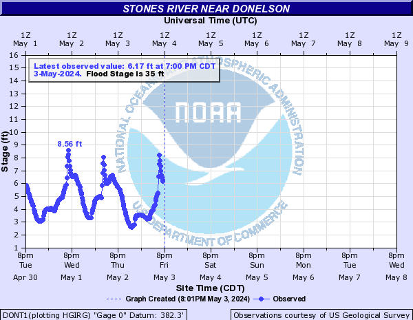
There is only one river in “Action Stage” that has prompted a flood advisory. The Stones River near Donelson is currently at 20.83 feet, almost 15 ft. below the 35 ft. flood stage. Flooding of this river or any river is not expected at this time:
All other river in the area are “No Flooding”:

Everyone have a great week. I’m going storm chasing in the Great Plains! See y’all in 10 days!
–The Intern
Categories: Forecast Blogs (Legacy)