
Quick Look Forecast from NWS

Next Rain Maker Approaches Tonight
Light showers are expected through the overnight hours into Monday morning. The HRRR model predicts light rain Monday morning:

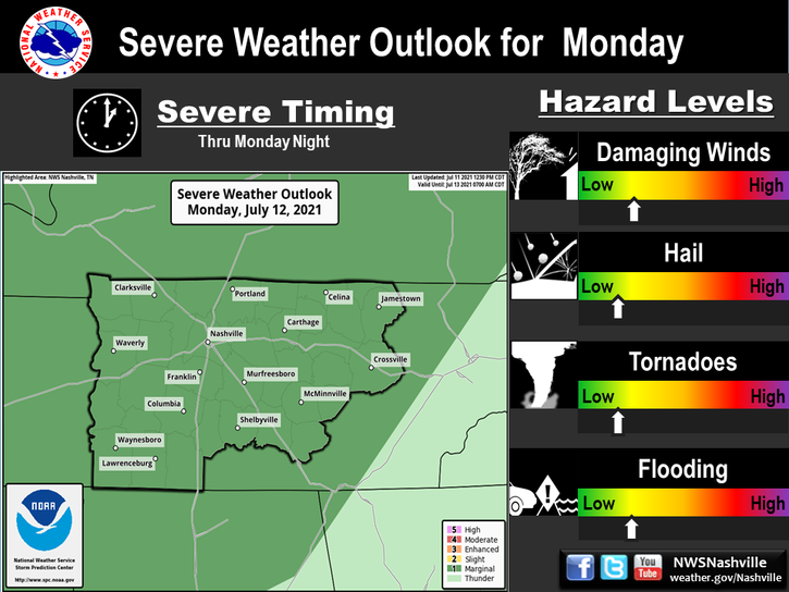
More Active Monday Into Tuesday
Showers and gusty winds (up to 30 mph) on Monday will be a good indicator of warm south winds, ahead of our next cold front.


You must be logged in to post a comment.