Dry Heat Today, Isolated Storms Over the Weekend

Welcome to the weekend. The headline over the next several days is “heat”. At least through midweek next week, temperatures will run 7-10ºF above average for this time of the year.

Welcome to the weekend. The headline over the next several days is “heat”. At least through midweek next week, temperatures will run 7-10ºF above average for this time of the year.
GFS Model 2-Meter Temperatures Through Sunday
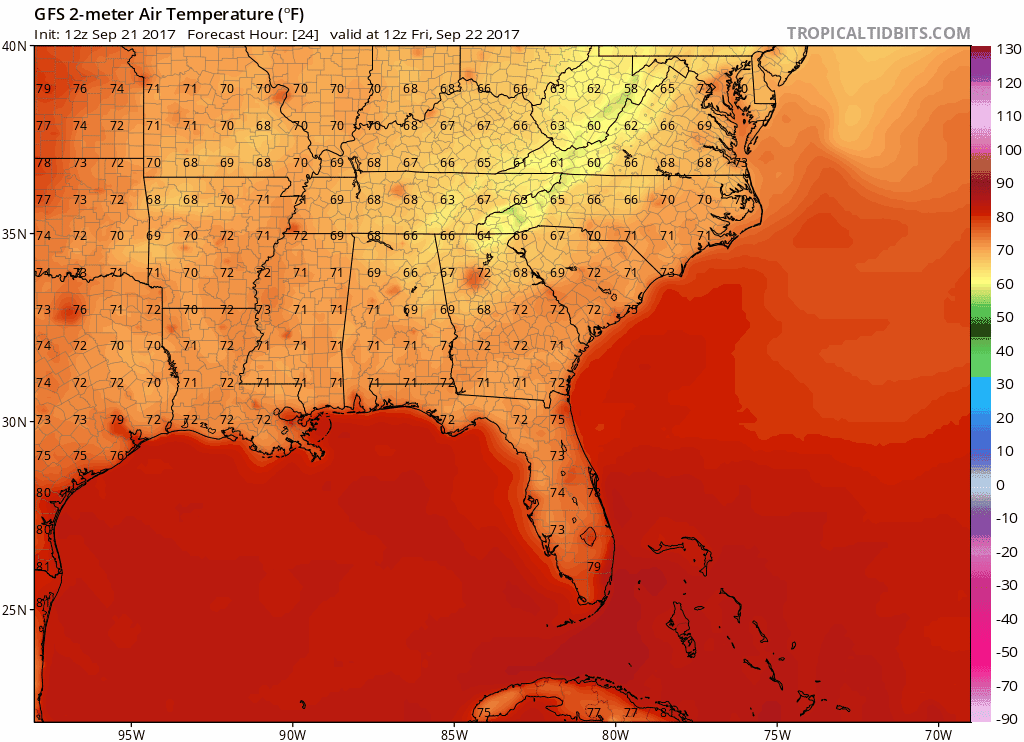
The GFS has temps running in the mid 80s for Friday into the weekend, but this seems underdone. Expect upper 80s at the very least to continue as high pressure builds back in strong by the beginning of next week. A chance for storms exists Saturday afternoon, but the atmosphere will be somewhat moisture starved, so not everyone gets rain.
Really a whole lot of nothing looks to continue for the foreseeable future with our forecast. Current surface analysis over the country shows this pretty bland weather pattern here in Tennessee with a high pressure influencing our conditions.
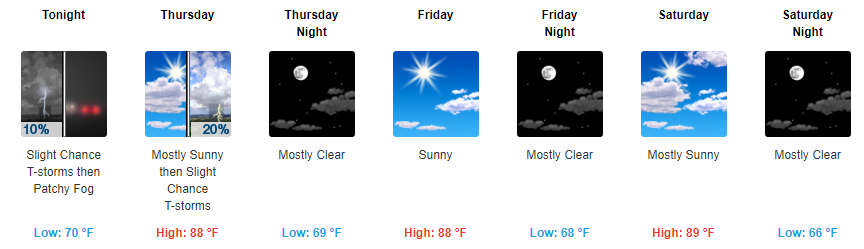
Several clusters of showers and thunderstorms are rolling through north-central Middle Tennessee this morning and a couple are packing a real punch. Energy from a shortwave will continue to slowly traverse the Nashville area today, keeping the chance for rain going through early evening.
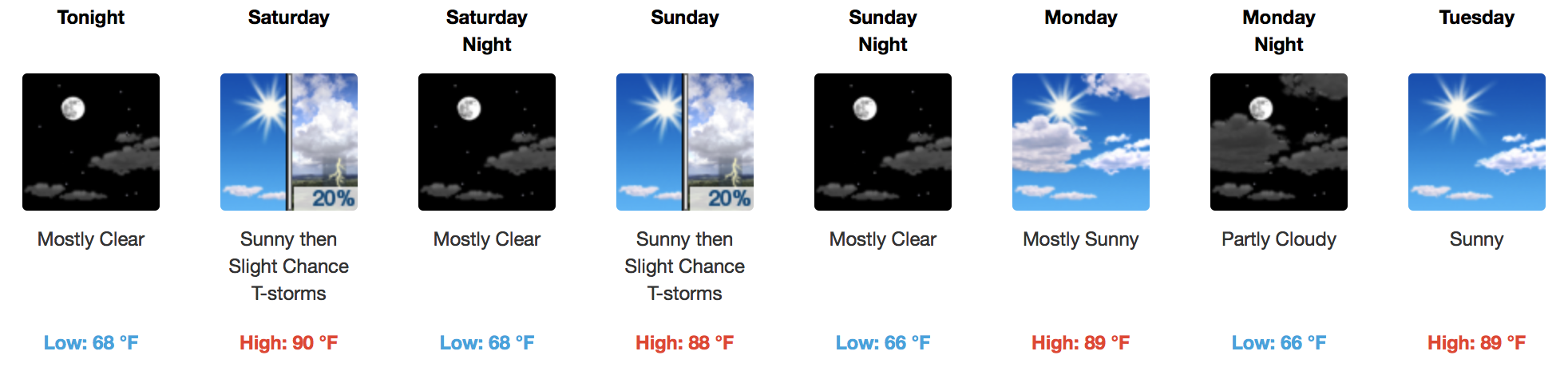
Rest of today appears to be a continuation of that “summertime feeling”. Highs will top off just below 90° with dew point temps cruising in the mid-60s. Popcorn afternoon showers are possible once again today, any shower that develops should die-off by the evening hours.
Monday — Rain chances remain very low. The better rain chances will be northwest of Nashville.
Rest of the Week — The morning shift at NWS-Nashville thought Wednesday afternoon would bring the best chance of rain.
Today — Temps soaring to 88° this afternoon should lift our sweaty, drippy air mass, producing a few pop up showers or weak storms somewhere in Middle Tennessee. The rain will probably be northwest of us, but we can’t rule out a shower. Without low instability, this will probably be a non-event, which will end as temps fall tonight.
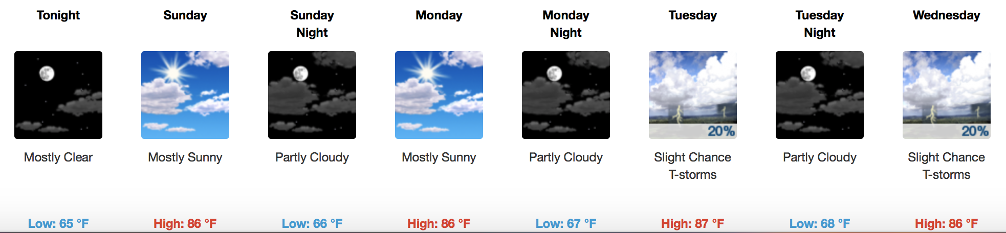

No *concerning* rain is in the forecast, thanks to a well-established ridge of high pressure over the middle U.S. Middle to upper 80s for afternoon highs will carry us through the weekend into early next week.
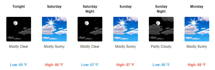
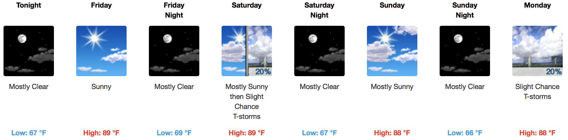
Starting today we will finally transition back into a sunshine filled period. With this sunshine will also come a spike in our temps with highs expected to reach into the upper 80s. Our dew point temps will be in the mid-60s through the weekend. It could feel a bit sticky, but it won’t be too bad.
GOES 16 Visible Loop
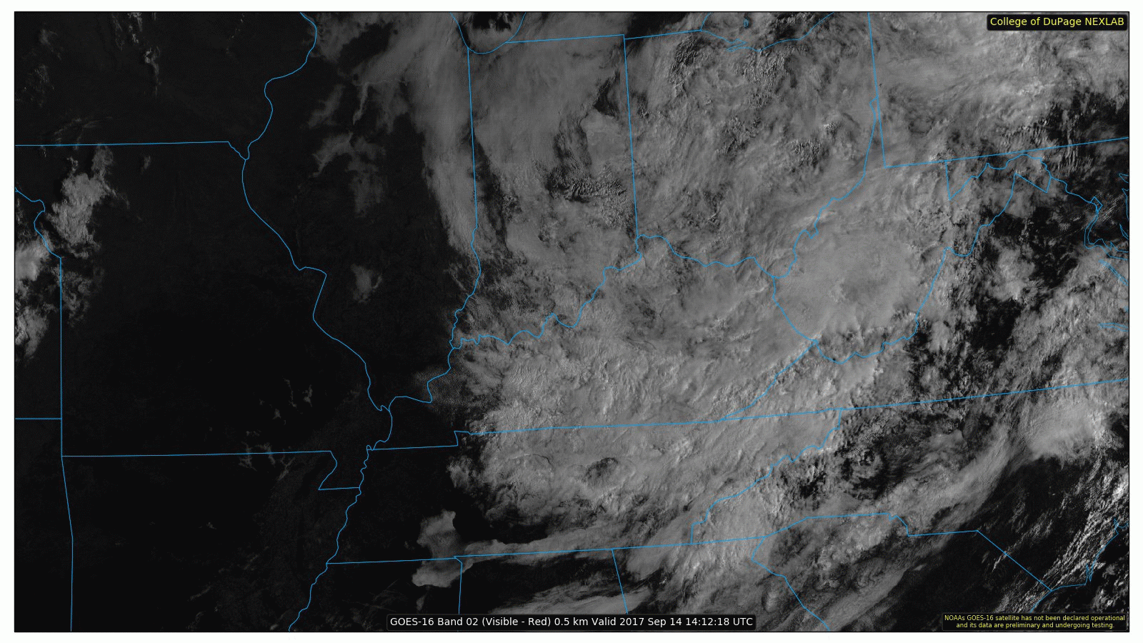
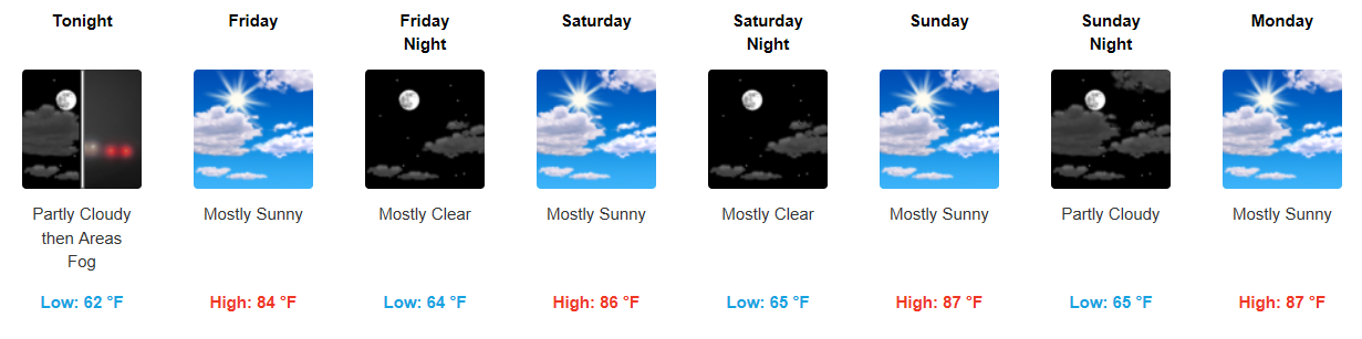
A few showers continue this morning, but the good news is that we expect sunshine to return this afternoon! Temperatures will react appropriately, nearing 80°F for a high today. The remnant low pressure system over the Ohio Valley will take clouds and rain with it to the northeastern U.S. this weekend. Below is an image of GOES 16 water vapor, where the reds/oranges are high water vapor content and the gray areas are dry air.
You must be logged in to post a comment.