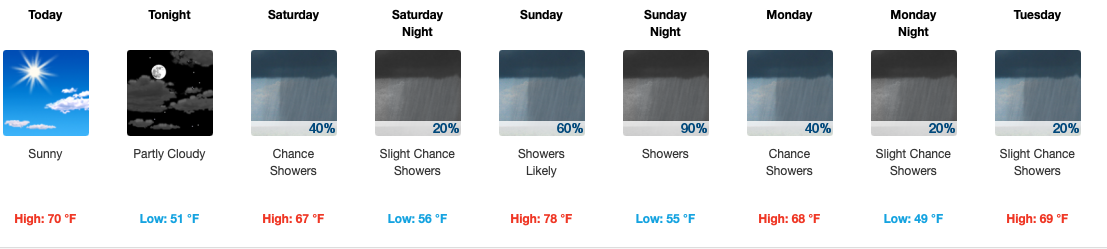
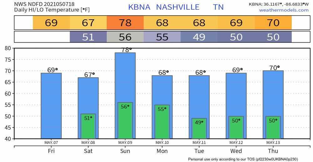
First of all… I hate the typical clip art on weather sites/apps, but I’m going to show it now because I think it give us a clue as to what to expect for the next few days.
Rain
May is our wettest month, so it’s no surprise that we’ll see plenty of water in the coming days. read more
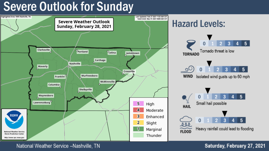
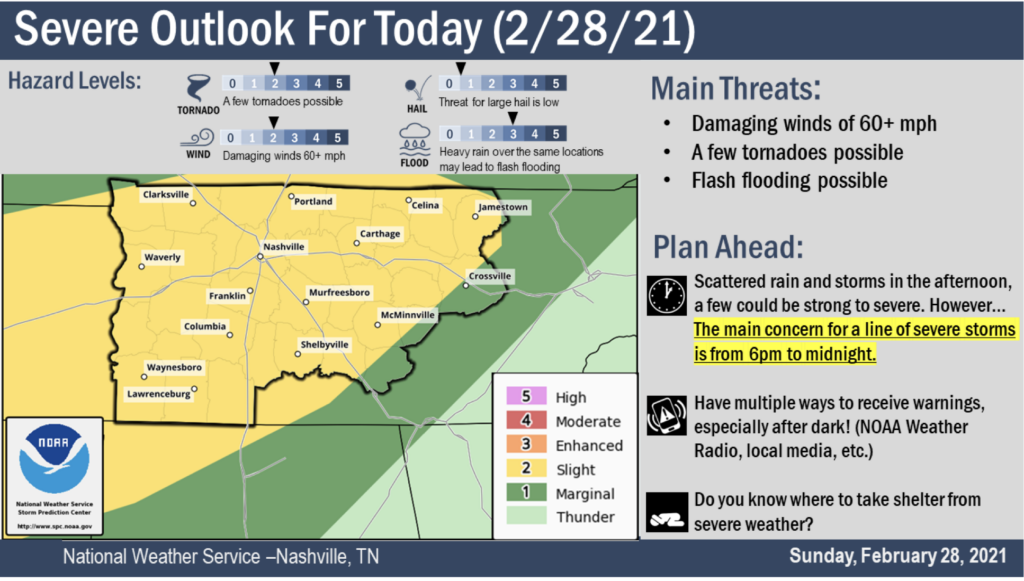
The Storm Prediction Center in Norman, OK has given us a Slight Risk for Sunday afternoon, but we don’t expect widespread severe weather.
Sunday
As mentioned above, spc put us in a slight risk for Sunday. The main concerns are flooding, and a non-zero chance of brief Tornados, damaging wind, and small hail. This isn’t some widespread severe weather event, but it has us interested enough to write a special blog to discuss it. So let’s dig in.
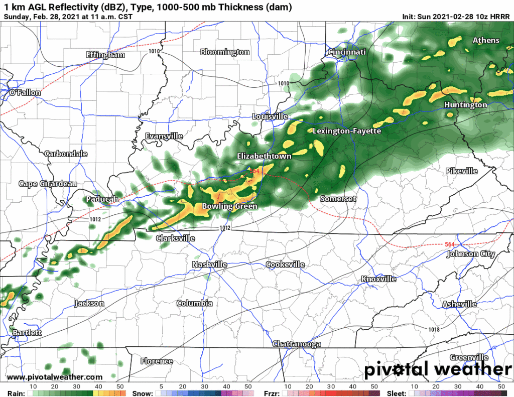
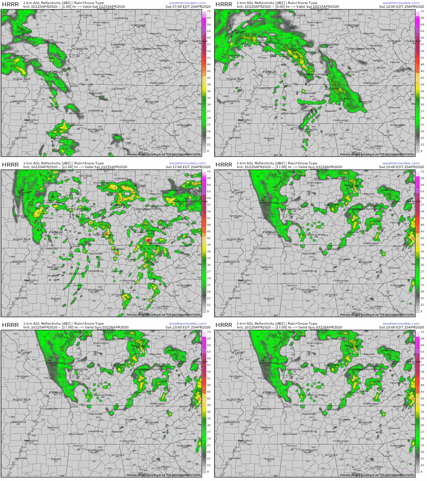
10z HRRR Reflectivity Loop
Above, the HRRR model is running through Sunday night. A storm complex riding a cool front comes our way Sunday afternoon. Exact timing is still a little unsteady, but we think it will be Sunday evening for the “main event”.
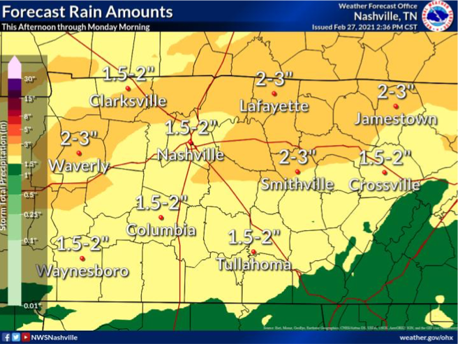
We know it will bring us lots of rain.
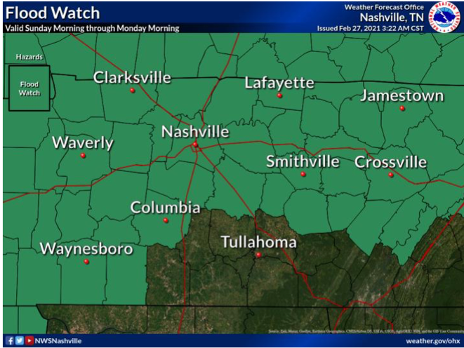
The above graphic is showing a forecasted amount of multiple inches, and that has triggered a flood watch through Monday morning. Creeks, rivers, drainage ditches will remain full and may exceed flood guidance, triggering flood warnings tomorrow night. An isolated 4″ of rain for some us is not out of the question. Flash flooding will be of most concern in areas that receive a lot of rain yesterday. Creek and river levels can be checked here… NashSevereWX Flood Resources
A flood advisory will like remain in effect through 6pm Wednesday.
Severe Threat
It’s low. But it’s not zero and the greater threat exists if there isn’t a cloud deck in place tomorrow afternoon. The setup Sunday is going to be influenced by storm fuel (heat + instability).
Here’s what the NWS said in their Saturday afternoon AFD…
Afternoon
high temps on Sunday expected to sore into mid 70s south with a
good amount of instability and favorable lapses rates for strong
to severe convection development, especially if rainfall does not
move into this portion of mid state region until late afternoon
hours allowing for increased atmospheric instability due to
enhanced diurnal heating influences.read more
Lots of sun today. We’ve hit 73° in my back yard and 75° at BNA. These clear skies and warm temps continue. Tomorrow, the 80’s return.
Beyond Saturday
The blue skies and sun continue through Sunday morning. Clouds begin moving in around lunch and by sundown Sunday night begins our chance for rain and storms. read more
Today will be around 72º with plenty of mid-day sun.
Storms and Rain on Saturday and Sunday?
Low pressure moves from west to east Saturday. Showers may start as early as midnight tonight, and will get wider in coverage through the morning. Strongest winds will be around mid-day and stick around through Sunday. read more
Sunny skies for days as high pressure abounds today and the majority of this week.. High temperatures during the day will stay in the low to mid 50’s, lows around freezing. Except for a chance for showers overnight on Tuesday, we’ll be dry. read more
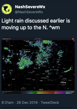
Today began with a good misting of rain for many of us.
That rain has pulled out and taken some of the cloud cover with it, but it won’t last long.
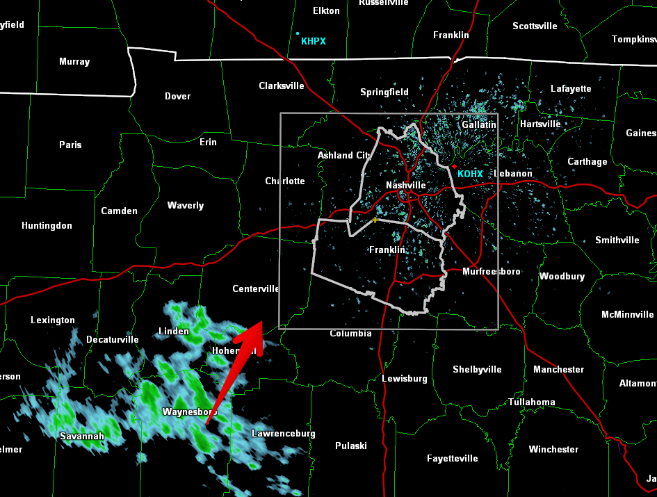
Here is a wide angle view of the radar at 12:35pm showing more light showers similar to this morning on our SW doorstep.
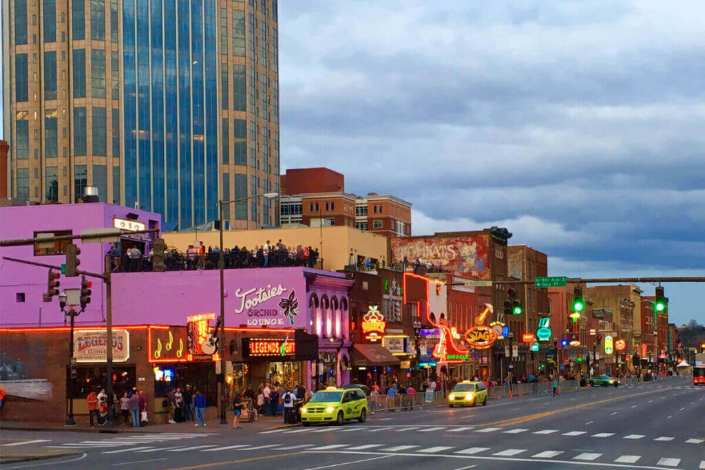
This won’t ruin any plans, but it will make the roads wet again, and usher in some cooler temps while it’s overhead. Bring a rain jacket to the honkey tonks tonight.
Sunday Rain/Storm Chances
An upper low will deepen as it swings off the Rockies and through the central part of the country. Southerly surface flow will pick up ahead of this system encouraging temperatures to warm into the
mid to upper 60s again on Sunday. PWATS are still running very high for the time of the year. Values of 1.5 inches or higher could be possible through the early morning hours on Sunday to Sunday night.
Models have shifted the axis of heaviest precip to
the west, over portions of west Tennessee and western Kentucky. However, this axis could easily wobble east or west over the next 24 hours as we see how the system evolves. For now, expect anywhere from 1 to 2 and a half inches of rain in Middle
Tennessee.read more
Subscribe to Blog via Email
Privacy & Cookies: This site uses cookies. By continuing to use this website, you agree to their use.
To find out more, including how to control cookies, see here:
Privacy Policy








You must be logged in to post a comment.