Author Archives

Will

Awesome Today, Awesomeness Tapers Off Through Weekend

Today

Today’s skies are forecasted to clear, with mild temps and more sunshine. I wouldn’t be surprised if we exceed our forecasted high of 51º if these clouds give way.

Overnight low is down to 36º as clouds move back in overnight and trap the heat like a fluffy comforter.

Saturday

Saturday’s temps will be may a few degrees warmer, up to 54º. However, the could that moved in overnight will stick around. Call it mostly cloudy by afternoon. These clouds set the stage for our next chance of rain.

Rain? Model Roulette

Sometime the best models we can use to predict rain have disagreements. Actually, it’s more than sometimes. It’s something we struggle with when doing blogs like this, and something the National Weather Service is dealing with this disagreement today.

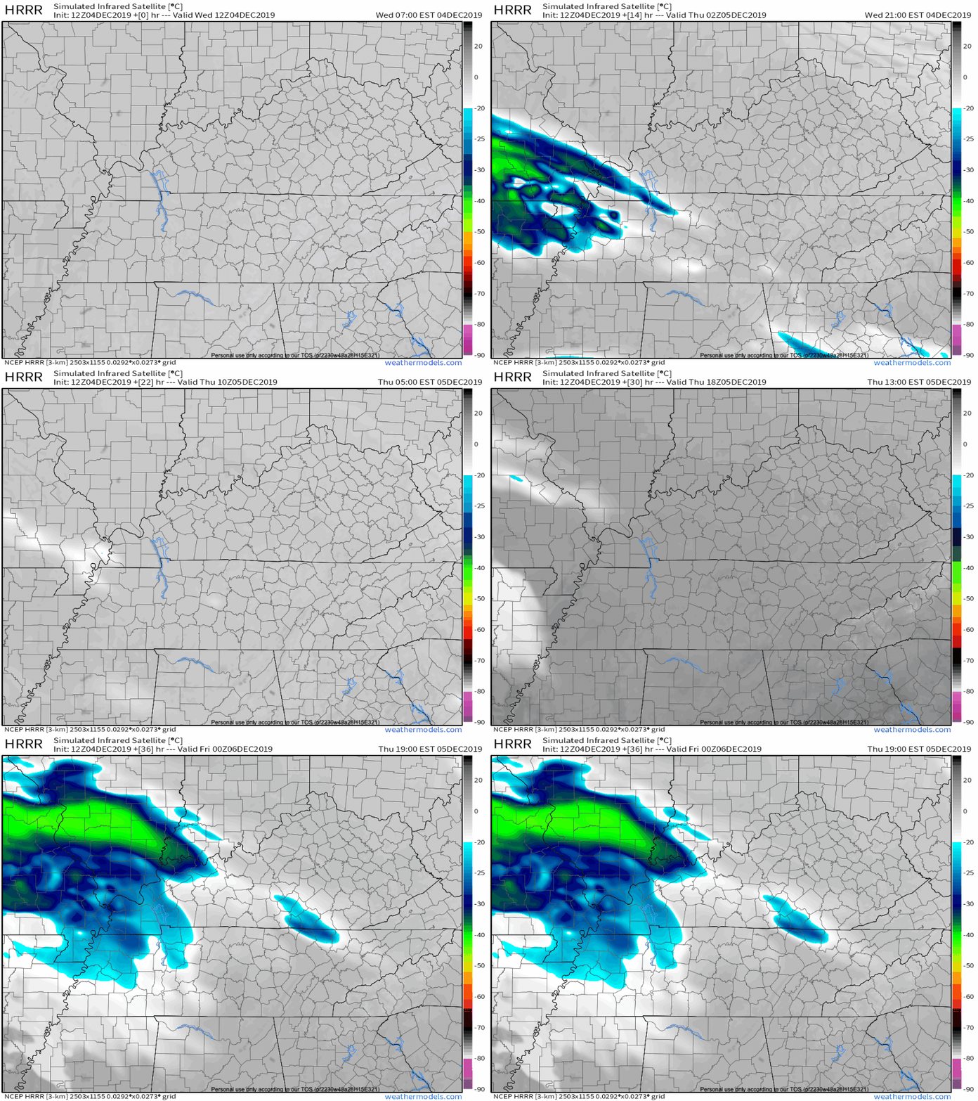
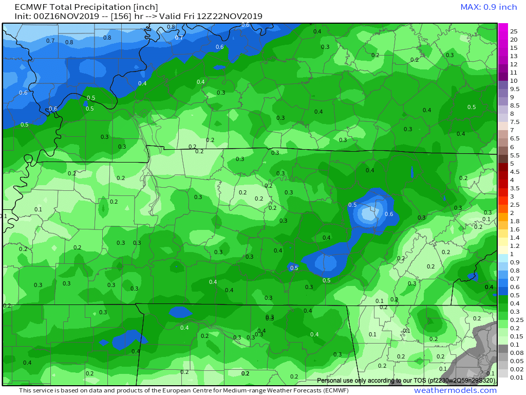
Most of the current iterations are giving southern and southeastern Middle TN some showers by Sunday. The problem is, the GFS is dry, the Euro is kinda wet and the NAM is giving all of the mid-state a deluge. read more
Sunny Skies Give Way To Rainy Weekend

Today

Beautiful skies and lots of sunshine. Temps in the low 50’s this afternoon. 39 tonight.

Downright nice day all around. Get outside and enjoy it. Brittney is excited about it too.

Chance for showers?

There’s a slight chance of showers late tonight and through tomorrow. That chance will be much more than slight as we head toward afternoon Friday. This will set the stage for a wet weekend for all of us.

Digging a little deeper

NWS-Nashville had this to say about precipitation this weekend.

As evening hours progress tonight, the dry weather pattern since the late evening hours on Tue night will commence to ending. It will be replaced with an overall wet weather pattern established across mid state region through at least next Monday night. read more

It snowed! Near Record Cold Temps Wednesday Morning, then we Warm Up.

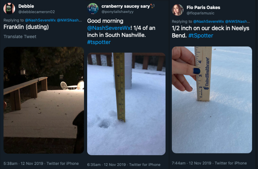
Most of us saw some snow accumulations last night. Here are the highlights.

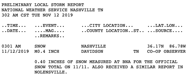
Official snow totals at BNA was 0.4″. The official forecast was between nothing and 0.5″, so not bad!

We continue to see frigid temps today. We’ve not made it above 28º at the time of writing this and after the sun goes down we’ll quickly drop back down below 25º. From there temps will nose dive into the teens. read more

Today

At the time of writing this the temperature is 89º, but it sure doesn’t feel like with a 52º dew point. A steady 10mph breeze doesn’t hurt anything either. All in all, if you’re tailgating, back yard tailgating, or outside for Pilgrimage, things are pretty comfortable. That being said, take some sunscreen.


Sunday

Almost exactly like today, but with a little more humidity. Still not too shabby.


Rain??? Cooler Temps???

Well, the word “thunderstorm” comes back into our vocabulary on Monday, but nothing widespread is expected. It would be great if we saw broad coverage of soaking rain and temps in the low 80’s, but that’s not happening.

Why are things so hot and dry???

Nashville normally averages 81º for a high in September and around 3.5″ of rain. We’ve seen temps consistently in the 90s and like .01″ of rain at BNA. The cause is continuous waves of high pressure moving from West to East across the country. Strong enough high pressure to keep rain makers in the south from moving into our area. Unusual? Somewhat. Annoying? For sure.

Although there is a chance for rain on Monday, it is slight. And… it will be a while until we have another chance.

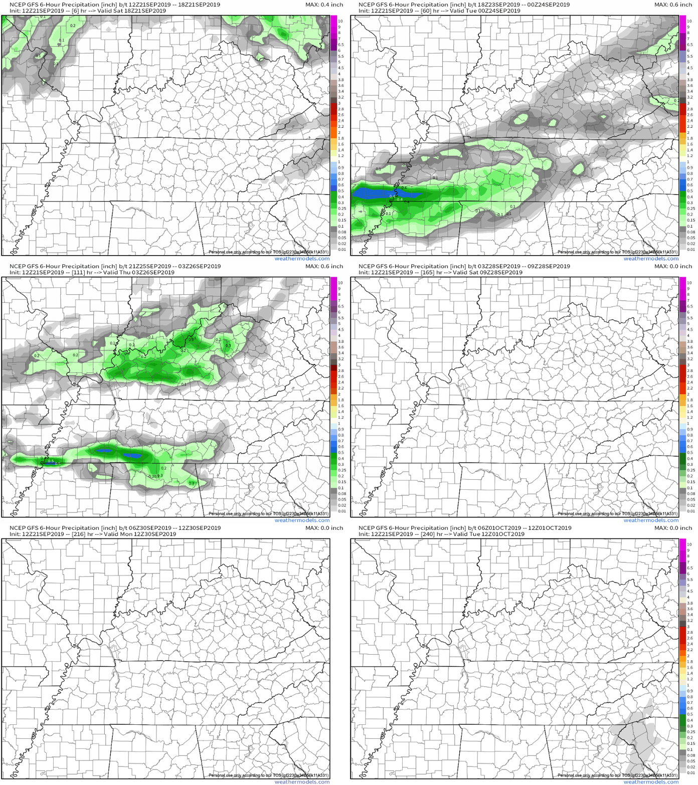
Here is the GFS model’s prediction for 6hr rain totals for the next 240 or so hours.

So… we’ll see! Hopefully this model is wrong (decent chance) and we get some soaking rain soon.

Check back soon!


Feelin’ Hot Hot Hot

TODAY

It’s going to be a great day weather wise. The dew point and temperature are both lower this morning than they were yesterday.

Temperature today will be 95º at 3pm, but a north breeze will keep us sane. Tomorrow, the insanity begins…

This Week

Monday’s heat index will be 102º. Tuesday’s heat index will be 106º. Wednesday’s heat index will be 96º.

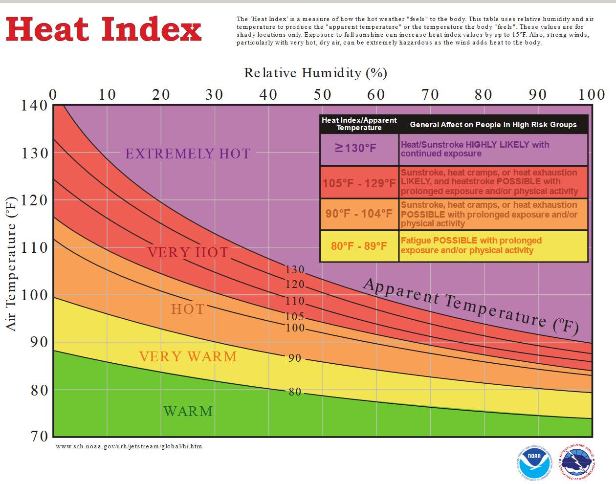
The temperatures will be the same as Sunday, but with higher dew points, it will feel so much hotter. Here’s a breakdown on how heat index works.

So we’ll have Heat Advisory worthy heat this week. But, There’s a complication in all of this…

STORMS

A “cold front” from the mid-west will be coming down into our area Tuesday. When “colder” air meets the hot and swampy air that will be firmly in place, we will see isolated showers and thunderstorms.

This morning’s area forecast discussion from the national weather service says the following.

The latest SPC Day 3 Outlook has
not been issued yet but would not be surprised to see a marginal
or slight risk added for parts of our area on Tuesday. read more

Very Hot With A Chance Of Storms

Today

More heat!

If you’re having a pool party for your birthday, you picked a pretty good one. Happy Birthday!

The temps will hover around 93 with a heat index of 101º. But, keep an eye on the radar this afternoon…there is also a chance for showers and thunderstorms this afternoon. If thunder roars, go indoors!

The National Weather Service in Nashville sum things up in a special weather statement issued early this morning.

ISOLATED TO SCATTERED SHOWERS AND THUNDERSTORMS WILL DEVELOP
ACROSS MID STATE REGION THIS AFTERNOON. MAXIMUM AFTERNOON
HEAT INDEX VALUES OF 99 TO 104 DEGREES ARE EXPECTED FOR LOCATIONS
WEST OF CUMBERLAND PLATEAU

read more