
TODAY
Hot and sunny, with a high of 94º. Heat index values will rise to 98º.

We’ll barely see a cloud in the sky by the afternoon.
SUNDAY
Hotter. Fueled by a steady breeze from the south, high temperature and heat index values will jump up into the upper 90’s.

The Next Work Week
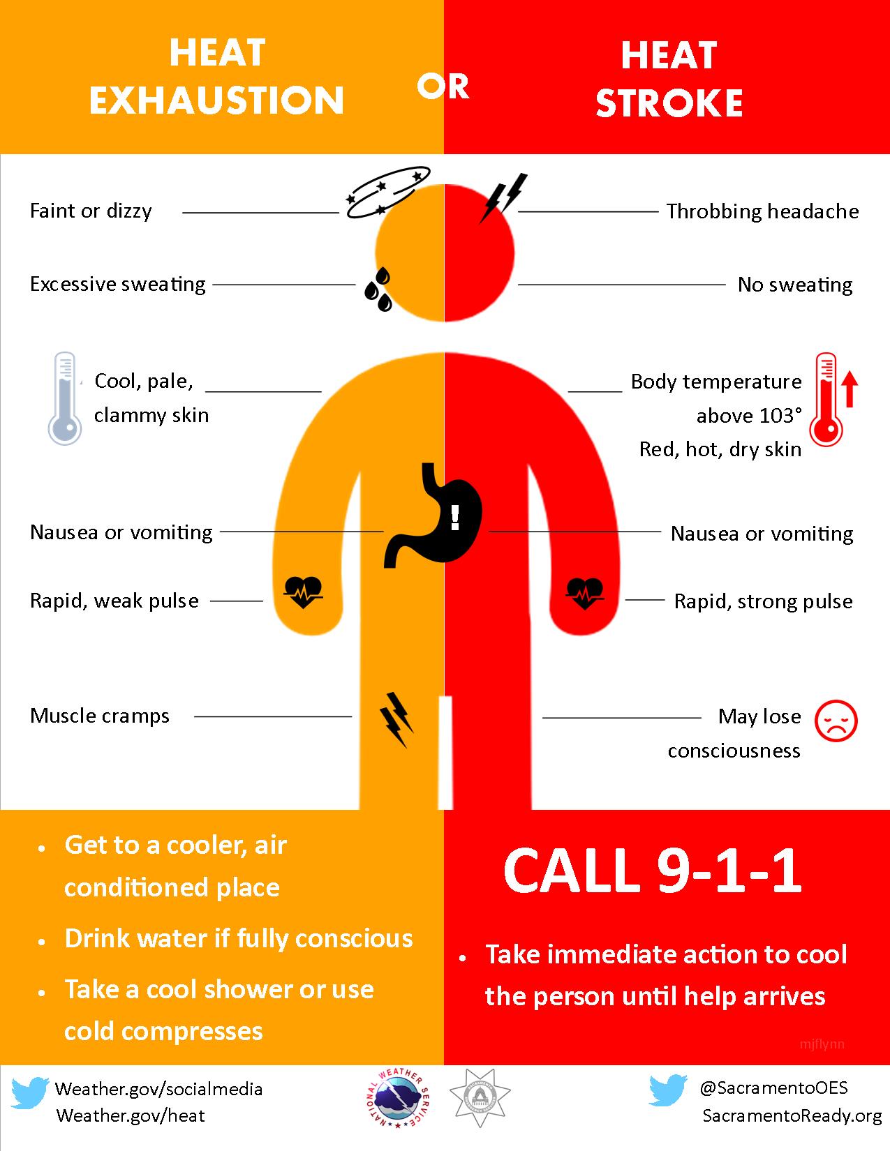
Temps will continue to be in the upper 90’s for the first part of the week. Additional humidity will be added each day making heat index values above 100º Monday through Wednesday. It will be oppressive, and for some possibly dangerous.
Beginning late Wednesday, chances for isolated showers and thunderstorms return to our forecast. Here’s a quote from the morning Area Forecast Discussion from NWS-Nashville:
With temps again climbing in the low/mid
90s, isolated storms will be back in the fold, especially Wed and
Thu when vertical motion/moisture a bit more favorable...and a
weak boundary passes.
Check back with us here and follow us on twitter for more details.

Categories: Forecast Blogs (Legacy)
You must be logged in to post a comment.