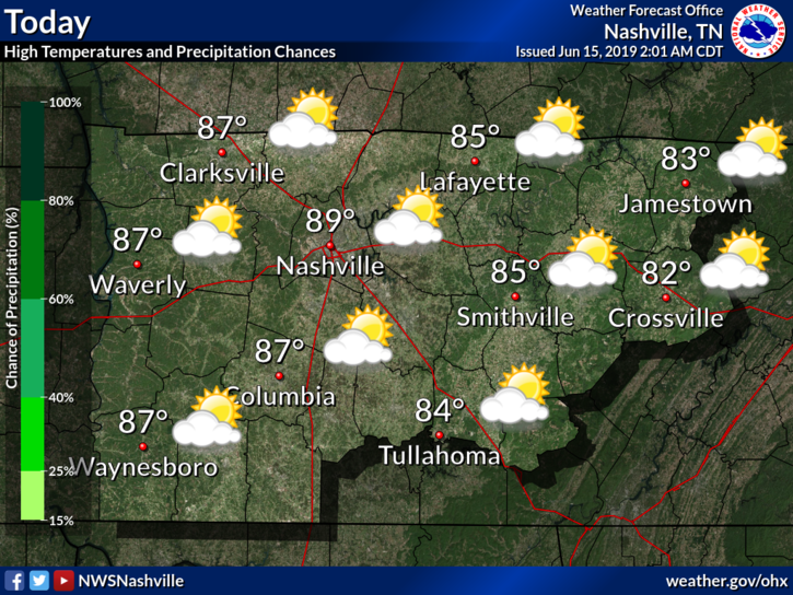
Father’s Day Showers/Storms
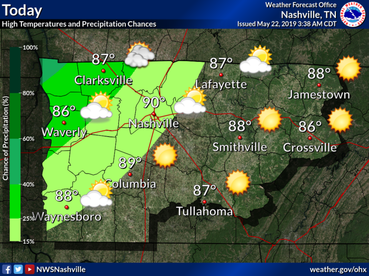
Temperatures will reach a high of 91° with a dewpoint of 70°, so be sure to put on an extra spritz of hairspray and swipe of deodorant. The heat index will run into the mid 90s in the shade, hotter in sunlight.

Temperatures will reach a high of 91° with a dewpoint of 70°, so be sure to put on an extra spritz of hairspray and swipe of deodorant. The heat index will run into the mid 90s in the shade, hotter in sunlight.
Today should make for a nice day, though warmer temperatures and 60° dewpoints return.
Note that winds will hang around 10-15 MPH and gusts could reach as high as 25 MPH.
The chance for rain returns Sunday.

Editor’s Note: This morning’s Nashville weather balloon reported a dewpoint of 71° with CAPE 1,018 j/kg and PWAT of 1.96″. That’s nerd talk for a lot of moisture available to create rain. It’s more than yesterday morning.
Editor’s Note: many have stuff going on at specific times beginning tonight thru the weekend. A show. Cookout. Baseball game. Walking outside to tell your neighbor’s dog to shut up. Golf tournament. Also I heard there is a big fest downtown.
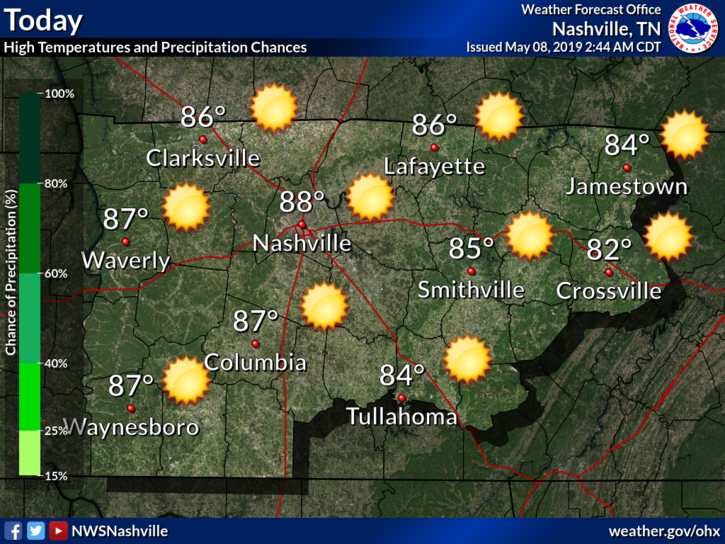
Not too much to say here except hot and sunny:
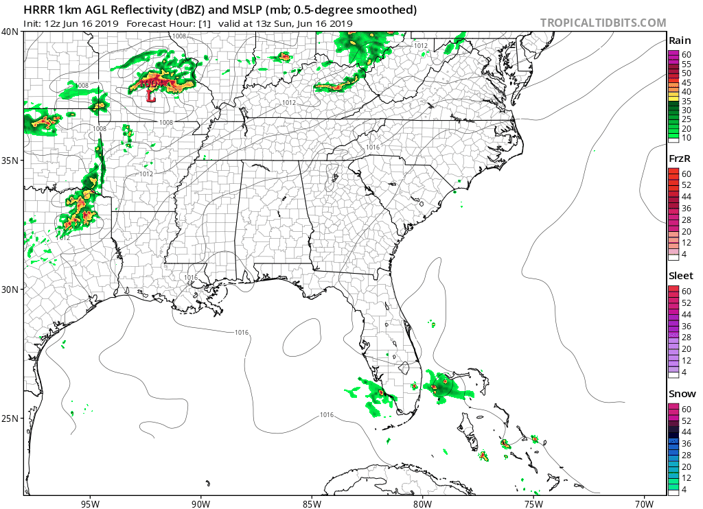
The HRRR model shows rain staying to our north.
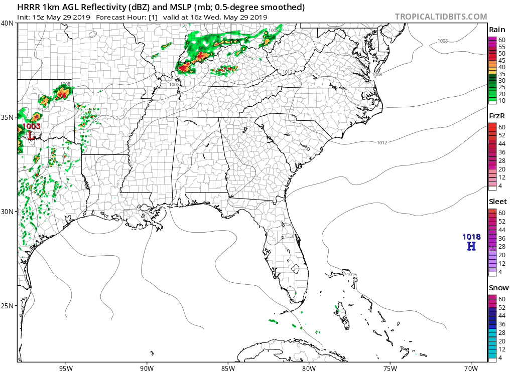
Note these storms are passing pretty close to us. We still think they’ll miss us but this will need to be watched in case the data is a bit off and we get surprised.
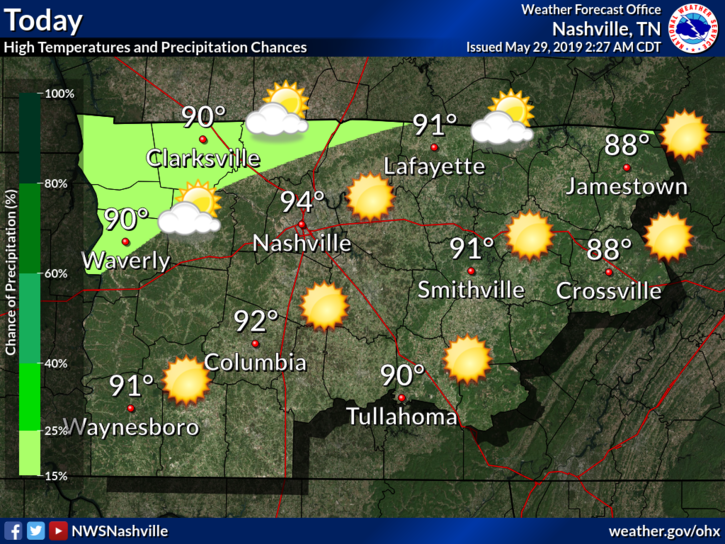
Today will be a beautiful day (if you like temps around 90°).
Winds will be around 15 MPH with gusts as high as 25 MPH, offering some relief.
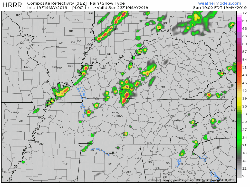
There is the potential for a pop up shower or two. The HRRR model shows a couple scattered showers this evening:
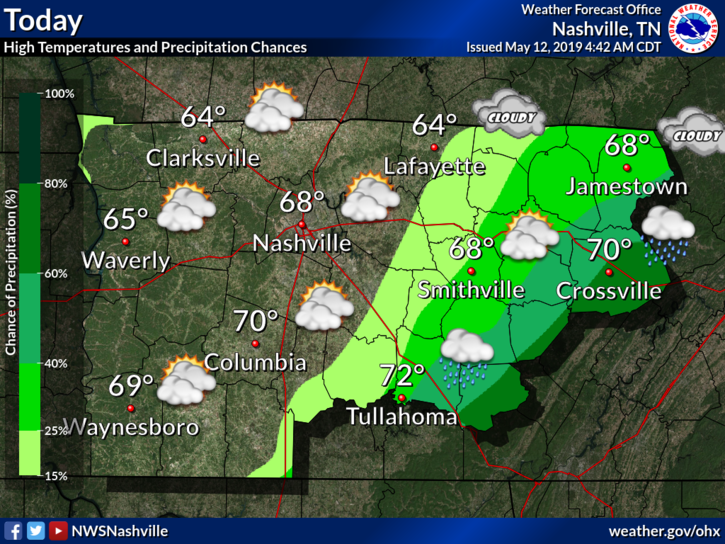
We will see some scattered showers and thunderstorms today as an upper-level low and front move eastward.
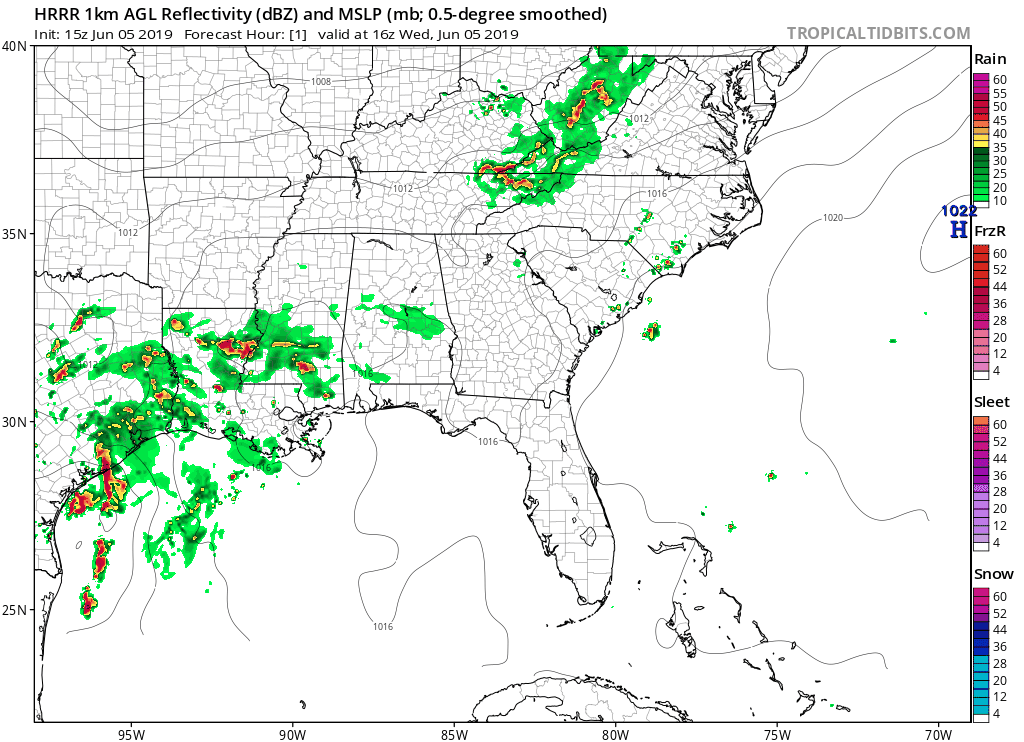
The HRRR model shows the main cluster of rain this afternoon has now passed us, with scattered showers during the evening and nighttime hours. None of the rain really gets heavy. It’s scattered and pretty weak.
This morning’s round of rain has exited our two counties. HRRR (below) shows the possibility of a couple of leftover showers behind this morning’s main rain blob. At noon, these are weakening on radar as they approach from the NW, but they could still give us some light rain in the afternoon hours.
Any lingering showers should move out of the area within the next hour or so, leaving us with comfortable weather for the remainder of the day.
EDITOR’S NOTE:

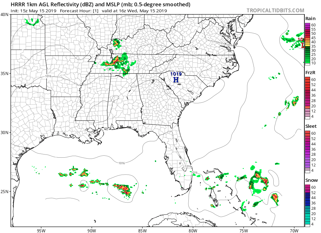
There is a chance we could see an overnight shower and hear a rumble or two of thunder. The HRRR model shows some rain moving in from our west overnight. It should pass before the morning commute to work.
Today will be a beautiful day.
Winds will be around 5-15 MPH, but we could also see gusts as high as 25 MPH.
[Editor’s Note/Fun Fact: If we reach our forecast high of 88°, this would be the warmest day so far this calendar year.]
You must be logged in to post a comment.