Scattered Showers Today; Clearing (probably) Thurs-Fri; Isolated/Scattered Weekend Rain Chances. Very High Humidity Remains.

Wednesday

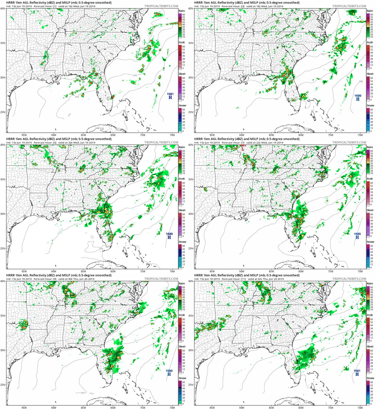
Unfortunately, scattered showers are still in the forecast for today.

Here’s the HRRR model:
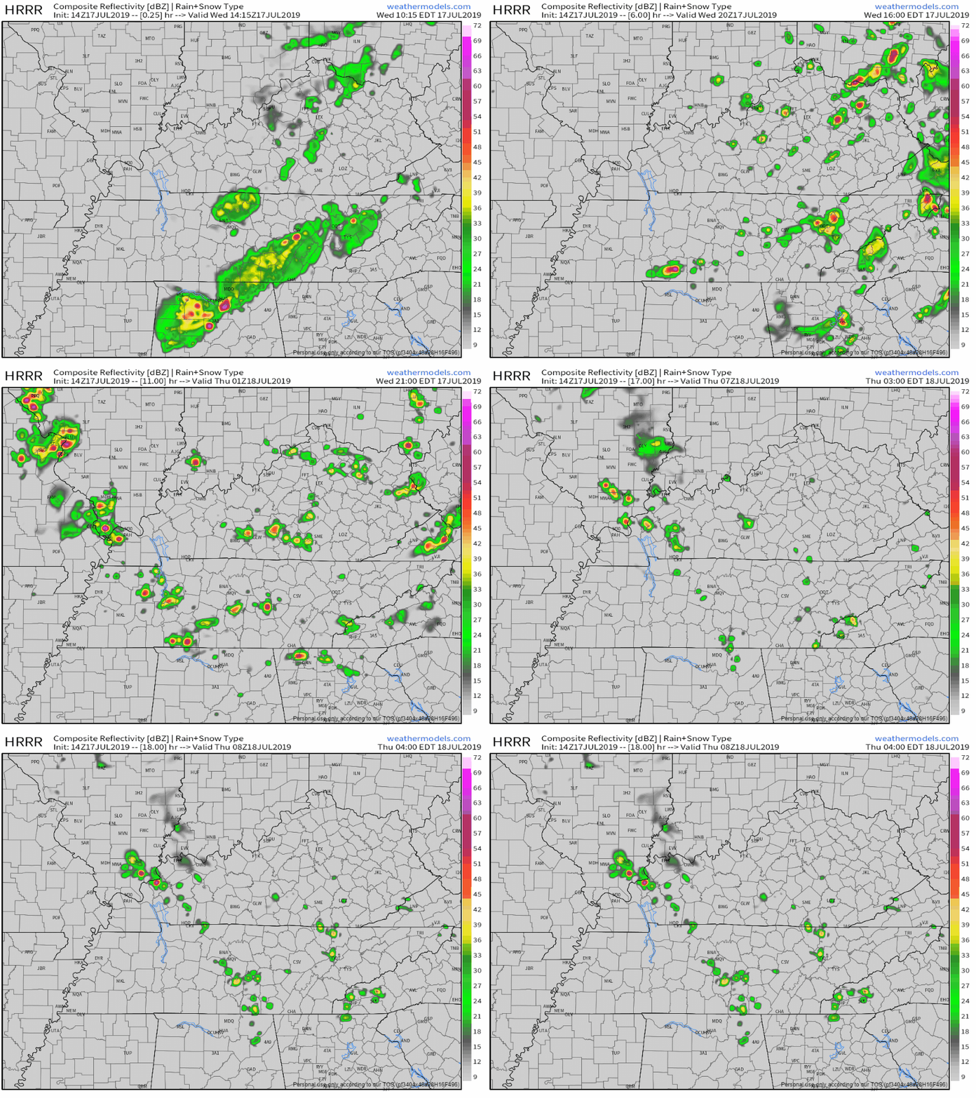
The NAM3 model keeps us a little drier.

Hope for the NAM3, but prepare for the HRRR today just in case more scattered showers find us.

Probably not enough rain to ruin any outside plans. And maybe no more rain at all.

Here’s a snippet from NWS-Nashville’s morning discussion explaining why the showers will be scattered:

“While deep layer drying occurs behind this trough, low level moisture will remain high into this evening with drier air helping to increase instability, showers and storms will remain at least iso/sct [isolated/scattered] through the afternoon and well into tonight…”

Temperatures will reach a high of 89°.

Dewpoint temperatures will reach the mid-70s. This is very humid, even for Middle Tennessee. Take extra precautions and wear some extra deodorant and hairspray if need be.

EDITOR’S NOTE. Be mindful. Don’t leave your kids, pets, anyone in a car. Lock your car if you have small kids so they don’t wander into one, unable to get out:

End of the Week

Rain clears Thursday and Friday.

With temperatures back in the 90s and dewpoints lingering in the mid-70s, we can see heat index values as high as 100°, if not higher.

Disclaimer: a pop-up afternoon or early evening shower or two may find you because it is summertime.

Stay hydrated, find shade, and take breaks if outside.

Weekend Rain Chances

“Isolated/scattered storms likely to pop both days, but more so Sat, especially on the Plateau.” @ NWS-Nashville

Rain chances are on the lower end right now, but we could see some scattered showers and storms this weekend.

Monday, a cold front looks to sweep the area, bringing higher rain/storm chances. This will bring some heat relief, but more on that as we get closer to next week.

Humidity will still be oppressive as dewpoint temps stay in the lower to mid-70s. Sadly, they don’t want to let up just yet.

Enjoy the break in weather at the end of the week, and keep checking back for updates!


Scattered Showers Through Wednesday as Barry Moves North; Clearing Thursday

EDITOR’S NOTE:

Ladies and Gentlemen, I present Tropical Storm Barry.


BTW: Only the WMO names storms, and only tropical cyclones. When the weather channel does it in the winter they’re trying to scare old people. 
Sunday

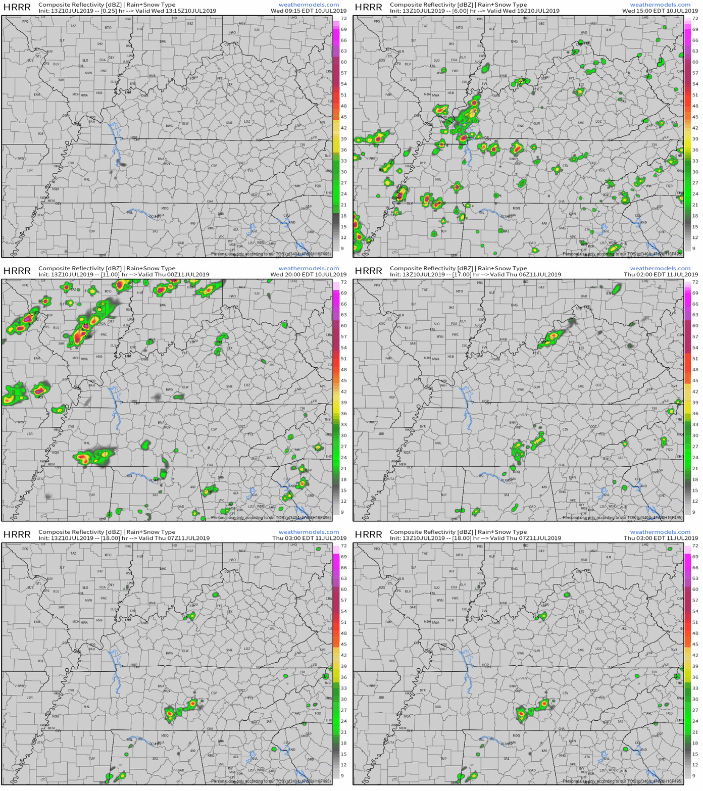
As Barry moves further north, we could see some scattered showers today, though not everybody will get caught underneath one.

Here’s the HRRR model:

Those showers are expected to stay widespread overnight, though the heaviest should continue to stay west of us.

Here’s a look at satellite.

All that cloud cover will help keep our high temperature down to 88° today. Dewpoint temperatures will reside in the upper-60s.

Monday-Wednesday

Barry is still expected to stay well to our west, but we will still see some rain. Here’s the current predicted path:

NWS-Nashville says:

“This all translates to our current trend of scattered/numerous showers/storms continuing really into the middle of [this] week. Precipitable water values likely to stay 1.75-2+ which will continue threat of localized flooding with slow movement of storms at times. While local amounts may be higher, overall widespread rainfall amounts of around 3 inches west to 0.5 to 1 east now most likely with track and weakening of tropical system.

Here’s the expected rainfall totals from the National Hurricane Center:

So, what could we expect as of right now?

We will see some scattered showers and potential storms from Barry, but the heaviest rain should stay to our west if Barry keeps to its current track. If it moves further east, we could see more rain. Localized flooding is possible if caught under a slow and heavy shower.

Currently, the highest chance of seeing rain from Barry is Wednesday.

Winds will also ramp up some at 10-15 MPH, but we could see gusts as high as 20 MPH.

Humidity? Gross. Dewpoint temperatures will be in the lower to mid-70s.

On a better note, temperatures will continue to stay in the mid to upper-80s thanks to cloud cover.

End of the Week Clearing

Once Barry finally moves out of the region Thursday, we will see a turnaround in the weather.

Of course scattered showers will not be ruled out because it’s summer and it’s hot and humid, but we should generally see drier weather and clear skies.

Unfortunately, temperatures will rise into the 90s again.

As for Friday and Saturday, there is some uncertainty due to model differences.

“EURO favors ridging across much of the east, centered up in the OH valley. GFS keep ridging further west, with almost a summer clipper type trough over the east, which brings a front/pcpn though the area Sat. Have to wait and see on that one.” @ NWS-Nashville

We may see rain or we may not. Current precipitation chances are low, but this could change if the GFS’s vision comes true.

For now, all we can do is wait until we get a little better guidance as we get closer to next weekend.

Don’t put up the rain gear, and keep checking back for updates!


Showers/Storms thru Thursday; Friday Relief; Weekend Uncertainty

Wednesday

Showers and storms do exist in the forecast today.

The HRRR model shows them firing up later this afternoon:

The NAM3 is a bit calmer, but still shows a shower passing over in the late afternoon:
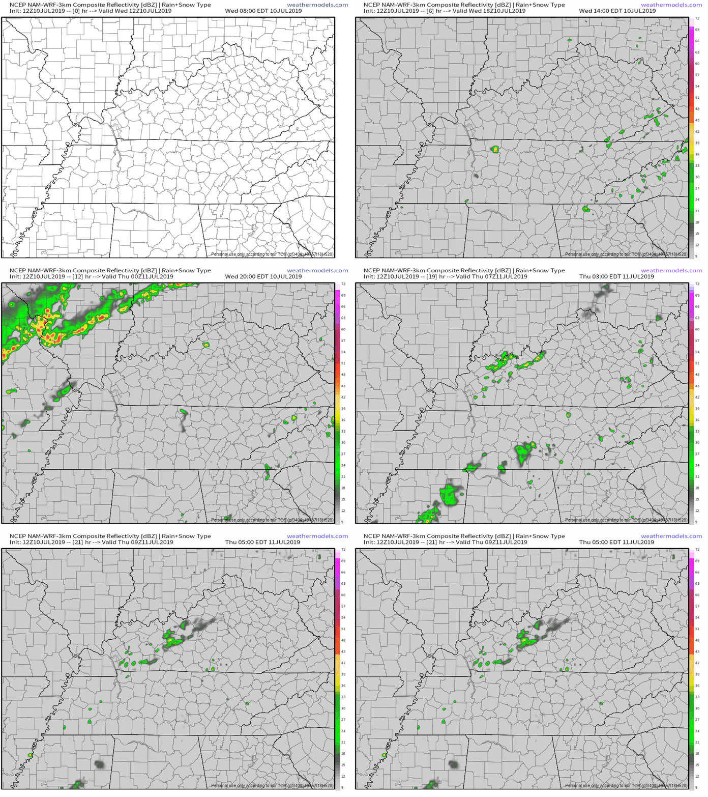
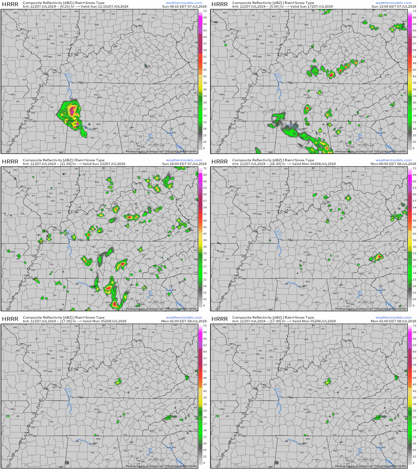
Regardless, keep the umbrella handy today. There is plenty of moisture and heat to trigger some pop-up showers, so be prepared just in case.

Speaking of heat, the high will reach 96°, but heat index could reach as high as 103°.

I don’t know about you, but this weather is too hot for me.

Please take proper precautions. Heat exhaustion and heat stroke can be real issues during this nasty summer heat.

Thursday

Due to a passing boundary, we could still see some showers and storms in the area.

“This boundary will give the environment enough of a push that we could get additional showers and some strong to severe thunderstorms tomorrow afternoon. The SPC does have those primarily east of I-24 in a Marginal Risk for severe weather, with the main concerns being damaging wind gusts and small hail.” @ NWS-Nashville

Here’s the current SPC Day 2 Outlook. Remember, Marginal Risk means a 5% chance of seeing severe storms within 25 miles of you.

Overall, we aren’t too concerned, but as always we will monitor.

Here’s the NAM3 for tomorrow, though this is subject to change:

Besides rain chances, temperatures drop to 91°, though heat index could still reach 101°.

Friday Relief

“Highs on Friday will struggle to reach 90 and more manageable dewpoint temps. Scattered showers and thunderstorms will be possible, but mostly for those south of I-40.” @ NWS-Nashville

Besides those possible showers, Friday will be mostly sunny.

Weekend Uncertainty

Unfortunately, there’s still some uncertainty this weekend.

That low pressure system currently has a 90% chance of turning into a Tropical Depression in the Gulf, but models still aren’t totally sure where this thing will go.

Some models want to take it westward, which decreases our rain chances. Others think it’ll have a more eastward track, which could mean a higher rain chance for us here in Tennessee.

This will be monitored, but until then, here are the current PoPs (probability of precipitation) and temperatures for the weekend:

Stay cool and hydrated in this heat, enjoy the break Friday, and keep checking back for updates!


Possible Showers Today, Clear Start to the Week (probably), Rain Chances Return Thurs

Sunday

Rain currently southwest, south, and southeast so far, but we could also see some showers today.

HRRR model predicts afternoon and evening scattered showers:

Some scattered storms later Sunday afternoon will be capable of heavy rain and strong winds, so have a backup plan in case you’re spending the day outside and find yourself under one of these pop-ups.

Temperatures will reach a high of 92°, though heat index values could make it feel like 100°.

Clearing Monday-Wednesday

Finally.

We still can’t rule out a pop-up shower or two because all the heat and moisture, but we should generally be dry over the next few days.

Heat index will still make it feel like temps are in the upper-90s (possibly even 100°).

As we’ve mentioned before, stay hydrated, and be sure to find shade and take breaks if outside.

Rain Chances Return Later This Week

We could see some more rain before the end of the week.

A weak cold front is expected to sweep the region Thursday, which increases our rain chances again.

It doesn’t look like a washout, and we don’t expect any severe weather from it right now.

Below is the GFS model, just to provide a little bit of a visual of the higher rain chances. Remember, this is a long range model and is subject to change.

Temperatures are expected to hang around the mid-90s Thursday.

Skies should clear up on Friday, and thanks to that weak front, high temperatures will drop just a little to 90°.

Peek Into Next Weekend

Right now, it’s pretty hard to say what will happen next weekend.

Meteorologists have their eyes on a potential low pressure/tropical system working its way from the Gulf up into Middle Tennessee. The EURO model thinks what’s left of the tropical system will arrive here next weekend, but the GFS doesn’t agree.

If the EURO is right and this happens, it’ll rain. However, there is also a really good chance this won’t happen.

For now, enjoy the clear beginning to the week, and keep checking back for updates!


Scattered Showers on the 4th, Rain Chances Remain through the Weekend

Independence Day

Unfortunately, we are looking at more possible showers and storms today.

Here’s the HRRR model:

The NAM3 shows much less development. Don’t count on this. We can hope for the NAM3, but to be on the safe side, I’d prepare for the HRRR today.
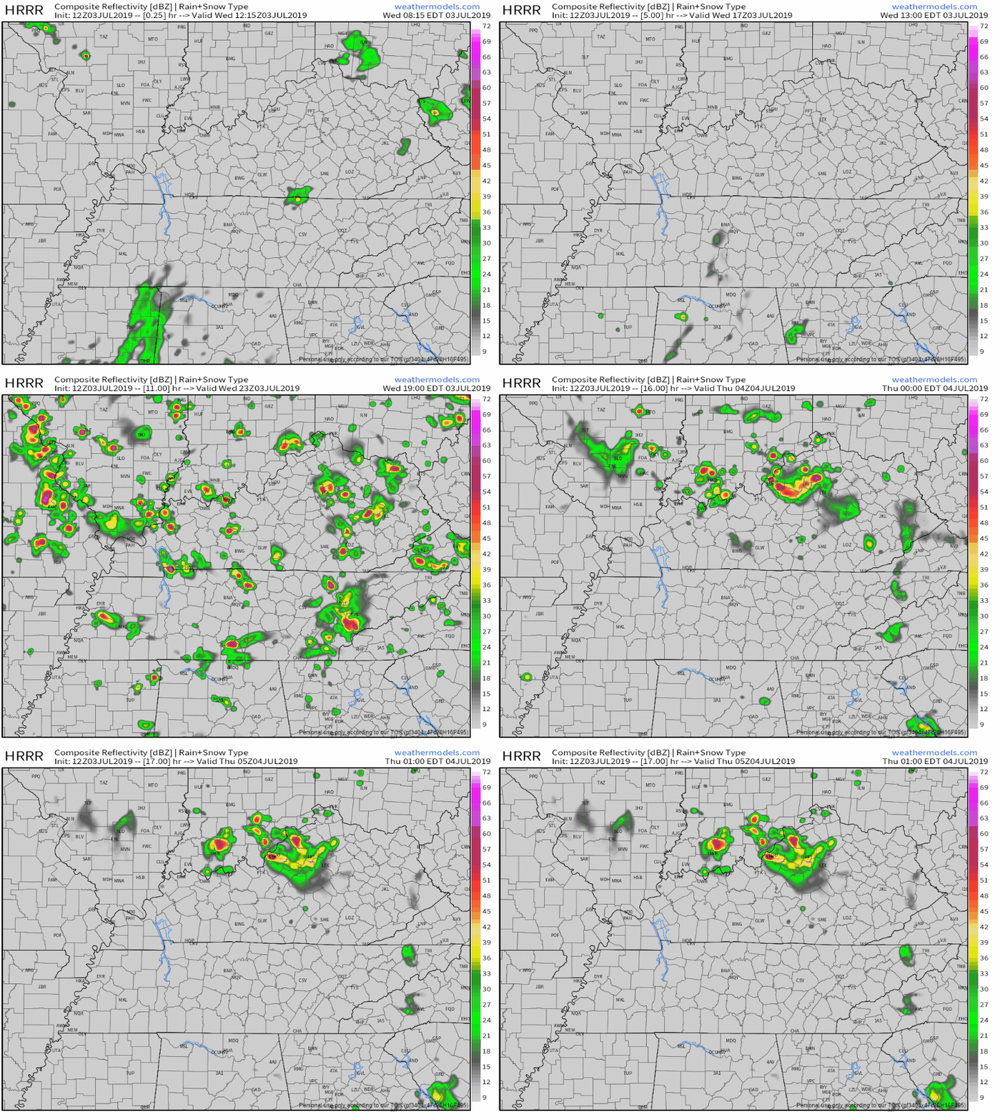
Any pop-up showers could hinder outdoor grilling this afternoon, though they look to taper off by nighttime. If anything, firework shows could be delayed, but hopefully not cancelled.

Here’s what NWS-Nashville says (quick translation below):

“We should see thunderstorms develop on a similar timeline as yesterday, with scattered storms late in the morning becoming more widespread in the afternoon hours. Instability (MUCAPE values near 3000 j/kg) will be high enough for storms to become tall and produce small hail, gusty winds and lightning, however, shear values will continue to be very low, which will inhibit organization and lead to the typical summertime pulse storms that we`ve been seeing the last few days. PWATS remain higher than normal for this time of the year, around 1.9 to 2 inches and storm motion will be fairly slow again today, so some heavy downpours could cause ponding on roadways and quick rises and falls in flashy creeks. While many places could see storms this afternoon, it shouldn`t rain all day at any one place, so hopefully the storms don`t do much more than delay holiday celebrations.

Quick translation: scattered pop-up storms beginning this afternoon, nothing severe expected (though watch for small hail, gusty winds, and lightning), possible ponding from lots of moisture and slower storms.

Please stay weather aware today, especially if you will be outdoors, and have a plan B or somewhere to take shelter in case you find yourself in one of these showers/storms.

When thunder roars, go indoors.

Aside from rain/storm chances, today will reach a high of 91° with heat index values reaching as high as 98°. Stay hydrated, find some accessible shade if outside, and take breaks.

Oh, and…

Rest of the Week

There aren’t many changes in the forecast since yesterday.

Afternoon/early evening storms are still possible over the next few days due to diurnal heating, though we still aren’t too concerned with severe storms. We will monitor.

A second snippet from NWS-Nashville’s morning discussion:

“We won`t see much change in the forecast between today and tomorrow other than the introduction of a weak shortwave that could encourage slightly more thunderstorms development during the afternoon on Friday through Saturday evening.

Heat index values? No relief. These will still reach values in the upper-90s and could peak to 100° (I’m looking at you, Sunday).

Dewpoint temperatures? Lower to mid-70s.

Stay weather aware today, stay cool (and hydrated), and have a safe and happy 4th!

Keep checking back for updates!


Rain, Rain, and More Rain Chances

Wednesday

Today we can expect mostly cloudy skies and a high of 92°, though heat index will make it feel like 98°.

The HRRR model shows scattered showers and storms beginning later this afternoon around 2pm:

Here’s the NAM3 model:

Keep the umbrella on hand in case you find yourself in one of these scattered showers/storms later today.

Independence Day

Whether you’re spending the afternoon grilling, out on the lake, or even at work, the chance for scattered showers and storms still linger in the forecast.

However, evening plans may still be in spared. Check out a recent tweet from NWS-Nashville:

Regardless, still have backup plans in case a scattered shower or storm finds you.

The NAM3 and HRRR models are currently disagreeing on the timing and coverage (NAM3 says very little to no showers, HRRR says quite a few scattered showers). Hopefully we have some more model guidance tomorrow, though as mentioned before, they don’t handle these summer pop-ups very well.

Make note that heat index values are still expected to near 100°, so be sure to stay hydrated and take breaks from strenuous outdoor activities.

Have a safe and happy 4th tomorrow!

Still Rain, Rain, and More Rain Possible

Unfortunately, the rest of the week still follows the same pattern of possible scattered showers/storms.

I know I keep sounding like a broken record between the rain and heat, but heat index values will still be around 100° over the next few days.

Any Severe Storms?

“The lack of the upper ridge influence also means that a few more strong storms will become possible each afternoon. Strong gusty winds, heavy rain and LOTS of lightning are going to be big concerns as we move through this week of Independence Day celebrations. Please remain weather aware if you will be attending outdoor activities this week.” @ NWS-Nashville

NWS-Nashville’s discussion also mentions Saturday having the highest chance for widespread rain and storms, with a possibility of one or two being severe due to an extra pinch of instability (thanks, summer).

Stay weather aware, plan accordingly, and have a backup in case you end up under a storm (especially if you are outside).

Have a safe week and Happy 4th of July tomorrow! Keep checking back for updates!


Spotty Showers Possible Today, Overall Hot Week Ahead with Chances of Rain

Sunday

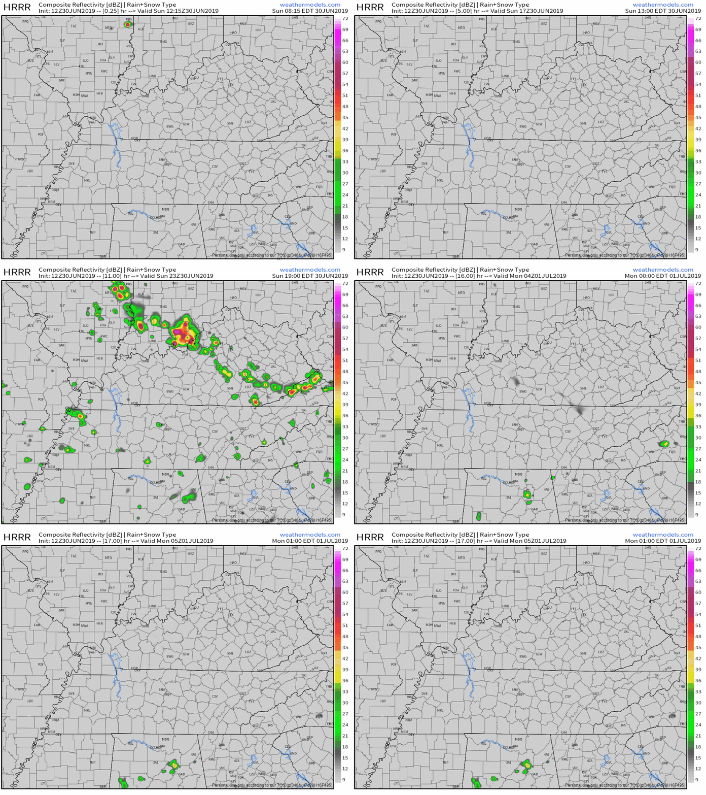
The HRRR shows some spotty showers beginning this afternoon (2 or 3pm):
Here’s the NAM3 model:
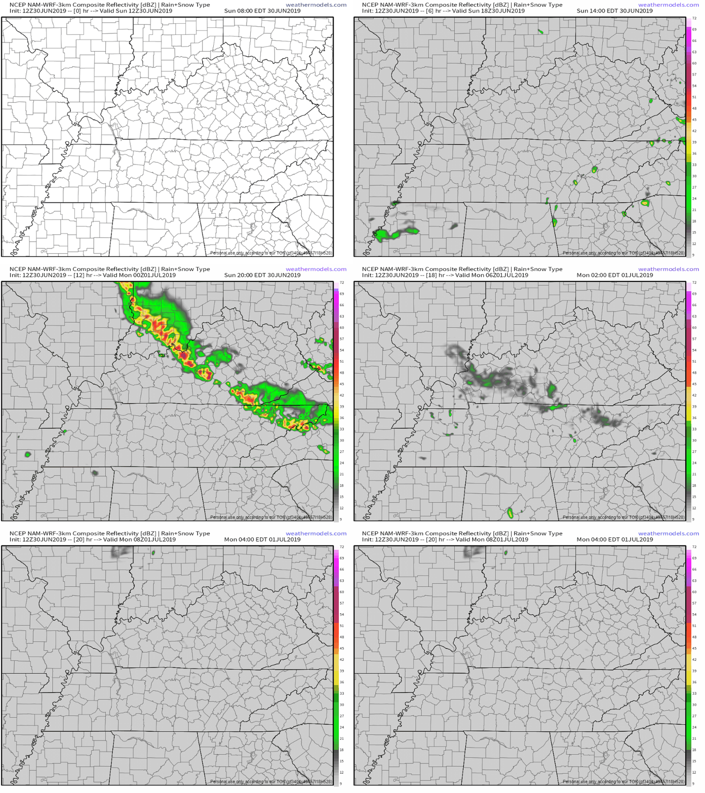
You may see a shower or you may not. If you do, it’ll be short lived and not a rainout.

Note the big cluster of storms in Kentucky. Right now models show them dissipating before they reach Tennessee (NAM3 carries them over just a little, but they’re weak).

Those storms will be monitored throughout the day, just in case they don’t lose all their fuel as they reach the state line.

If they somehow survive, timing would probably be overnight/early Monday morning, but right now that’s a big “if.” We will monitor.

Temperatures will reach a high of 92°, but the heat index will make it feel closer to 100°. Plan accordingly.

Monday

We should have a dry Monday, though we can’t rule out a brief pop-up shower from the heat and humidity.

Don’t let that 93° fool you though – factor in dewpoint temperatures and we get an even higher heat index of 102°.


EDITOR’S NOTE: Take precaution with this heat. If outdoors, hydrate and take frequent breaks from strenuous activity. 


Rain Chances

Rain chances return Tuesday and will carry on for a few days, though PoPs (probability of precipitation) are low right now.

Heat index will still run around 100°+ throughout the remainder of the week. Tuesday looks to be the warmest day. Please take the proper precautions.

For those planning for the 4th of July, the chance for rain is still on the table. The GFS and EURO models both show some rain, but it’s hard to give any specifics right now. Plus, they’re both long range models, and things could change by then.

Just to be on the safe side, have a plan B in place. Just in case.

Peek Into Next Weekend

“By the end of the week and into next weekend, we lose the southwesterly flow aloft and a weak west-east boundary could slip towards the mid-state. This would increase rain chances a little more. Models were trying to increase PoPs into the likely categories for Friday through Sunday, but will run with chance PoPs and adjust through the week based on any persistence of this boundary.” @ NWS-Nashville

Rain is possible, but is also dependent on a weak boundary that could sweep the area next weekend.

Still far out, so we will keep updating as the week goes on.

Keep checking back for updates, and stay cool outside!


Mostly Clear Weekend, Rain Chances Return Tuesday as Heat Cranks Back Up. Guessing the Fourth.

Clearing Saturday through Monday

We should have some clearing for the next few days.

We can’t completely rule out any pop-up showers. Some of you may get wet. But we aren’t concerned with any rain-outs or outdoor plan ruiners.
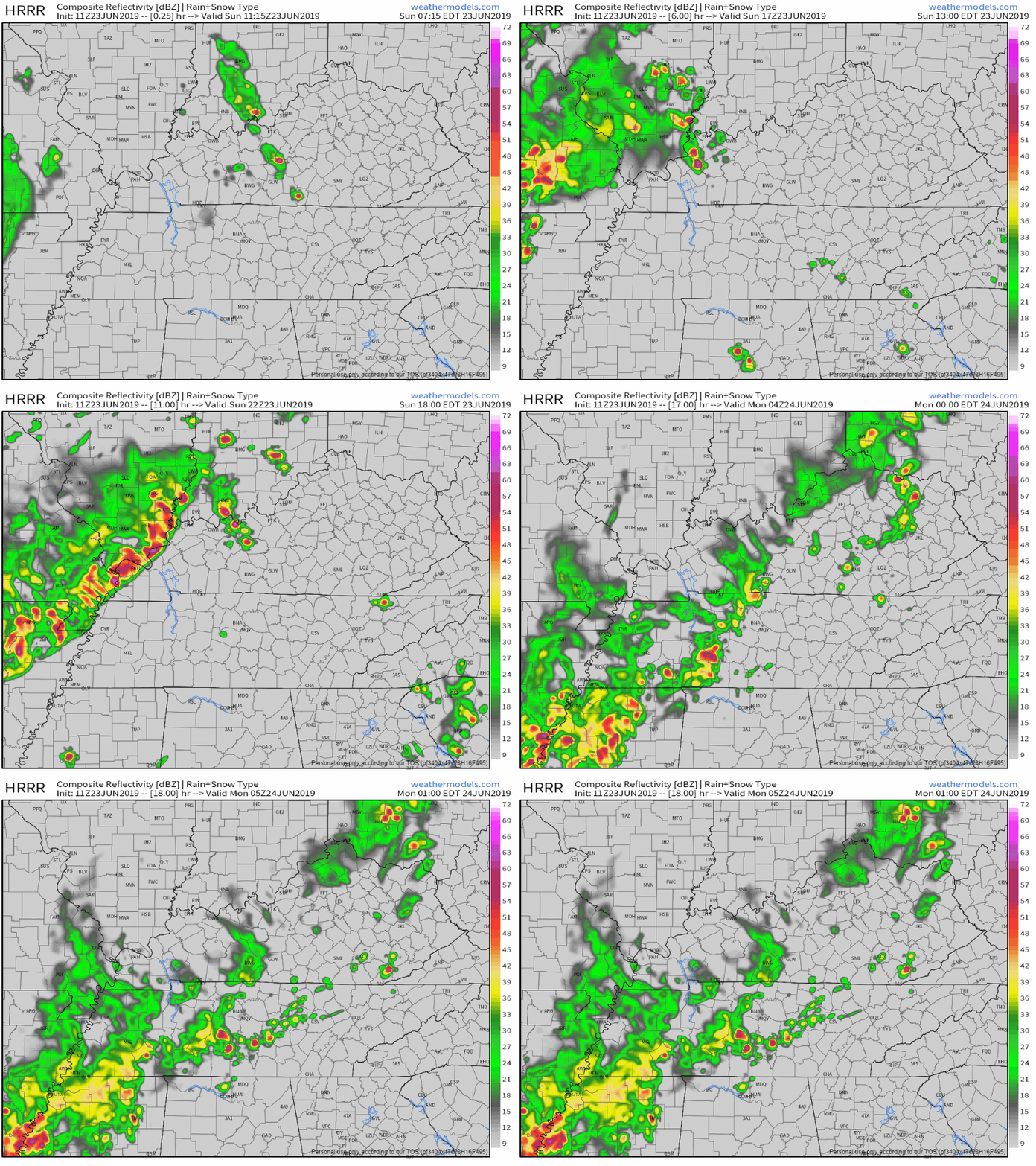
The HRRR model shows some scattered showers around us Saturday, but they don’t quite reach us.

You may see a shower, or you may not. But probably not.

We could see the same thing Sunday – mostly sunny, but a pop-up shower could catch one by surprise.

And Monday has the highest chance of being dry.

Rain Chances Mid-Week

Rain chances return Tuesday, though they’re on the lower end.

The greatest chance of rain is Wednesday and after.

NWS-Nashville says:

“By then, both a surface and an upper ridge will be situated to our east, and we`ll start to see some additional Gulf moisture rotate around the high and into Middle Tennessee. Look for even better rain chances from Wednesday onward as a succession of ripples starts developing in the upper flow.”

Here’s a look at the GFS, which takes us from Tuesday all the way through Friday.

Disclaimer: this is far out and not high-resolution. Don’t completely bank on this, especially towards the end of next week. (Editor’s Note: the GFS has been hot garbage lately. Not enough to totally discount it though. But the latest run of the better Euro model has us kinda dry Wednesday and wet on the Fourt. The models really don’t have a great handle on it, but there is reason to be concerned about rain on the Fourth.)

So far, no severe storm concerns, but we will keep watch over the next few days.

High temperatures will remain in the low to mid-90s.

Summer Heat

“… look for temperatures to slowly creep upward, with readings in the low to mid 90`s common next week and heat indices reaching the upper 90`s to low 100`s across most of Middle Tennessee west of the Cumberland Plateau beginning Tuesday.” @ NWS-Nashville

In other words…

Not to worry anyone, but heat leads weather fatalities in the U.S. in 2018, on a 10-year average, and on a 30-year average.

Honestly I was pretty surprised when I learned this back in my natural hazards class.

Jon posted an awesome graphic yesterday from the NWS on how to stay safe in the heat – there are many other factors than just staying hydrated!

(Editor’s Note: The numbers are for the United States. Many of those heat related deaths impact most vulnerable people — those without AC, elderly/sick, poor/homeless, those not acclimated to heat waves — and may not impact you. But think about them, how can you help them. That said, heat stroke is a real thing, tough guy, you’re not invincible, your organs have needs, and also, don’t LEAVE YOUR KIDS IN A PARKED CAR IN THE HEAT. Or, really, ever).

For now, enjoy a mostly clear weekend/start to the week, and stay cool as temperatures ramp up again next week!


Possible Pop-Up Showers Today, Afternoon Rain Possible Monday, then Finally Some Clearing

Sunday

NWS-Nashville says:

“During the afternoon, short-range guidance depicts a few hit and miss thunderstorms, but nothing terribly organized. Instability, lapse rates, and moisture will be in place for thunderstorm development…however, low shear and weak mid-level ridging will work to keep storm coverage to a minimum. Any storms that do get going have the potential of becoming strong/severe with damaging winds and hail being the main concerns.”
The HRRR model keeps us mostly clear until around midnight when a line of storms approach the area:

The NAM3 model agrees, though the rain fizzles out a little more:

Could you get caught in a pop-up shower or storm today? Possibly.

Could it be severe? Eh, chances are low, but also possible for stubborn storms.

Will I get caught in that line of rain if I’m out tonight? Also possible. Due to the uncertainty of the weakening/fizzling, NWS-Nashville has low chances of precipitation tonight (for now), though this will be monitored throughout the day.

High temperature for the day? 91°.

Dewpoint temperatures? Lower 70s.

Overall, keep umbrellas and hairspray handy today, or risk hair doubling in size.

Rain Chances Monday

Yup, the rain can’t quite leave us alone just yet.

The NAM3 thinks we will see some rain right in the afternoon hours:

Fortunately, it shows the heaviest stuff staying barely north of us. Don’t believe this though – this can easily shift between now and then.

Another snippet from NWS-Nashville’s morning discussion:

“Some storms could be on the stronger side with gusty winds and hail possible. Wet weather may linger along and east of I-65 through early evening, while the rest of the Mid State dries out.”

We could be clipped by some light showers late Monday night, but there’s also a good chance they could miss us.

On a slightly better note, high temperatures drop a little to 86°.

Dewpoint temps will linger on the fine line of oppressive/uncomfortable.

Clearing Beginning Tuesday

We should finally begin to clear Tuesday (definitely a relief to hear over a hectic past few days).

Keep in mind it is summer and that heat and humidity this time of year can lead to pesky pop-up showers. If any are sparked, they’ll be limited to the afternoon/early evening.

Dewpoints drop just a little to the upper-60s. A little better than before, but still not great.

As temperatures increase back into the 90s, a good way to stay cool is to take a swim in the pool and eat some popsicles.

Our next chance of rain doesn’t look to return for a little bit after Monday, so enjoy the break and keep checking back for updates!


Two Rounds of Rain and Storms Later Today/Tonight/Overnight (with Severe Potential), Showers & Swamp Heat to Follow Through the Weekend

Severe Weather Potential Wednesday

Today we will see some rain and thunderstorms, some possibly severe.

Looks like two rounds.

The first round, early evening, but we aren’t sure about that.

The second round, later tonight, we’re more confident this will happen.

The most recent update of the HRRR model shows some scattered showers east of us early this afternoon, with more rain later tonight around 7pm. It shows the majority of the rain/storms staying just north of us; don’t totally count on this being right. They may smack us.

The NAM3 model also shows round one rain and storms at 7pm, with that second round coming in around 10 to 11 pm:

The HRRR has the second round arriving around 2 AM:

Don’t count on this exact timing, but know these will move into the area this evening into the overnight hours.

Now to the severe threat these storms could pose.

NWS-Nashville says:

“In translation, there are enough ingredients in place for storms to become severe from early evening through early Thursday morning. Damaging winds will be the primary concern, followed by heavy rainfall, and an isolated tornado. The flash flooding potential remains marginal/very conditional and will need to be assessed as the situation unfolds. Regardless, these storms will be taking advantage of a very moist environment and are expected to drop a lot of rain very quickly…

The Storm Prediction Center (SPC) has us under a slight risk, or 15% chance of seeing severe weather within 25 miles of you.

NWS-Nashville also breaks down threats in a graphic:

Risk assessors rejoice, the lunchtime SPC outlook arrived. Probability of X within 25 miles of you tonight:

  • Damaging thunderstorm winds: 15%,
  • 1″ hail: 5%,
  • Tornado: 2%.

There is more concern with the second round of rain and storms becoming severe, though the first round will also be monitored closely.

Again, ETA for the second round varies by model, arriving as early as 10 PM, most likely around midnight or so, or as late as 3 AM. This will be updated and covered extensively today, tonight, and overnight on Twitter @NashSevereWx.

Be sure to stay weather aware in case any storms turn nasty, and keep updated on our Twitter page.

Aside from rain and storms, the high will reach 88° with dewpoints around 70°. Gross.

Rest of the Week/Weekend

The chance for showers follows us throughout these next few days.

Temperatures also reach back up into the 90s beginning Friday, when our heat index (feels like) should reach up to 100 in the shade.

We don’t expect anything severe from any storms that show up.

I guess the dewpoint temperatures like where they’re at, because they’ll still linger around 70° over the next few days.

In the meantime, stay weather aware throughout this evening and don’t hang those rain jackets up just yet.

Keep checking back for updates!