Heavy Rain Today and Tomorrow; Flood Watch

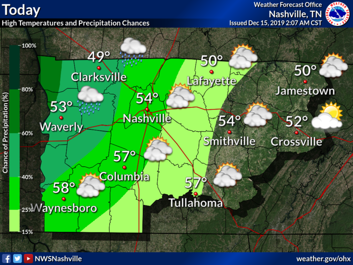
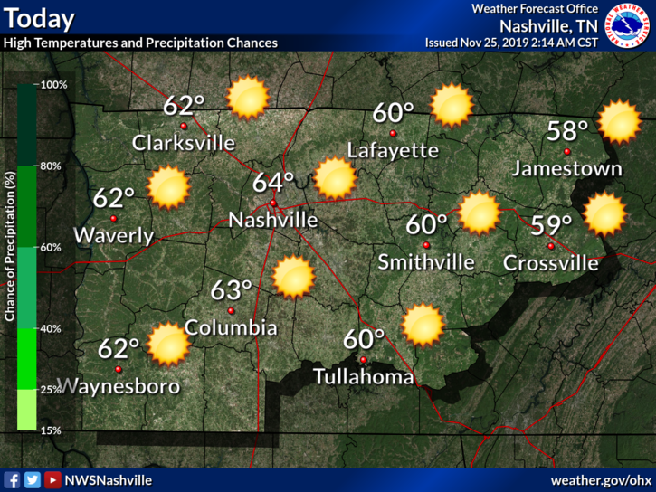
Rain, Flooding Possible Thursday thru Friday

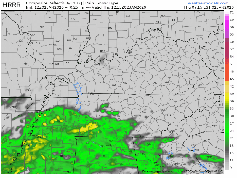
Rain is already moving into the area this Thursday morning. It will last through Friday.

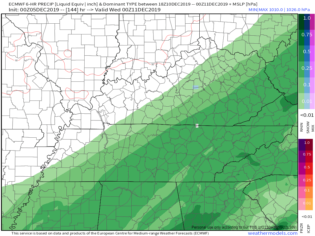
The HRRR model shows rain all of Thursday, before dispersing on Friday:

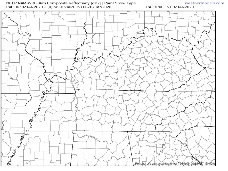
The NAM3 model agrees:

Heavier rain should move out by Friday afternoon (as of right now), and the rest should leave by Friday night, though we could see some lighter lingering showers into Saturday. read more

Cool and Sunny Start to 2020; Rain to End the Week

Cool but Clear New Years Eve

Most of the clouds have finally cleared out.

Current temperature at 2:35 PM: 48°.

Overall, a cool but nice day to close out 2019.

Going out tonight to celebrate?

Temperatures will drop to a low of 32° just before sunrise Wednesday, so be sure to bring an extra layer of warmth. read more

Friday Sprinkles Possible; Heavier Rain Sat Night thru Sunday

Thursday

Nice overall with some clouds hanging out:

Copy and Paste Friday with some Possible Sprinkles

Friday generally looks the same as Thursday with a high of 64°.

Some sprinkles are possible. Most won’t feel any and if you do, they will be very light and brief. read more

GREAT Rest of the Week; Next Rain-Maker Moves in this Weekend

Beautiful Rest of the Week

Tuesday, aka Christmas Eve

Sunny with a high of 70°. In other words…

Christmas Day

Is it really already Christmas? It won’t feel like it though as high temps reach 72°.

… while we won`t have a White Christmas, it`s going to be a warm one. Someone want to call Santa and let him know to wear shorts?

NWS-Nashville Afternoon Discussion, 12/24/19

Thursday

Partly sunny with a high of 70°. I’m loving this. read more

Maybe (Probably Not) a Little Light Rain This Weekend; Titans Game Forecast + Unfortunate Pun; Nice Start to Christmas Week

Cool Thursday

Sunny but chilly Thursday with a high of 46°.

Tomorrow morning we drop to 28°. Stay warm out there!

Friday thru the Weekend: Overall Nice, Slight Rain Chances

A low pressure system could bring us rain this weekend, but maybe not. If it goes far enough south, we should stay dry; however, if it ends up further north, we could see a little rain. read more

Showers Begin Sun Night, Heavier Rain/Storms Monday

Meh Sunday, Showers Begin Sunday Night

Not much going on today, but we will see some showers move in tonight before heavier rain follows on Monday.

Breezy with winds coming from the east/southeast at 5-10 MPH.

No rain expected for the Titans game at noon. read more

Rain/Snow/Splat Event Today, Watch for Black Ice Tonight/Tomorrow Morning

What’s Going on Today (Tuesday)?

Air temperature as of 11:00 AM: 35°.

Temperatures may fluctuate some today. However, according to our nearest road sensor at the Kentucky border, road surfaces are running about 8° higher than the air temp for now. That’s good news, but may change later tonight. More on that below. read more

Rain, then a Splat/Melt Wintry Mix Tuesday?

Sunday

Meh.

High temperature: 60°.

Skies: starting great, getting cloudy later.

Winds: 5-15 MPH with gusts as high as 20 MPH.

Showers possible very late Sunday night, light and brief, probably while most sleep, maybe lingering into the AM rush hour. So thinks the NAM3 model: read more

Chance of Rain Friday; Second Round of Rain Returns Mon/Tues; Knocking Down Snow Forecast for Next Week

Today:

Showers Overnight Thursday, Rain Friday

It may start as soon as late tonight: a few scattered showers.

The majority of the rain will move through Friday.

TIMING

The NAM3 model shows the heaviest rain passing through in the afternoon, and fizzling out Friday night. read more

Two Rounds of Rain this Week: Tuesday and Turkey Day thru the Weekend

Great Monday

Beautiful day ahead to start the work week.

Get outside and enjoy it because this will also be the best day of the week weather-wise.

Tuesday: Round 1 of the Rain

Two low pressure systems will move through this week and bring us rain, and this first system will move through Tuesday into Wednesday. read more