Author Archives

Megan Hanna

Low-Probability Severe Thunderstorms Friday

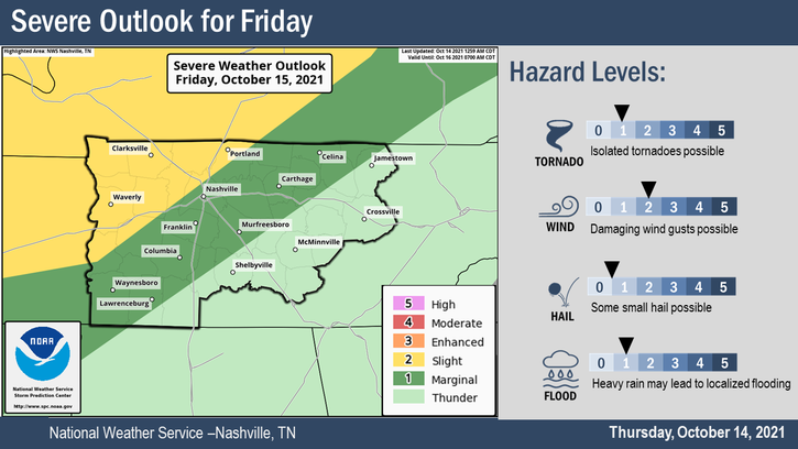
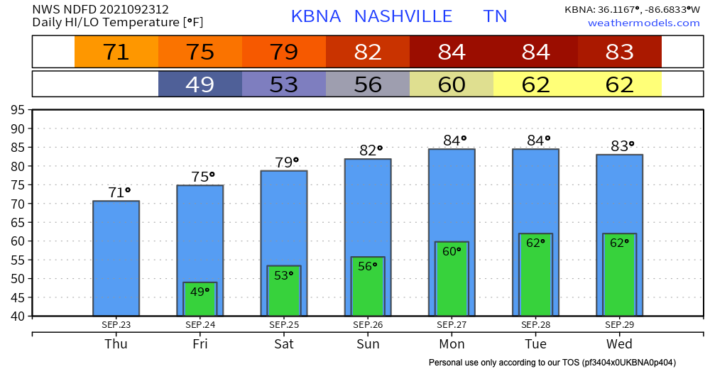
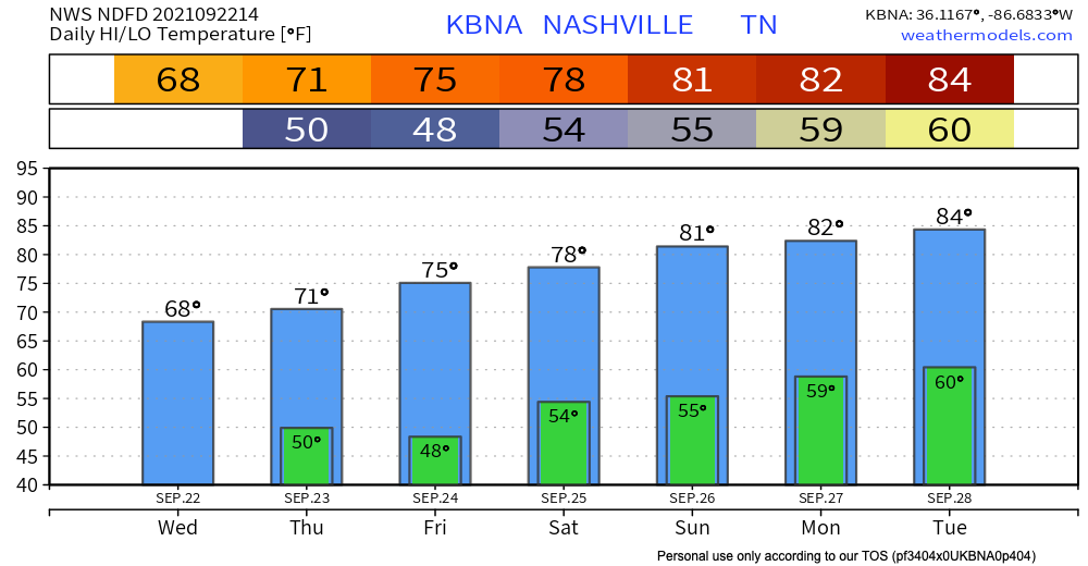
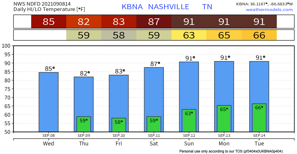
It’s going to rain and probably storm Friday. Storms carry a low-probability chance of turning bad.

The Storm Prediction Center and NWS-Nashville think the biggest threat is damaging straight line winds (58+ MPH). There’s a localized flooding risk especially in urban areas. One inch diameter hail and tornadoes are possible, but both are less likely. See outlook below. (Editor’s Note: you might notice SPC has the hail risk a bit higher than NWS-Nashville. That’s a distinction without a difference, when in doubt, I like the local forecast). read more

Sprinkles Today, Cold Front + Rain Friday

Showers for some of us are possible today. HRRR below has scattered showers from mid morning to early afternoon.

Our next rain-maker will be in the form of a strong Fall cold front. At the moment, the window for rain opens early Friday morning and closes pre-dawn Saturday morning. We believe the heaviest rain will fall Friday afternoon through the night. All of this should add up to between .25″-.50″. Check back on timing if you have outdoor plans Friday night. read more

Scattered Showers + Muggy Start To The Weekend

Those scattered showers from this morning might cause sprinkles for some of us until the early afternoon. For the rest of the day HRRR has the rain breaking up to avoid our counties.

This weekend is where we will see more of this rain. Saturday looks to have some scattered showers arriving around early afternoon. These won’t be too intense but will ease us into Sunday’s batch of rain starting Saturday night. read more

Lingering Showers Today + Fall Has Arrived!

Most of today’s rain is behind us! Some of us will see lingering isolated showers this afternoon and evening. These are chilly drizzlers on the back edge of the system that passed through last night. read more

Dry + Warming Continues into Next Week

It’s a quiet one today. But hey it could be worse right?! The fog has mixed out from this morning leaving us with a beautiful day. High temps reaching the low 80’s and dew points in the mid 50’s. Thanks to the cold front yesterday, highs and lows are staying below average until the weekend. Models have us staying dry today and for the rest of the week plus the weekend. This will stick until early next week. read more