Scattered Showers/Storms Continue + Drying Up Tomorrow?

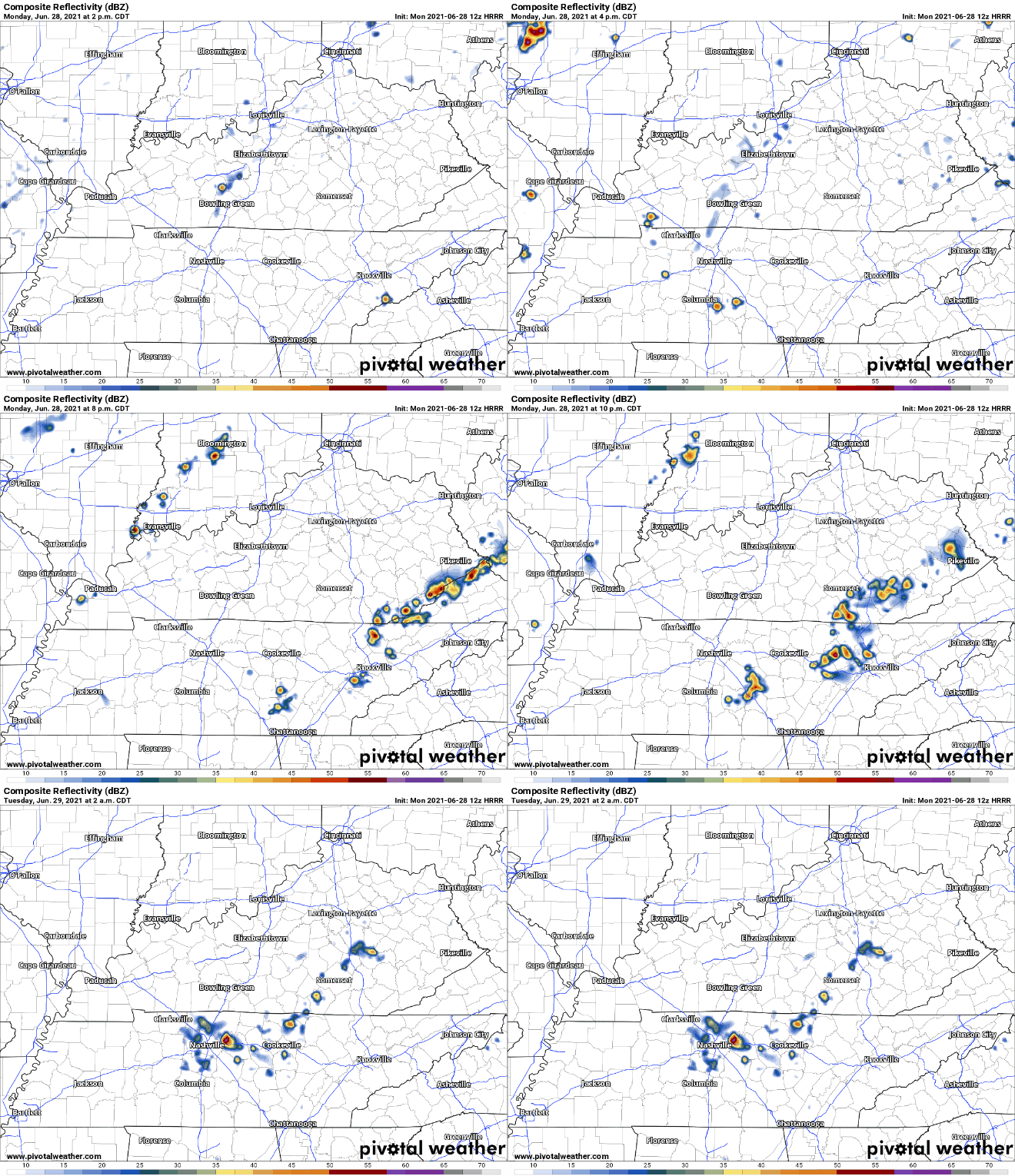
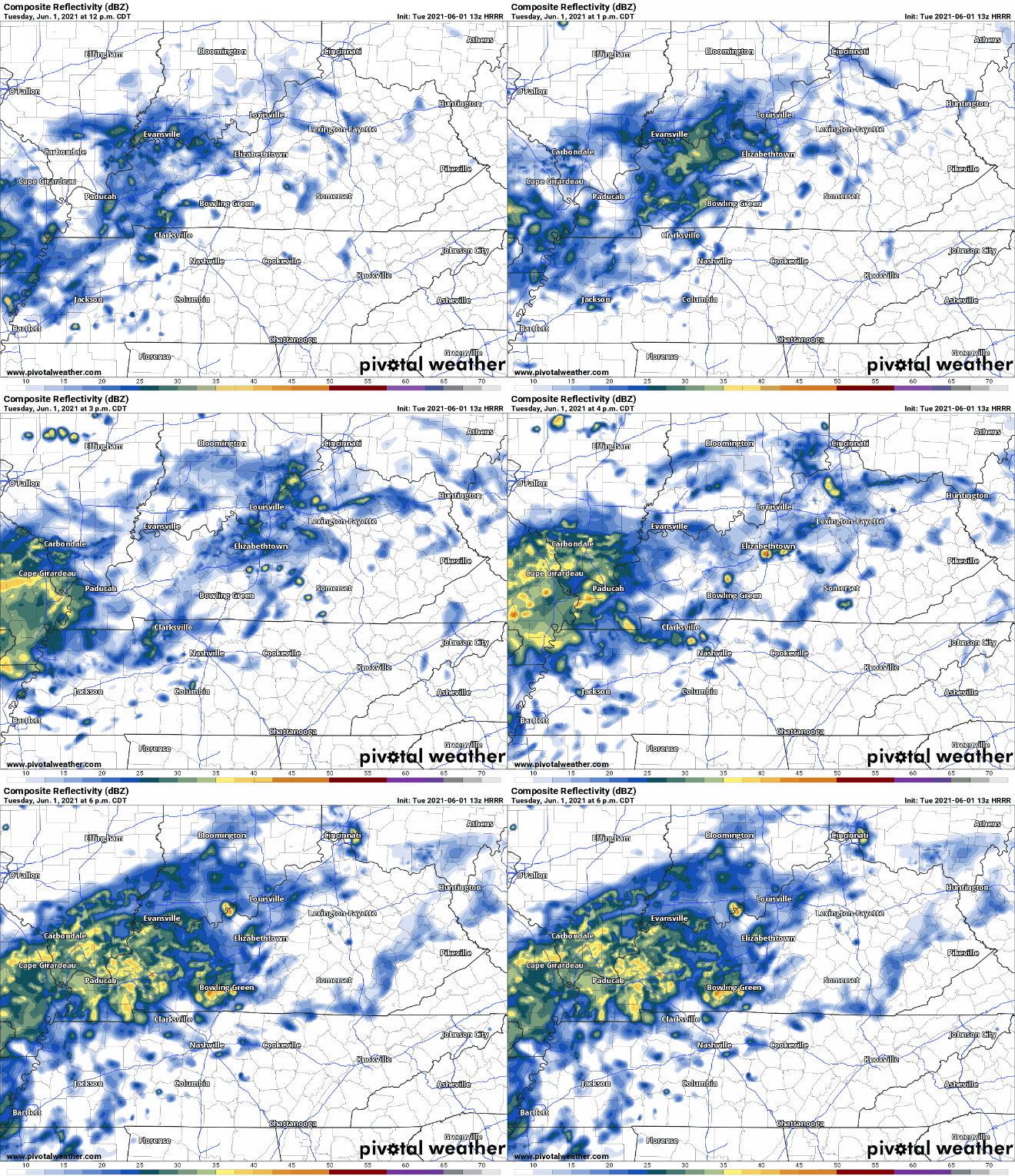
Clouds cover the area today with scattered showers and storms continuing to move through. Shear is low so not expecting severe weather to tag along with these. Still be prepared for wind gusts and lightning storms in the mix. Storms and showers should mainly be out of the area by 9pm-10pm, see HRRR below. read more

Humid and Wet Weekend!

Pop-Ups Expected Through the Weekend

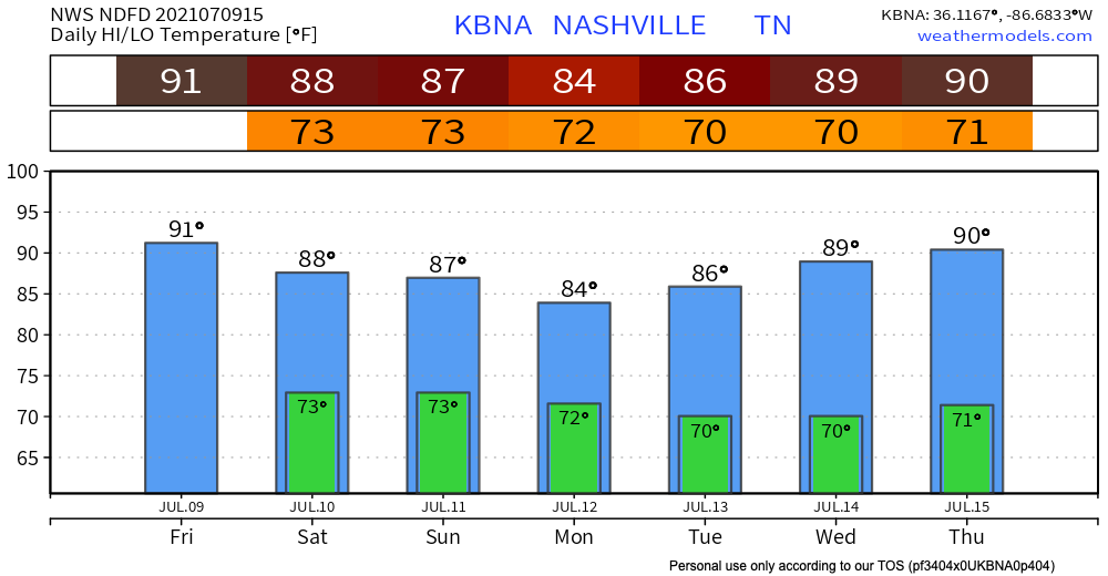
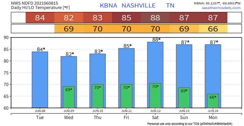
Temperatures are hotter than yesterday reaching the upper 80’s. Dew points are up to the low 70’s. Temps and dew points will stay this way for the weekend. Looks like we will need some gills for the upcoming days 😬. read more

Dry and Cooler Holiday Weekend!

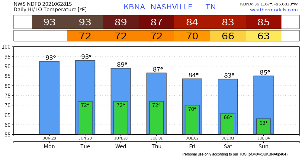
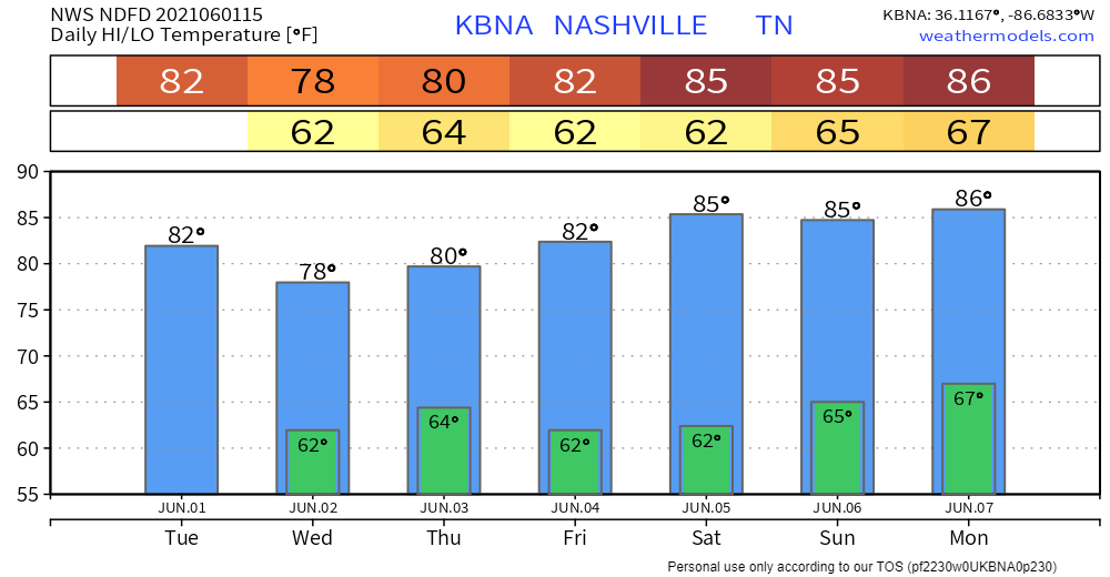
The cold front that brought all of that rain passed through TN this morning. This leaves us dry with temperatures reaching highs in the mid 80’s for the start of your weekend. Dew points are down to the low 60’s and even hit the mid 50’s for Saturday. For the 4th, highs reach back up to the low 90’s but dew points still hover around 60 degrees! Check out this handy dandy chart to reference the dew points. read more

Scattered Storms; Rain Event Starting Wednesday; Tropical Depression Four

Expect a few pop up showers and lightning storms starting this afternoon. Some storms stay into the night but most fade away with the heat of the day.

Storms Today: Hazards, Timing

A cold front moving east will collide with our humid airmass to bring activity delaying lightning, heavy rain in some spots, and — potentially — damaging straight line winds.

What to Expect:

We do not expect tornadoes. We’re excluded from SPC tornado outlooks and NWS-Nashville forecasts and graphics. This is because forecast data (see below) does not indicate a tornado-hospitable atmosphere as storms arrive. read more

Heating Up + Rain Possible Sunday

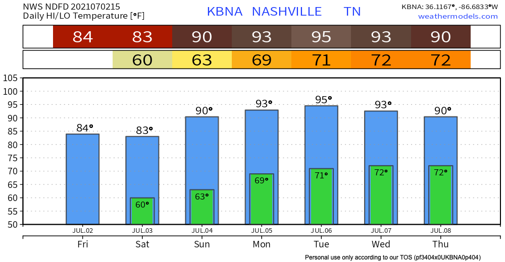
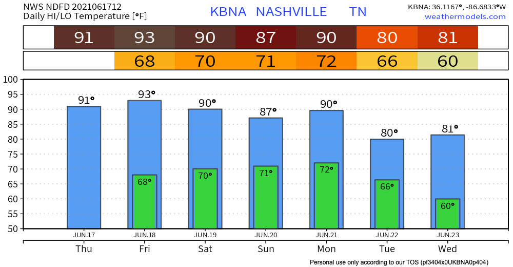
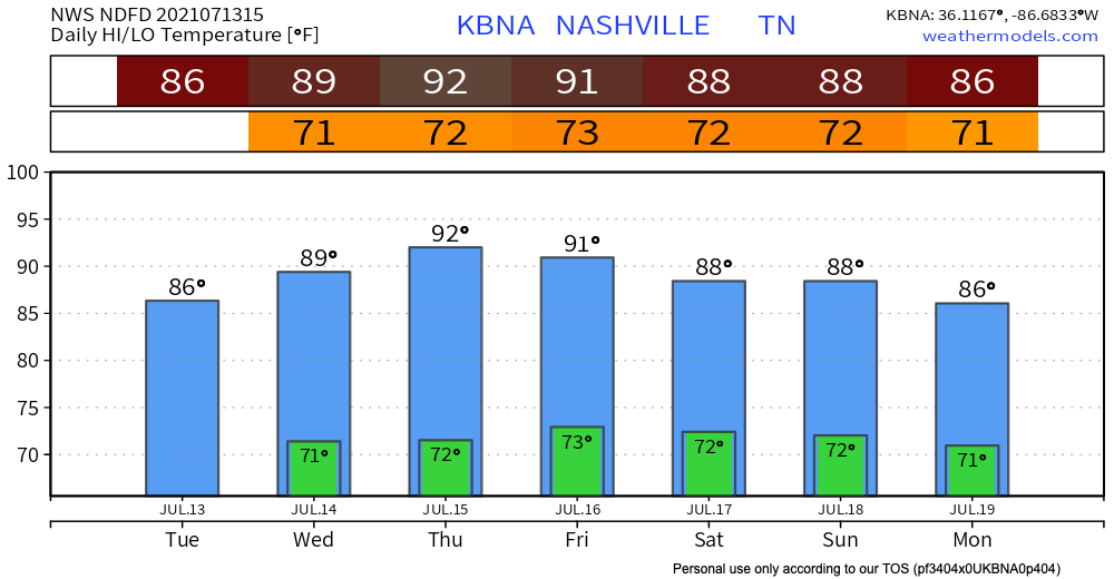
Temperatures start rising today with highs reaching the low 90’s up until Saturday. Dew points also rise to the upper 60’s by the end of the week. Ugh weren’t we enjoying that humidity break?! Rain chances begin to gradually increase as does the heat. read more

Dry and Cooling Down Woohoo!!

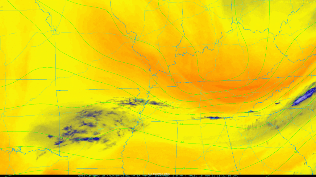
The cold front that caused that photogenic thunderstorm to our SE on Sunday has finally delivered the goods. Super dry air! See the deep oranges on the water vapor loop below, that’s the stuff:

No rain, mid 80’s this afternoon, with dewpoints in the 50’s, yes please: read more

Warm, Wet, and Humid Oh My!

Low pressure over Arkansas is bringing us rain for the next couple days.

Today

HRRR shows a line of showers moving in this afternoon after lunch. As instability builds, the rain blob will break apart into scattered showers and off and on thunderstorms. Lightning possible. Timing is difficult for any one location. These models run hourly, each run has a different idea. read more

It’s Going to Start Raining Again. Storms Tomorrow May Be Strong or Severe.

A few showers are possible late this afternoon but more likely later tonight as a moistmaking system inches closer to us. Here’s the HRRR model through 6 PM tonight.