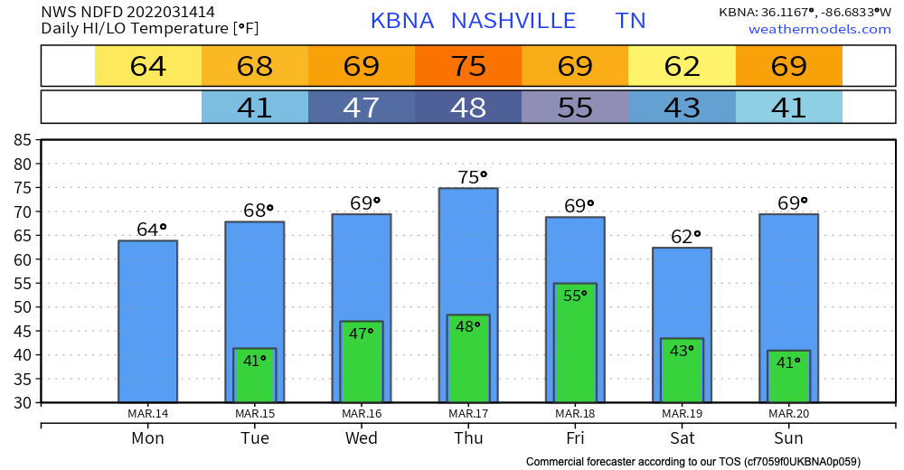
Forecast this week looks a lot different than the cold temps and snow we experienced over the weekend. Temperatures warm up to the mid 70s by Thursday. We stay warm for the rest of the week staying in the 60s.

Forecast this week looks a lot different than the cold temps and snow we experienced over the weekend. Temperatures warm up to the mid 70s by Thursday. We stay warm for the rest of the week staying in the 60s.
The storm threat is over.
HRRR model below shows scattered showers until dinner time.
Our counties are included in a wind advisory until 3pm. This is mainly in place for wind gusts ahead of the line of storms we just experienced. Model below shows wind gusts calming to the teens by dinner time.
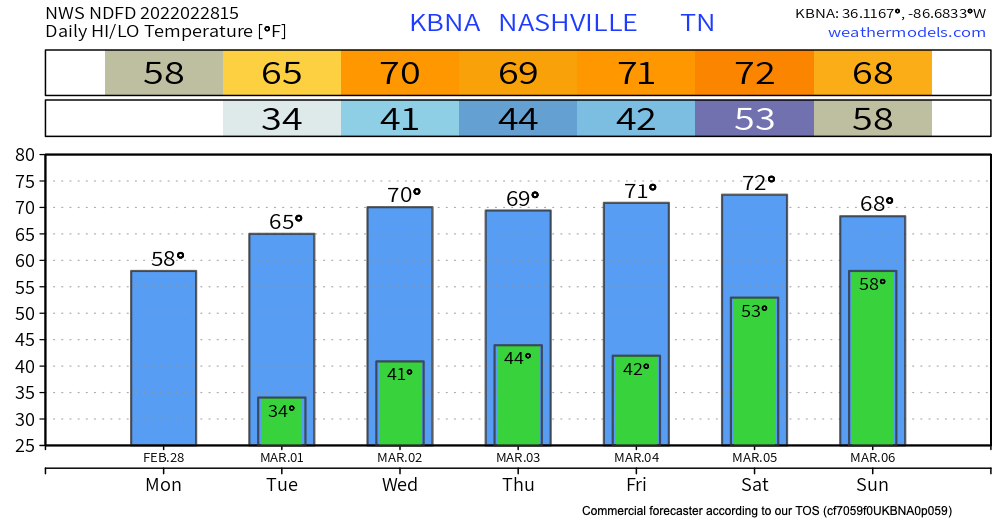
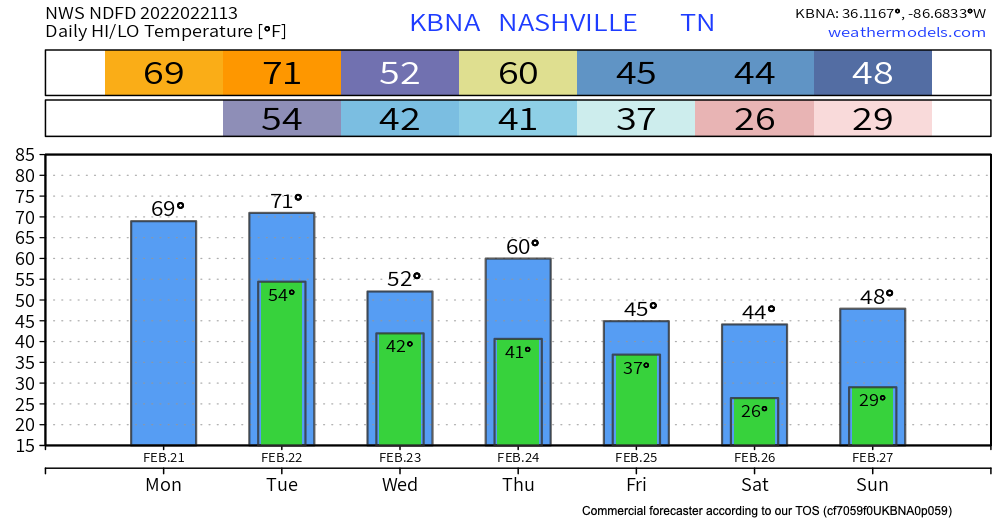
This week will definitely feel like springtime has arrived! Temps heat up to the low 70’s by Saturday. Overnight lows are still chilly during the work week dancing around the lower 40’s. A dry pattern sets in and stays until Saturday(ish). The pollen count rises to 7(medium) this week. This weather may have you feeling like this:
Temps are above average today with highs almost reaching the 70 deg mark. Might feel a tad sticky with the moisture that will roll in today.
A wet week is ahead with rain all throughout the work week. There will be two main rounds that we see this week.
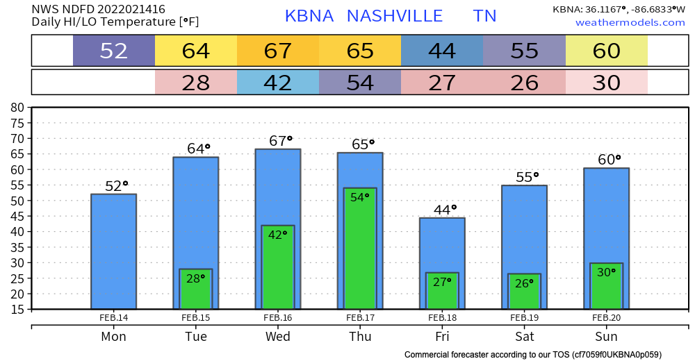
No rain is expected to interfere with any Valentine’s day plans.
Up until Thursday, the sun stays out keeping us dry. Temperatures rise into the mid 60’s by Wednesday.
Thursday, low pressure sweeps north of Tennessee. A strong cold front will pass through our area Thursday evening bringing strong storms and maybe severe weather.

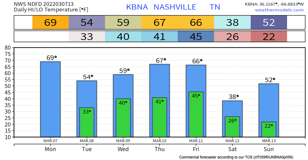
Cool and dry this week.
A cold front sweeps through Friday. Sometimes these fronts make rain, but right now the models think the precip will miss us. Even if rain were to develop it’d be very little.
Any freezing drizzles should be ending soon. Temps aren’t expected get above freezing for too long if at all today. Because of the lack of melting, black ice still poses a threat throughout today, tonight, and tomorrow morning. Proceed with caution in areas of elevation, overpasses and secondary roads.
We enjoyed some really nice temps today with a high of 67° and plenty of sun. But…
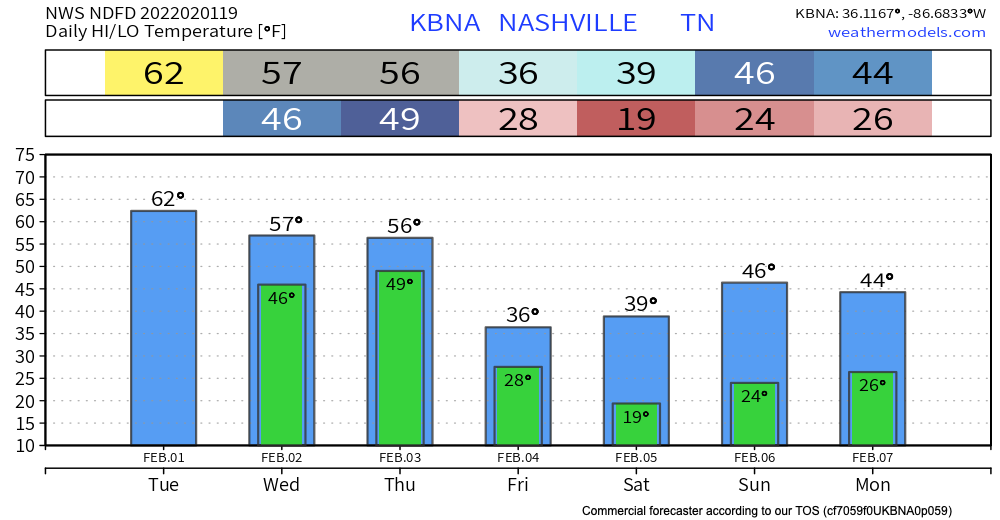
Temps stay in the mid 50’s for Wednesday and Thursday. Low pressure starts to come into our area bringing rain early Wednesday morning. Sustained winds Wednesday ramp up to 20 mph with gusts <30 mph. Showers continue but are spotty Wednesday afternoon to evening time.
Temps right around normal today will heat up to the low 60’s by tomorrow.
Rain should begin as early as Wednesday morning. but it’s more likely to start Wednesday afternoon. Rain should be heaviest after midnight Wednesday and into Thursday morning. Rainfall rates should be high, totaling 3″ to 4″ by Friday morning. It looks like rain will be spread out long enough to enable runoff and drainage, but local creeks, streams, and low lying areas should rise. Flooding concern is there, and will be watched closely, but the concern is not high right now. Those in flood prone areas should continue to monitor.
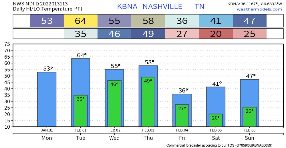
Today will be the warmest day we will see for a while.

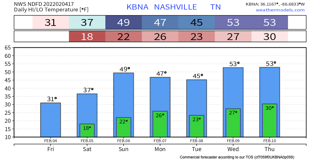
After reaching the mid to upper 50’s today, we won’t see temps above the mid 40’s until Sunday. A cold front moves through early Tuesday morning bringing cooler temperatures. Overnight lows past Tuesday won’t get above freezing.
You must be logged in to post a comment.