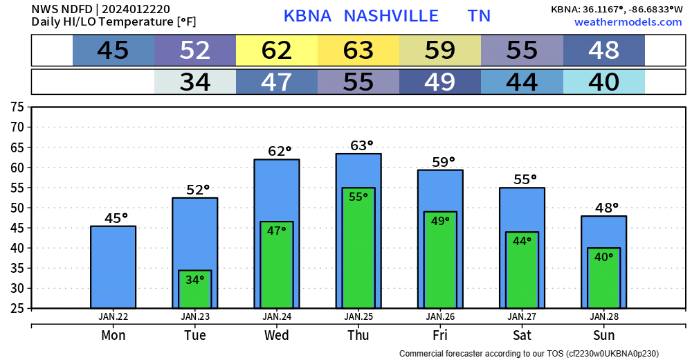
BNA got all the way up to 47° today, which feels like quite the accomplishment.
Snow melts at different rates at different places, most of it probably melted today, but some stubborn snow/ice could hold on until tomorrow.


BNA got all the way up to 47° today, which feels like quite the accomplishment.
Snow melts at different rates at different places, most of it probably melted today, but some stubborn snow/ice could hold on until tomorrow.
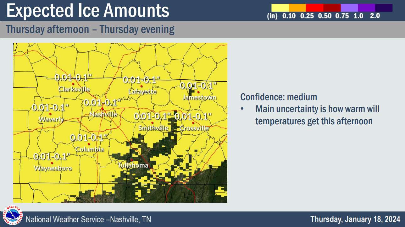
Freezing rain/drizzle is moving in our area and already causing travel issues.
Temperatures currently range from 30 – 33°, throughout our counties, impacts will differ from place to place.
Snow already on the ground will help ice accumulate either, freezing on top of the snow.
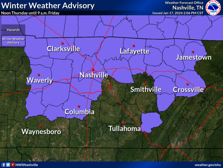
We have a Winter Weather Advisory for both of our counties from noon Thursday – 9am Friday.
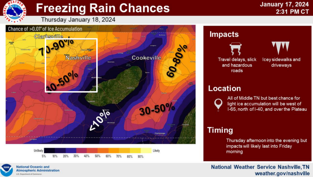
Across our counties, probabilities for >0.01″ of ice accumulation range from 30 – 70%.
Ice is a lot different from snow. All it takes is a glazing of ice to cause issues on the roads.
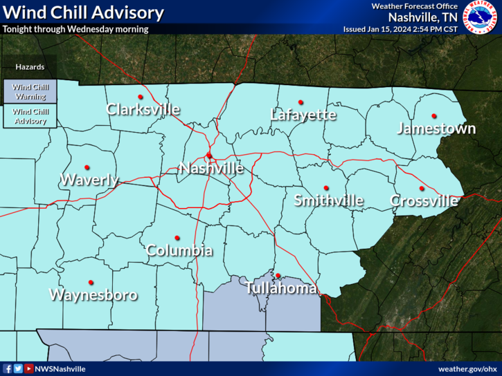
Wind Chill Advisory continues thru 10 AM Wednesday.
High temps only expected to make it to 18° today. Wind chills will be stuck in the single digits during the day.
Air temps tonight will be very close to 0°, your backyard may make it below zero.
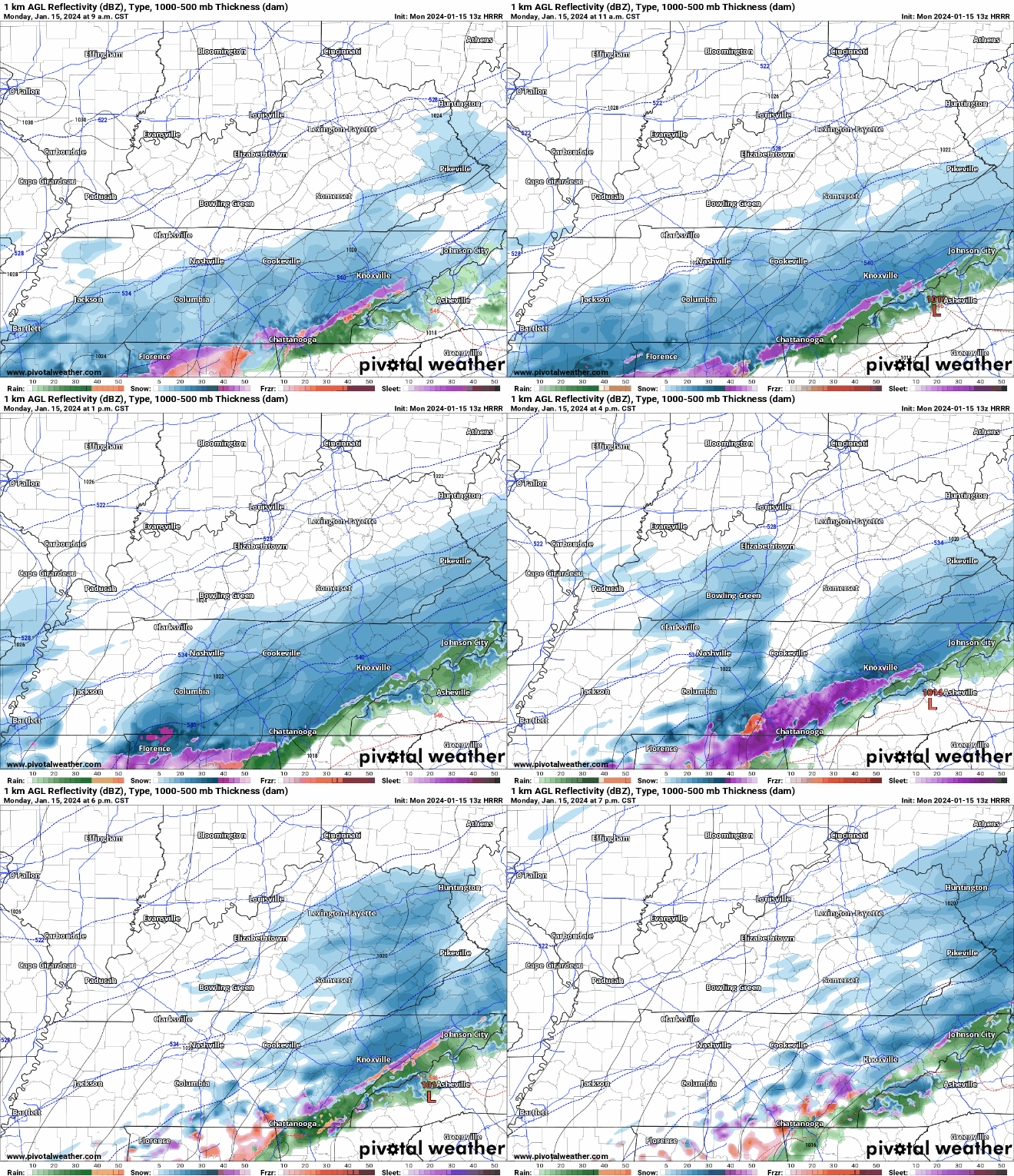
We woke up this morning to several inches of snow on the ground and air temperatures around 10°, with wind chill values around 0°. That doesn’t sound much like Middle TN. Quite the snow event we have here.
Well…it’s snowing.
As expected, snow has quickly accumulated across the area and road conditions are quickly deteriorating. If you don’t have to get out, please don’t. If you must get out, please, take it slow, leave plenty of room, and *clean the snow off the top of your car*. Snow on top of vehicles can become aerodynamic ice missiles, and you do not want that flying thru a windshield.
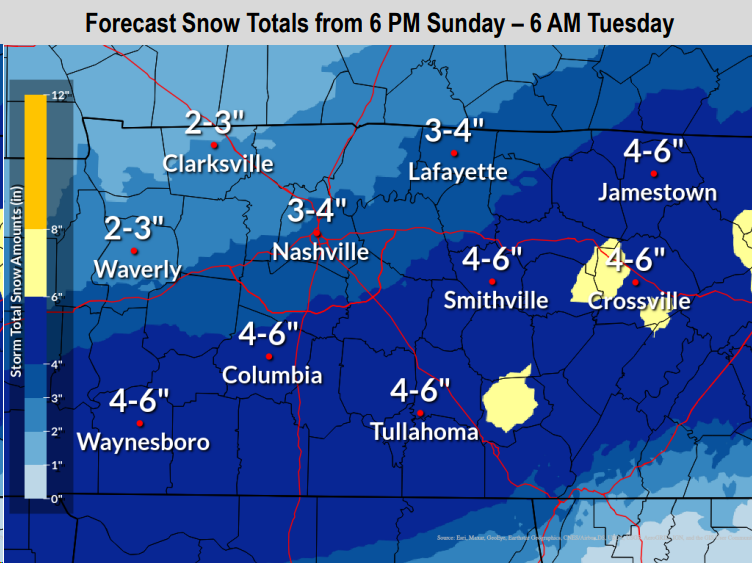
Our Winter Storm Watch has been upped to a Winter Storm Warning, valid from 6pm tonight thru 6am Tuesday. Although our impacts will last beyond Tuesday AM.
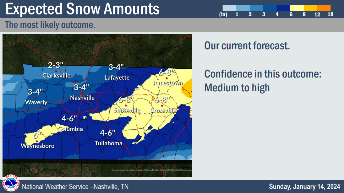
Our most likely snowfall totals remain around 3 – 4″. This is still subject to change, higher or lower.
Overnight tonight a cold front will swing thru, bringing in our very cold air. Along the front, there could be some flurries. Areas north of I-40 could see a dusting, no major impacts expected.
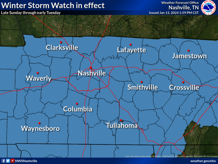
Both of our counties are under a Winter Storm Watch from Sunday evening thru Tuesday morning. This will likely be changed to a Winter Storm Warning later tonight or tomorrow.
A majority of the rain has moved out. Can’t rule out a few scattered showers this afternoon/evening, but our severe threat is over.
We still have a Wind Advisory thru midnight tonight, wind gusts up to 45 – 55 mph will be possible.
Enjoy the rest of this nice day today, our weather will change rather quickly tomorrow.
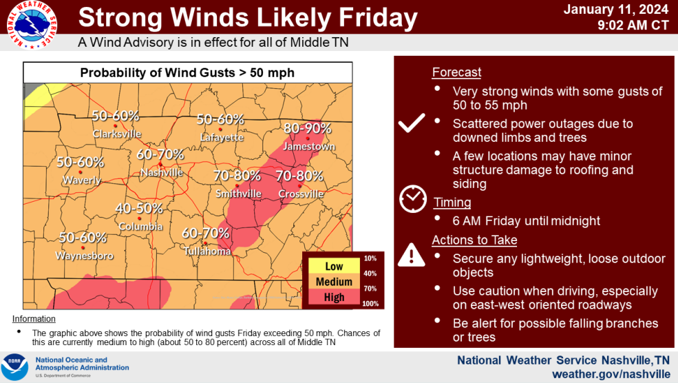
Yet another Wind Advisory has been issued for us from 6 am Friday thru midnight Friday.
Sustained winds from the SW at 25 – 35 mph with gusts up to 55 mph are expected. The graph above from NWS Nashville shows our odds of wind gusts 50+ mph at 60-70%.
You must be logged in to post a comment.