
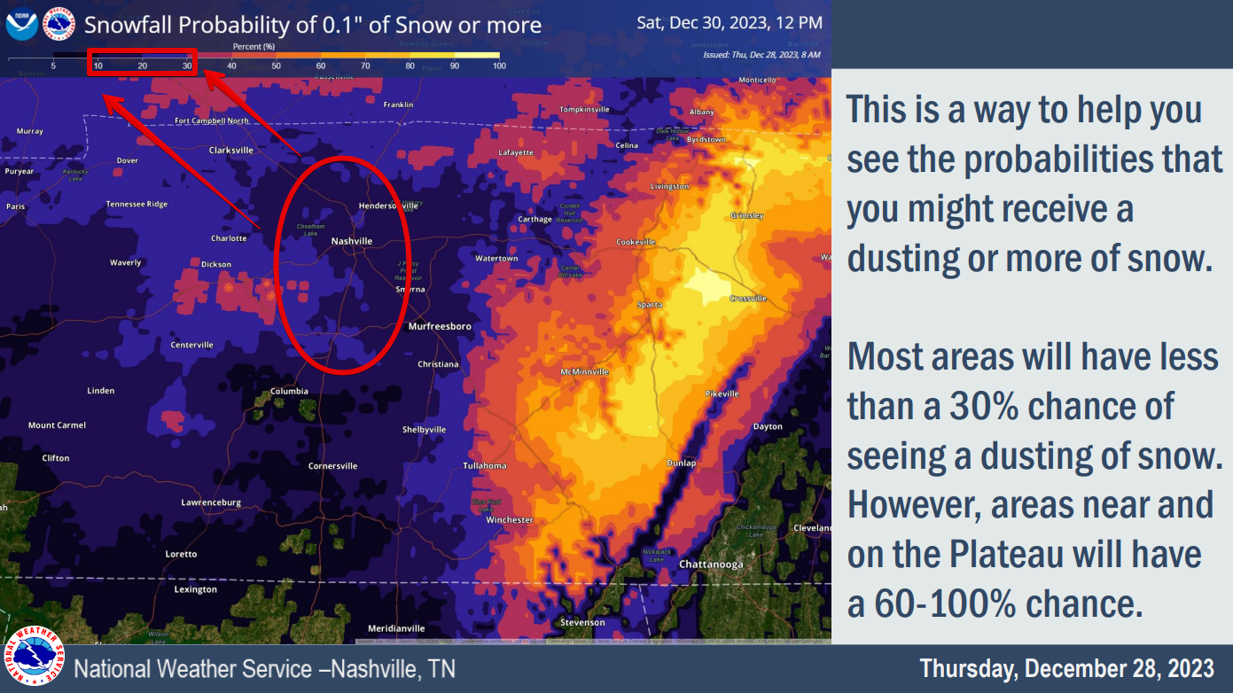

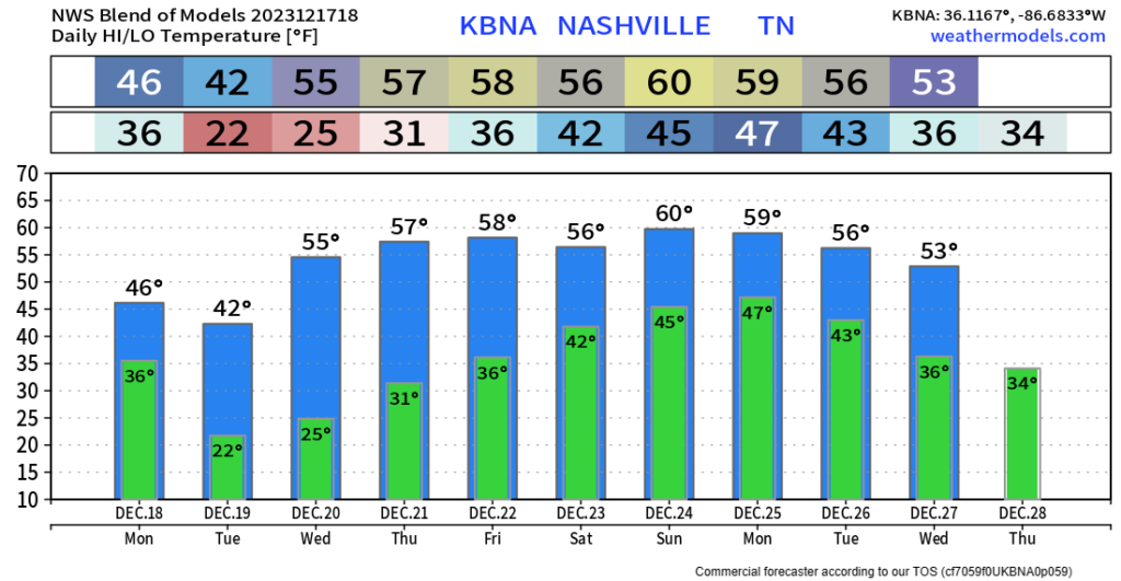
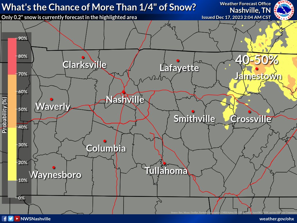
This graph from NWS Nashville shows only a 10 – 30% chance of us seeing 0.1″ +, or more commonly known as a dusting.
The odds are not in our favor.
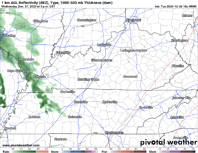
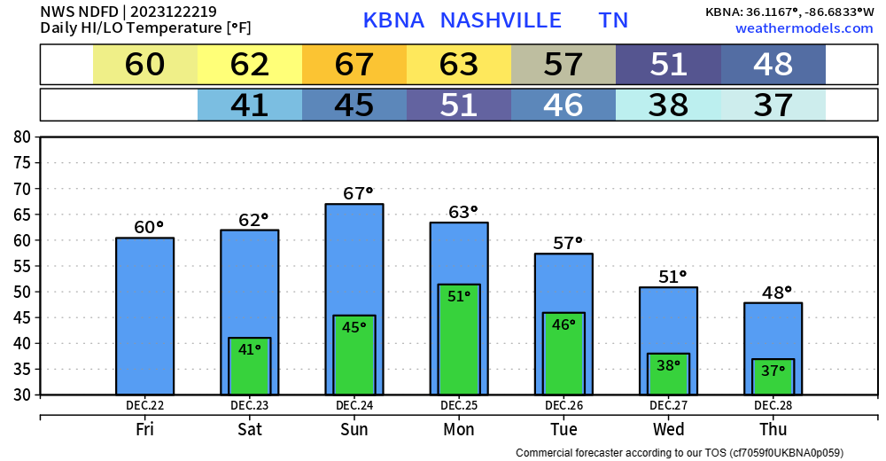
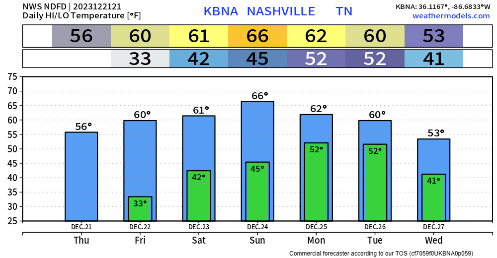
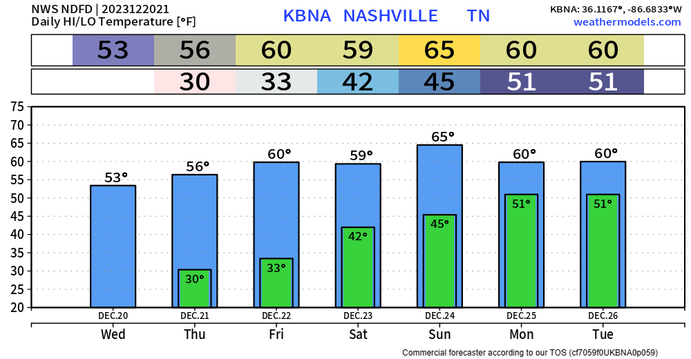
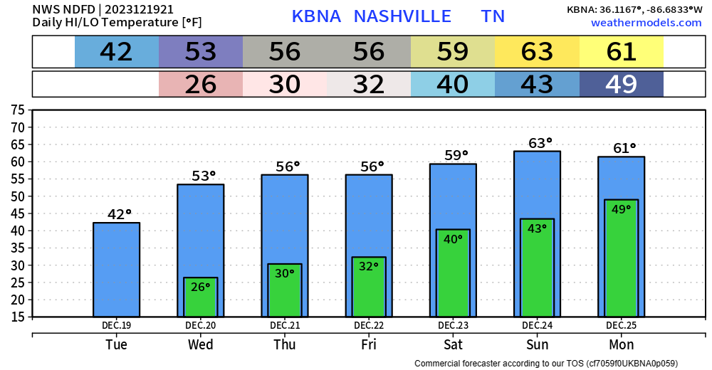
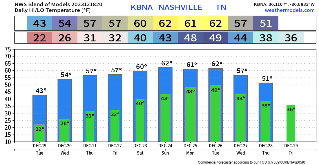
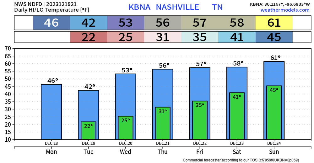
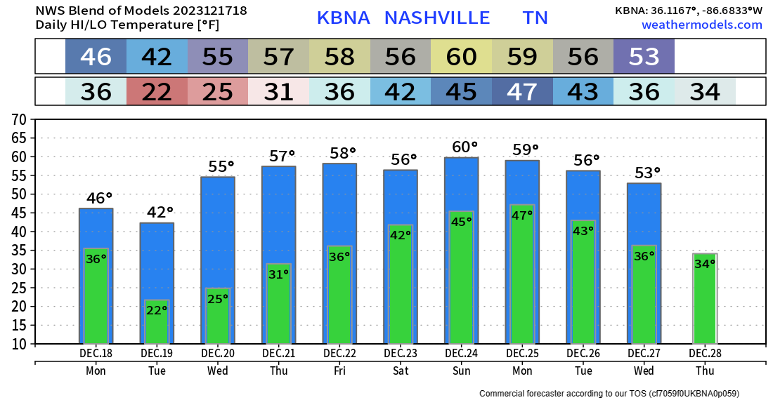
New model data keeps coming in, and it shows bad news for those who had their fingers crossed for accumulating snow.


You must be logged in to post a comment.