
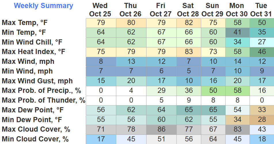
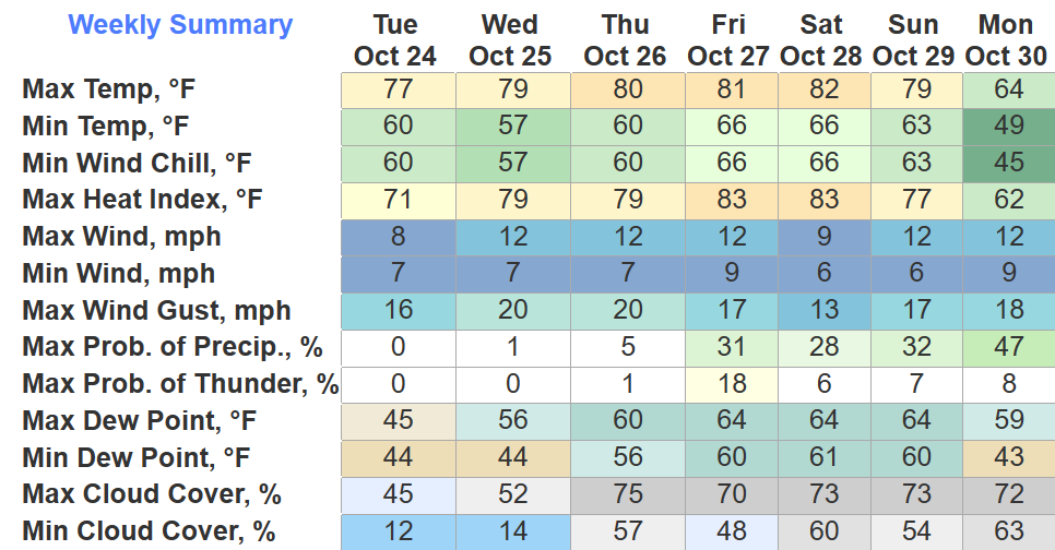
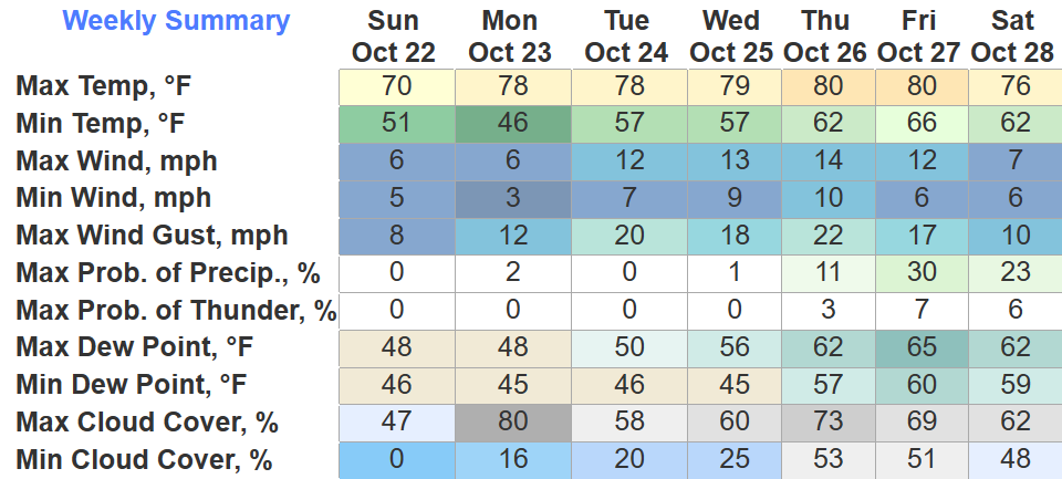
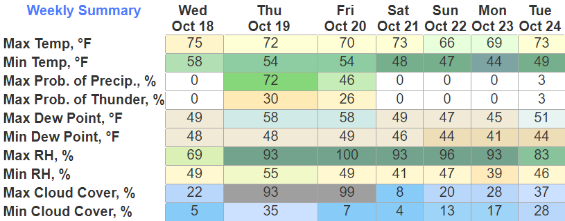
Another pleasant day and tomorrow will be more of the same. Still a lot warmer that what we are used to this time of year.
Rain chances finally come back around Friday.
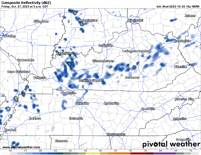
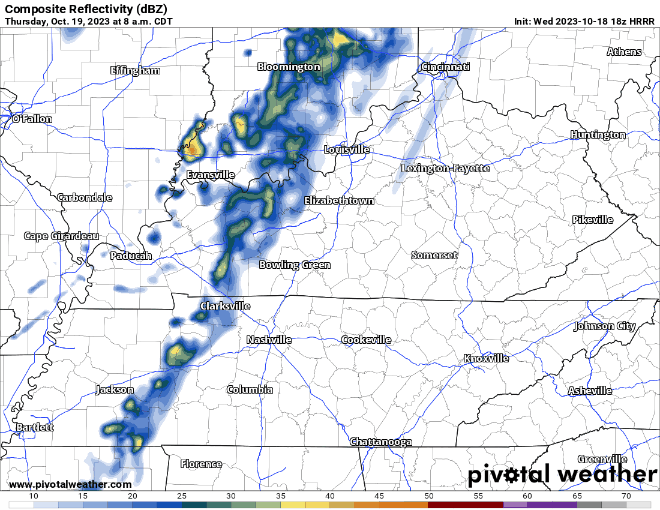
The HRRR model (above) shows showers creepin’ in Friday AM and staying on/off throughout the day. Any rain we see would be light, so not thinking any rainouts.
You must be logged in to post a comment.