
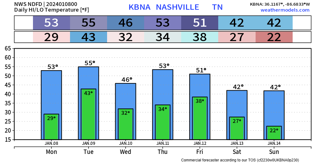
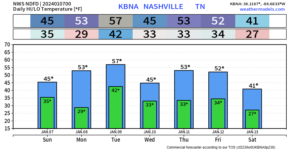
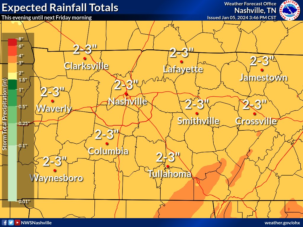
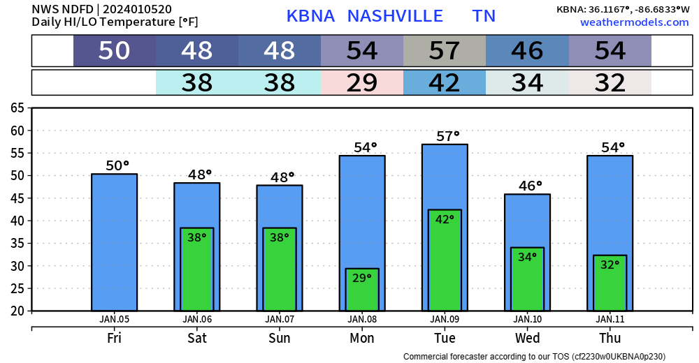
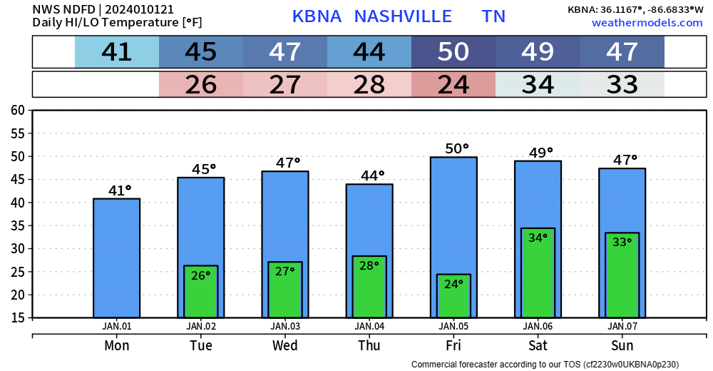
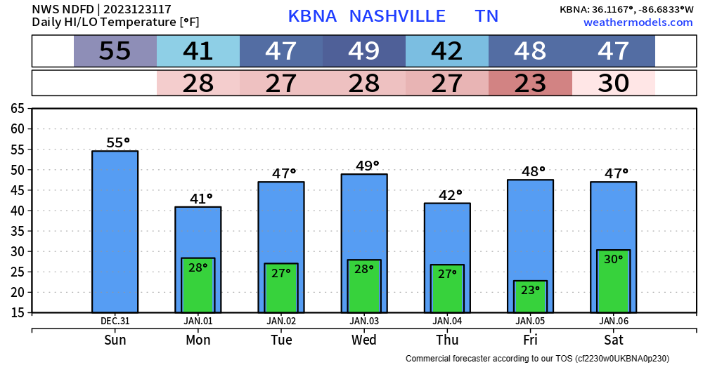
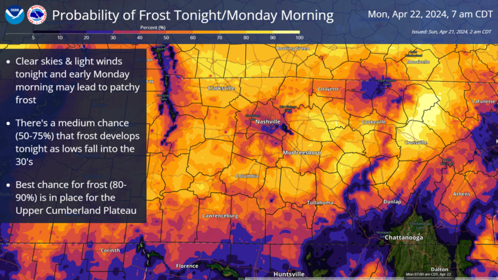
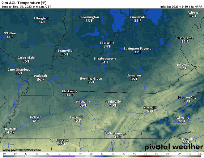
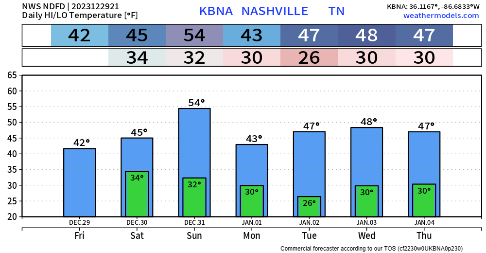
There’s a lot to break down. Let’s do it.
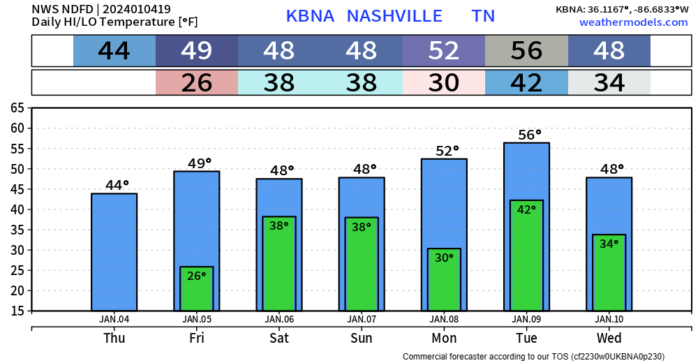
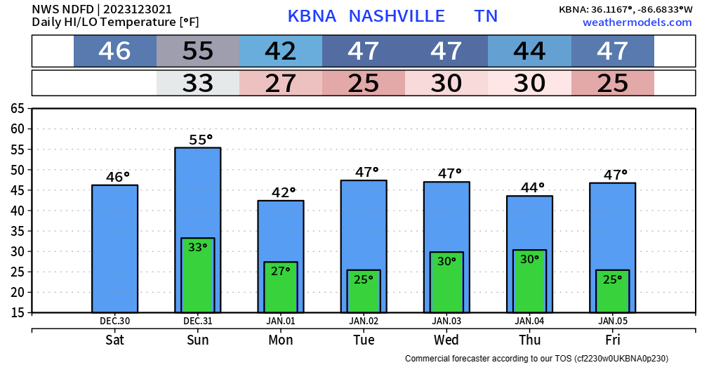
Wind Advisory
When? 6pm Monday – 6pm Tuesday
What? Sustained winds from 15-25 mph, with gusts up to 35 – 45 mph will be possible
Winds could blow around unsecured objects; tree limbs could also get blown down and cause a few power outages.

You must be logged in to post a comment.