

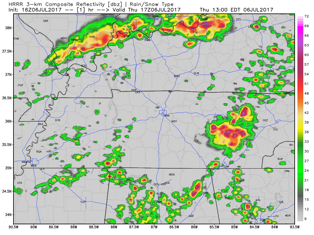
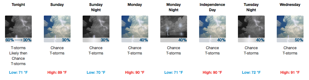
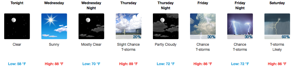
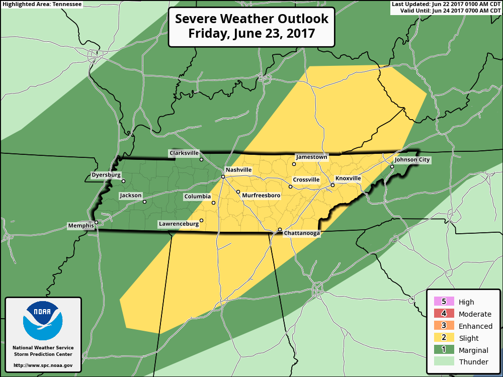
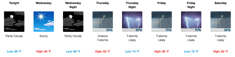
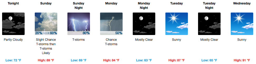
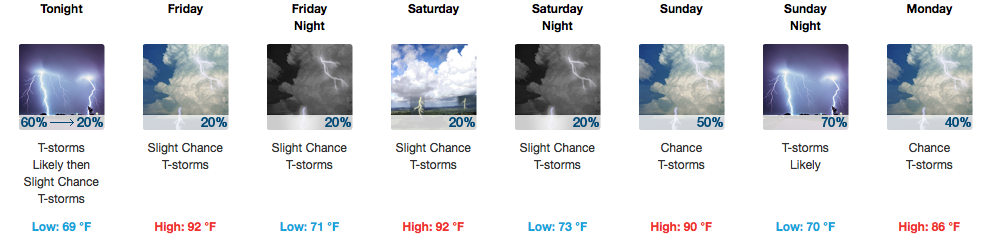
Finally, A Dry Weekend.
Rejoice! Rain is not in the forecast from now until Wednesday. This means that your weekend lake/BBQ/golf plans are finally a “go”, compared to the past couple of weeks.
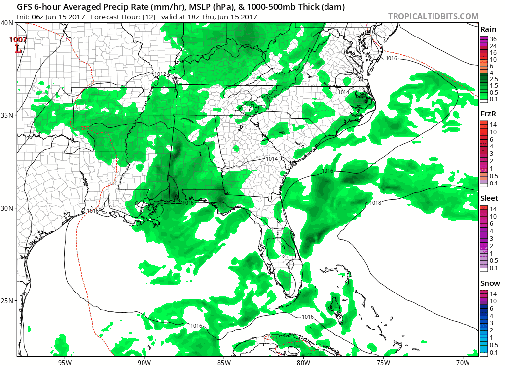
What will be keeping us dry for the next few days? High pressure (otherwise known as the big, blue “H”)!

You must be logged in to post a comment.