Pleasant Weather To End Week

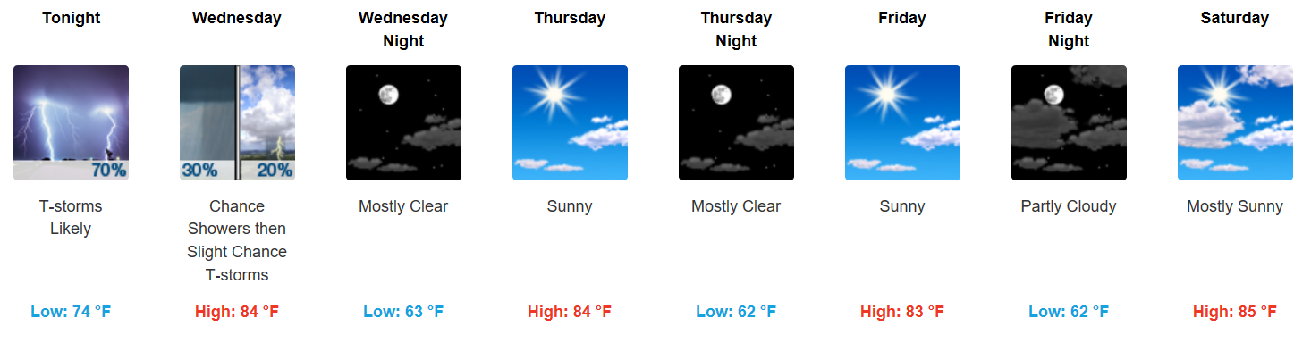
Cooling Off Considerably, Very Pleasant Conditions

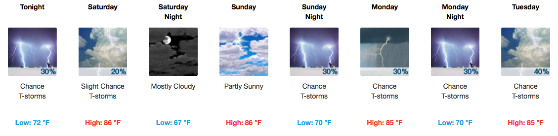
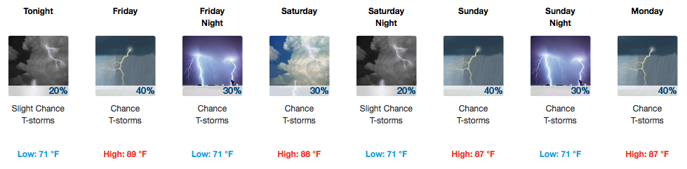
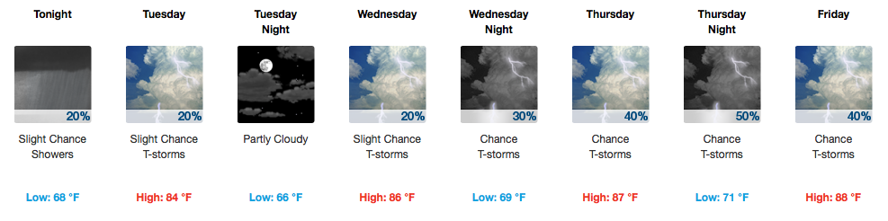
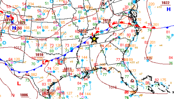
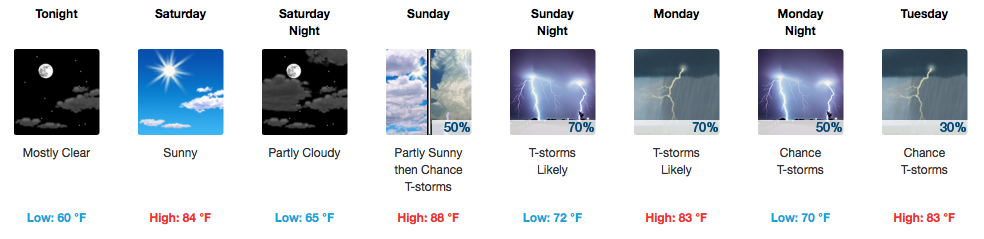
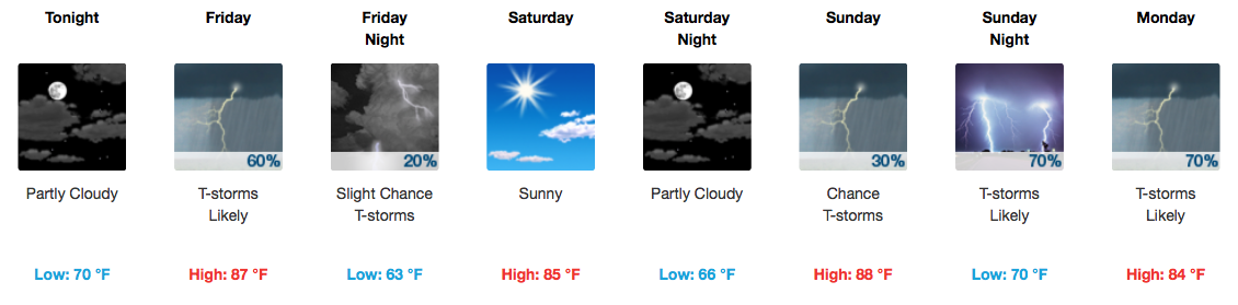
How do afternoon highs in the mid 80s sound? We have had our fair share of hot and humid days, but luckily a few cold fronts, like the one moving through tonight, have provided relief throughout the summer. High pressure is also going to be the headline, at least through Saturday. read more

Updated Eclipse Forecast, Looks Promising!

[tminus t=”21-08-2017 11:58:00″ align=”left” omitweeks=”true” id=”Solar-Eclipse”/]

A Total Eclipse of Nashville!

Once upon a time we were worried of rain, now we’re only watching for clouds.  read more

Cold Front and More Storms Tomorrow

Thursday + Live on the Green (LOTG) Forecast

Rain chances going up! A cold front will arrive late Thursday into early Friday, sparking showers and storms out ahead of it Thursday afternoon and night. Provided below are two solutions: a wetter, more active-throughout-the-day GFS vs. much drier until Friday morning NAM3 read more

Best Chance of Storms On Thursday, Fingers Crossed For Eclipse

Quieting Down! Rain Fizzles

As the sun sets, the rain chances diminish rapidly either way. Still, a muggy evening is expected.

Wednesday, Much of the Same.

The upper levels of the atmosphere are not exactly what you would call “organized” at this time. There’s no real telling where a shower or storm could pop up on Wednesday, but the heat and humidity will definitely be supportive. read more

Active Week of Rain and Storm Chances, Plus An Eclipse Outlook

Soggy Start to the Week

The hose is expected to finally shut off around dinnertime, leaving us with a drier evening. Temperatures will sink into the low-mid 70s by Tuesday morning.

Active Weather Pattern Continues

Afternoon storms are possible on Tuesday and again on Wednesday, aided by the warm and soupy airmass in place. Not everyone gets a free car wash, though! read more

Rainy Afternoon/Evening Possible, Dry For the Weekend

Showers, Few Storms Possible This Afternoon/Evening

First and foremost…happy Friday!

We are watching two weather features in specific today:

The first is a chance for pop-up afternoon storms, thanks to decent moisture in the area.

The second is a line of showers and storms still well to our west this morning that models are expecting to fizzle, but confidence is not high in this solution yet. Decent lift along an approaching cold front might support this line moving in to our area later today AND/OR more storms could re-develop as part of that line this afternoon. read more

Warm and Humid Brings Storm Chances Each Day

Live on the Green Forecast

Today 6:15 PM to 11 PM || Arkells, Michael Franti & Spearhead, and St. Paul and the Broken Bones

The aforementioned popcorn-style showers shouldn’t keep you away from tonight’s Live On The Green! In fact, grab your popcorn and head on down to 3rd Avenue for some great entertainment. Stick with us on Twitter this evening (@NashSevereWx) just in case there are a few pesky rainers are around. We’ll keep you posted! read more

Generally Cooler With A Few Late Week Weather Makers

Intermittent Showers Tapering Off Today

A frontal boundary is hanging out with us this week which means we will continue to forecast daily rain chances. As today goes on, this front is expected to slowly sag further south, which means areas in Northern Middle Tennessee will see less rain chances this week than those elsewhere. Somewhere in the middle are Davidson and Williamson Counties. read more

Storms Roll In and Out Today, Saturday Promises to Impress

Wowzers! Saturday is Going to Be Amazing

Low humidity (dew points in the 50s), temperatures in the low to mid 80s, and sunshine will make for a fantastic start to the weekend! I can attest to the power of this cold front…the air behind it feels and smells like fall. read more

Abundant Chances For Rain Through Next Week

Better Chances for Storms Through the Weekend

Friday

Storms are expected to be more widespread on Friday as a cold front approaches. This front will be moving through during afternoon peak-heating hours, which means a few thunderstorms could become strong to severe. Damaging winds and hail will be the most notable threats. The Storm Prediction Center has us under a 1/5 risk, or “Marginal” risk. read more