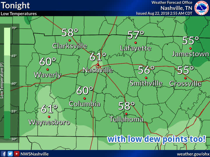
Brief Relief!
Step outside this morning, do you feel the drier air? Dew points are going to remain in the mid to low 60s today as the cold front that passed through last night ushers in drier air and relatively cooler temperatures.

Step outside this morning, do you feel the drier air? Dew points are going to remain in the mid to low 60s today as the cold front that passed through last night ushers in drier air and relatively cooler temperatures.
I think it is safe to say that yesterday was noisy, especially late last night when those NE-moving cells intensified over our heads.
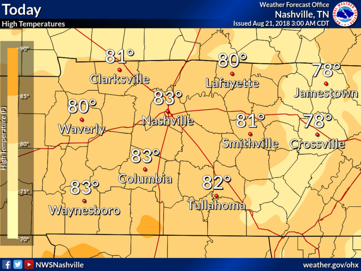
A cool down begins today, happening slowly but surely.
High temperatures will be in the low to mid-80s today as the cold front we talked about yesterday approaches and finally passes by this evening. The average high is 88º for this time of year.
Afternoon sunshine will help fuel development of more showers and thunderstorms later today and tonight. Both NAM3 and HRRR models have waffled back and forth on this, but now both agree rain and a few thunderstorms will develop to our west shortly after lunchtime, then become widespread in the late afternoon and early evening hours.
The humidity and afternoon showers and storms return… back to reality, I guess. For the first time in a couple days, we will have showers in the area. Even though a majority of the rain will be north and west, we have a chance of seeing some here in Williamson and Davidson Counties.

Long story short: Hot, lower humidity, no rain chance until Wednesday. Morning dewpoints in the mid 60°s, dropping into the low 60°s in the afternoons.
Afternoon high temperatures will be in the low 90s with morning lows in the range of 68º-72º. The average high for this time of the year is 88º.
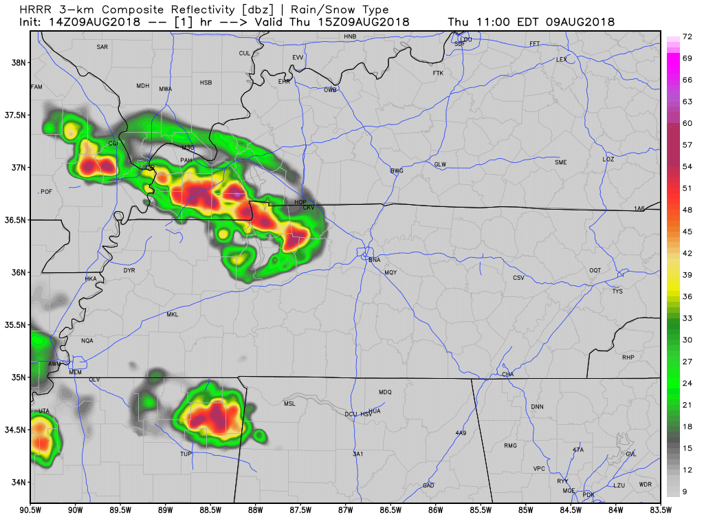
Showers and thunderstorms are expected today as the unsettled pattern continues and Nashville. The front that pushed through the area yesterday has stalled and giving us a chance of rain all day today. Here is more from NWS Nashville:
As I write, a line of heavy rain and gusty winds is passing through. Follow us on Twitter for the deets.
This storm formed thanks to a weak cold front over the Mid Mississippi River Valley – both associated with a larger scale trough crossing the Great Lakes.

Looking at a high of 92º today with a heat index in the mid-to-upper 90ºs. popcorn shower and storms. Not everyone will see one, but if you do, be prepared for heavy rain and gusty winds. Chance of rain is at 30%.
Temps and humidity will rise this afternoon. High today 91º, with dew points remaining in the mid to upper 60°s. That’s not oppressive humidity. Pretty much normal for early August.
This weekend will be hot, humid, and mostly dry.
The cold front that came through last night dropped the temperatures slightly and the dew points noticeably. Temperatures will be a bit lower today than yesterday. Looking at a high in the upper 80º range with dew points in the mid to low 60s.
You must be logged in to post a comment.