
Today
The humidity and afternoon showers and storms return… back to reality, I guess. For the first time in a couple days, we will have showers in the area. Even though a majority of the rain will be north and west, we have a chance of seeing some here in Williamson and Davidson Counties.
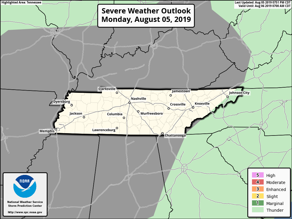
The Storm Prediction Center gives us a Marginal Chance (Level 1) for seeing severe weather today. Most of the storms, however, will be nonsevere, offering only localized potential for minor wind damage, isolated severe gusts may occur in the most intense cores.
Expect a high temperature near 94º today with dew points in the mid to upper 60s.

Rainy and Stormy End of the Week and Weekend Ahead
Like I said above, we are moving into more of a wet pattern with several rounds of rain moving through the area.
After another, brief round of rain this evening, tomorrow will be a little more complex. More from NWS Nashville:
As band of deep atmospheric moisture sags over our area on Thursday, the chance for showers and thunderstorms goes up area-wide, especially for the afternoon hours.
As heralded over the past several days, a low pressure area develops late this week north of Nashville, with a moist atmosphere remaining in place over the Mid-State, and another line of storms for the Thursday night-through-Friday night period. Showers and thunderstorms will be likely for most areas.
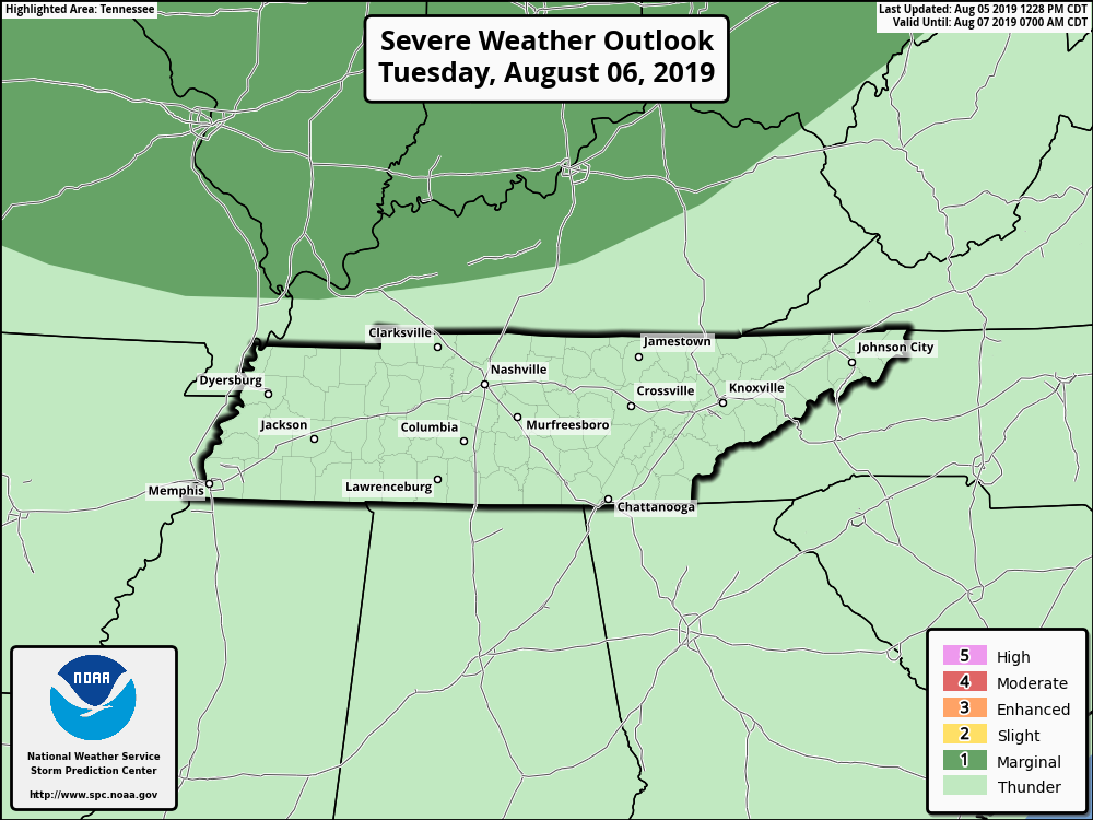
Because of this, the SPC has kept Middle Tennessee in the Marginal Risk for Thursday and Friday.
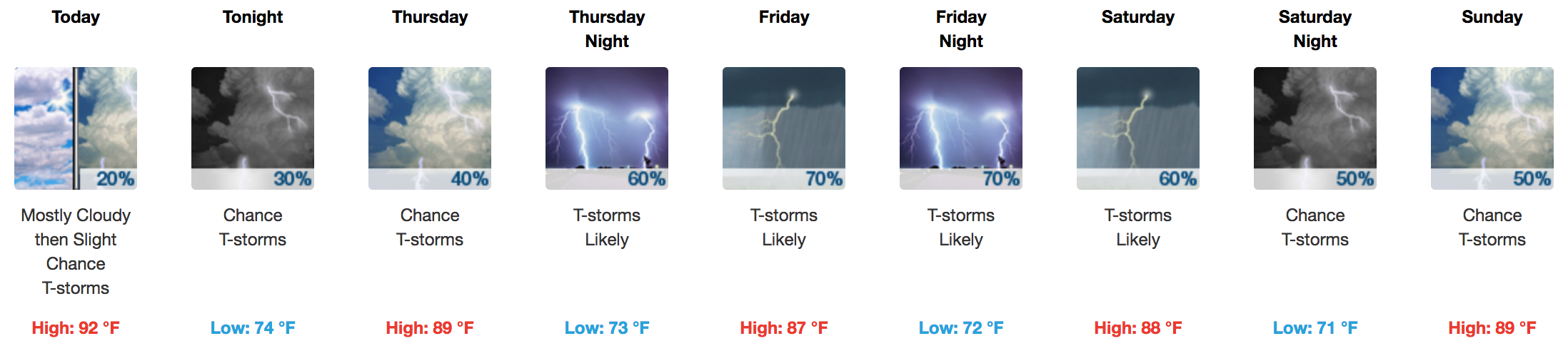
Timing is still going to be a challenge with this system. The short range models this morning had all sorts of initialization errors, so I am going to hold off on placing specific times for now. All in all, here is the NWS forecast for the rest of the week and the weekend ahead:
As always, we are watching the forecast. Stay tuned into @NashSevereWx for the latest!

Categories: Forecast Blogs (Legacy)
You must be logged in to post a comment.