
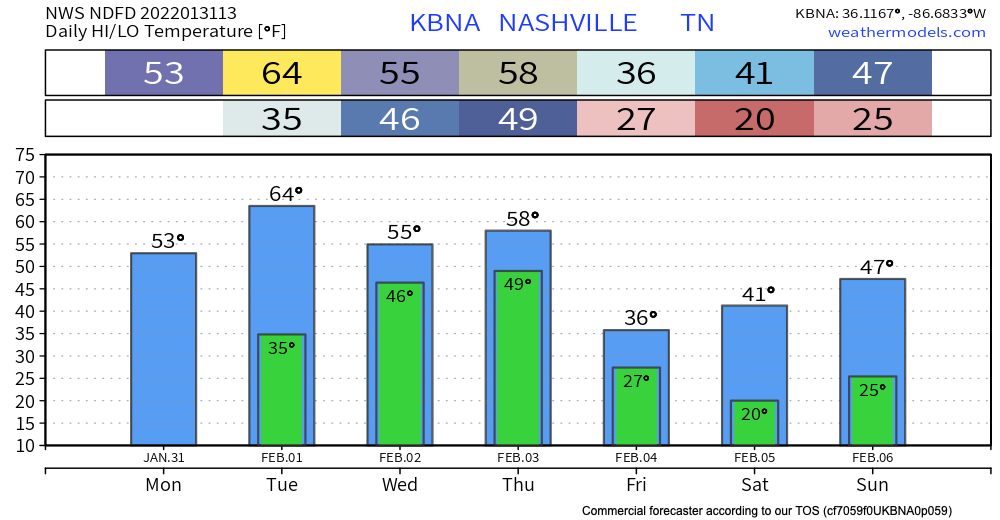
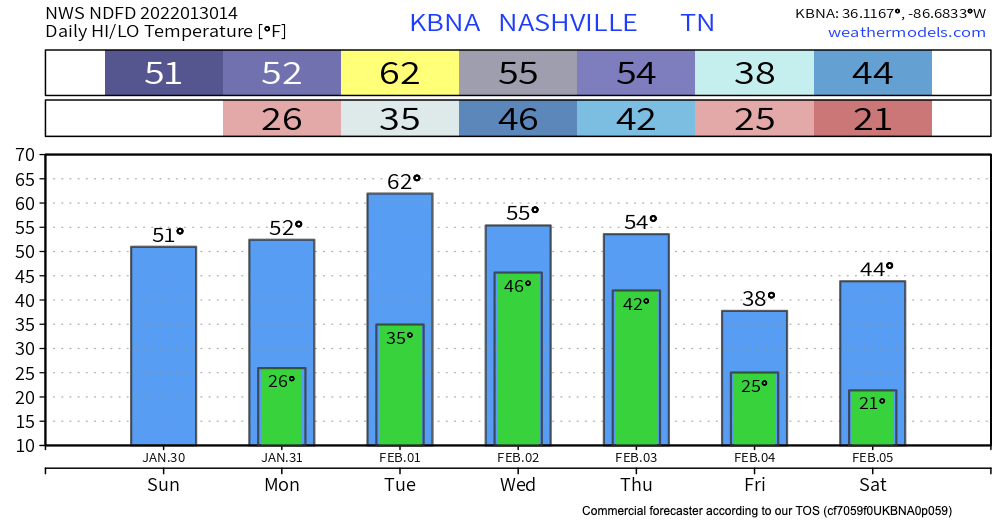
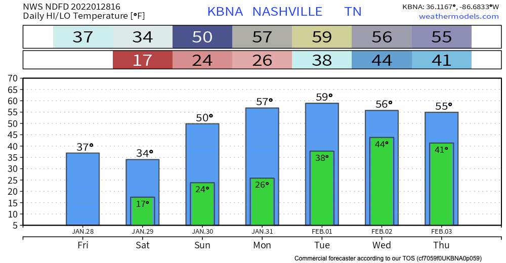
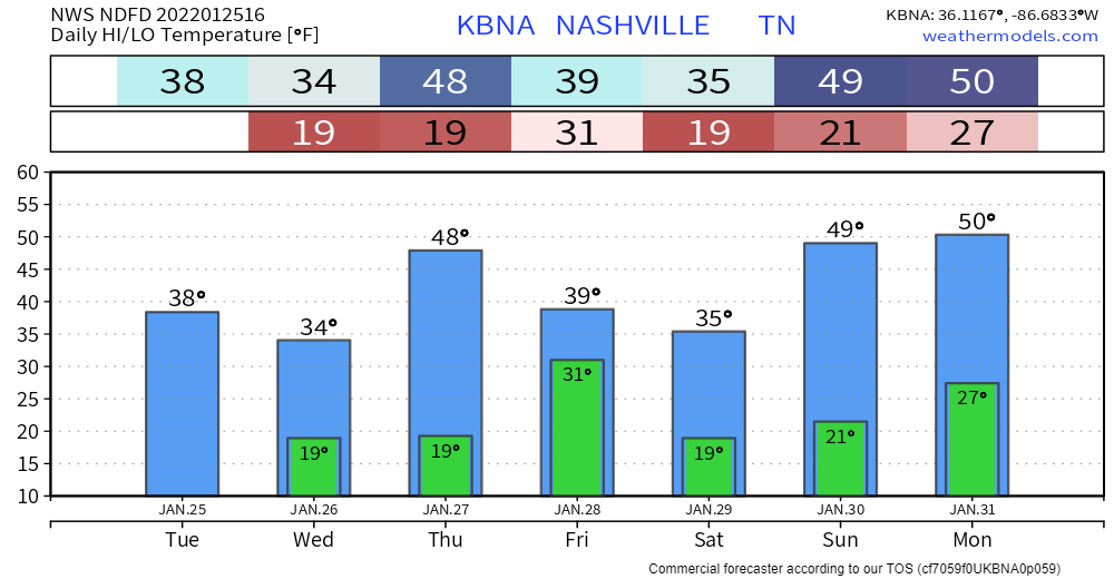
Temps right around normal today will heat up to the low 60’s by tomorrow.
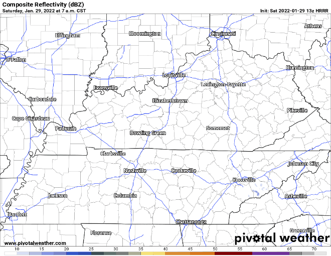
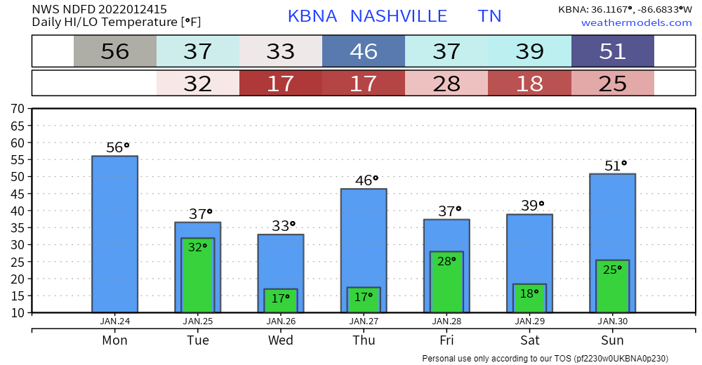
Rain should begin as early as Wednesday morning. but it’s more likely to start Wednesday afternoon. Rain should be heaviest after midnight Wednesday and into Thursday morning. Rainfall rates should be high, totaling 3″ to 4″ by Friday morning. It looks like rain will be spread out long enough to enable runoff and drainage, but local creeks, streams, and low lying areas should rise. Flooding concern is there, and will be watched closely, but the concern is not high right now. Those in flood prone areas should continue to monitor.


You must be logged in to post a comment.