Month: January 2022

Snow Thursday: Travel Problems Possible

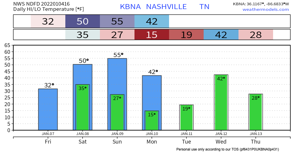
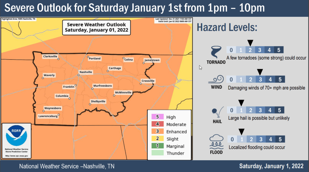
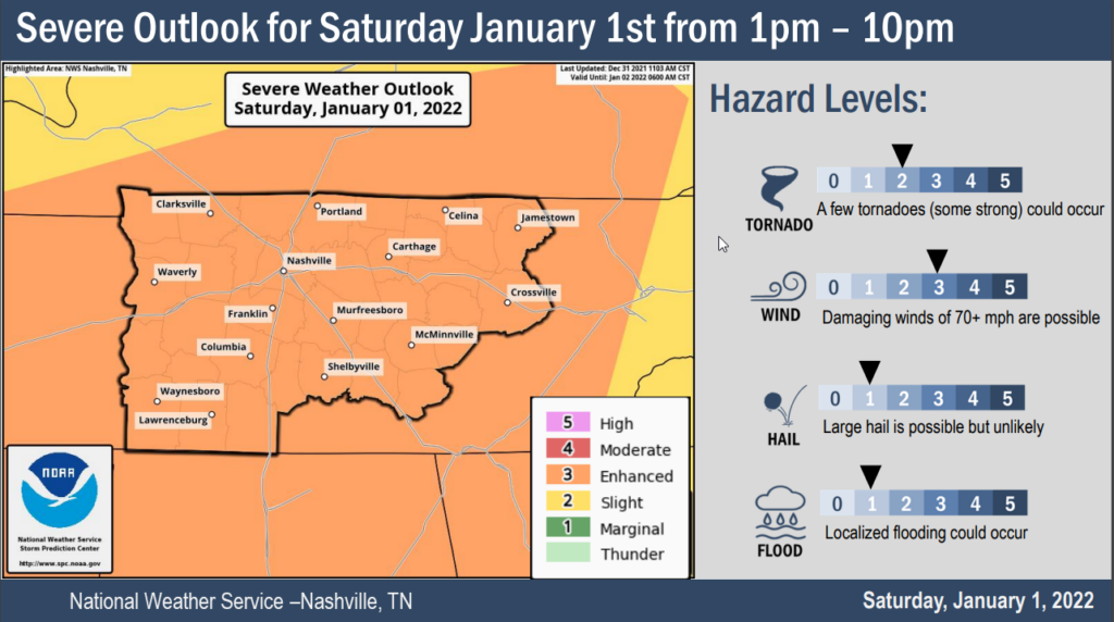
Put very scientifically by NWS-Nashville: “Yep, looks like old man winter will be taking another swing at the mid state on Thursday.”

Middle Tennessee, in general, can expect this:

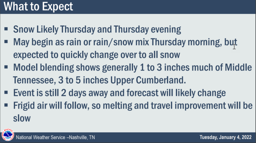
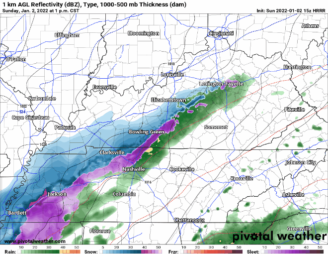
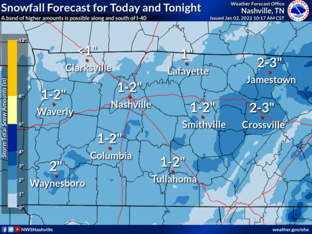
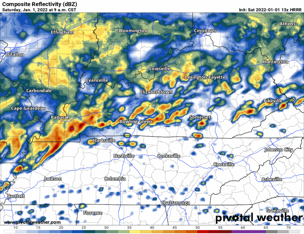
Timing remains iffy right now because we only have the lower resolution global models. Those models are the GFS and Euro. Both show a big blue blob (snow) moving through starting Thursday around 9 AM and lasting into early evening Thursday. Again, timing does not appear at all solid. Remember the above slide that says “Event is still 2 days away and forecast will likely change.” We will update you on changes on Twitter and in future blogs, as needed. read more

Snow Forecast Was For Less Than 1″, Now 1″ to 2″

Snow is coming.

The latest HRRR model run delivers snow earlier than the earlier 4-6 PM timeline. It thinks the wintry stuff could be here as early as 1 or 2 PM. See below:

This image has an empty alt attribute; its file name is floop-hrrr-2022010215.ref1km_ptype.us_state_ky_tn.gif

Expect the first hour or so of snow to melt on contact. The ground is very warm. But heavy snowfall rates should supercool everything, and eventually allow for the snow to stick to all surfaces. NWS-Nashville increased snow totals. read more

Snow Forecast Up from < 1", Now 1" to 2"

Snow is coming.

The latest HRRR model run delivers snow earlier than the earlier 4-6 PM timeline. It thinks the wintry stuff could be here as early as 1 or 2 PM. See below:

Expect the first hour or so of snow to melt on contact. The ground is very warm. But heavy snowfall rates should supercool everything, and eventually allow for the snow to stick to all surfaces. NWS-Nashville increased snow totals. read more

Sunday Snow Because Why Not

NEW YEAR’S DAY RECAP

Instability (not enough) – shear (way too much) combo was off today. Storms rotated and we had cause for the one tornado warning in west Williamson County, but by the time that storm got to the Will Co line it lost concerning tight rotation. We think Ned’s cap hung on just long to keep storms from exploding over 20kft, so we escaped New Year’s Day unscathed. read more