
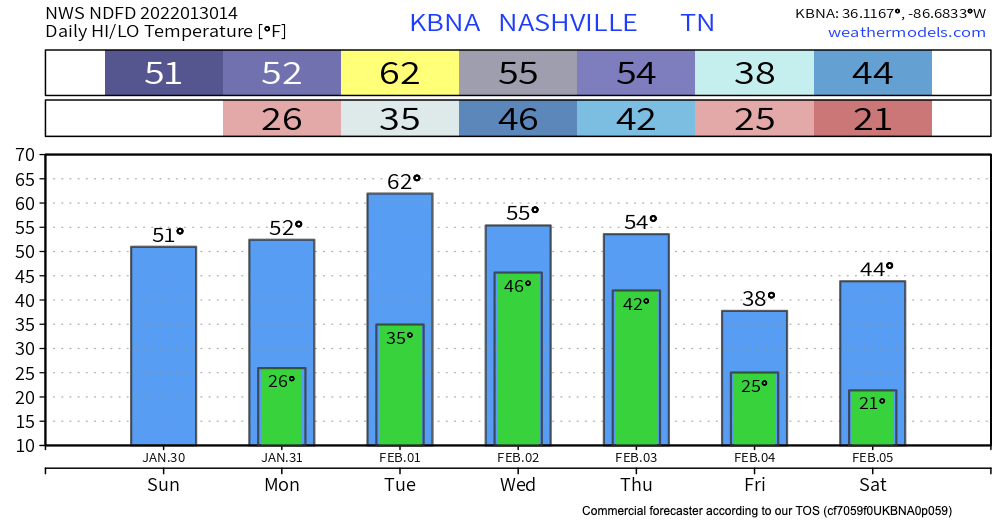
WARMER
High temps in the 30’s are a thing of the past. We should reach into the lower 50’s today.

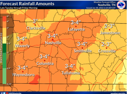
HEAVY RAIN
Rain begins Wednesday and runs through most of the day Thursday. Here’s the GFS model:
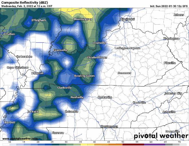
It’s a lot of rain. Heaviest from Wednesday afternoon overnight into Thursday morning. We can probably handle 3″ to 4″ of rain if we can spread it out over 24+ hours. So not overly worried about flooding but it is a low key concern, something to watch starting Monday night when the higher res models get a look at it.
WINTRY PRECIP
Our warm, wet earth will get suddenly cold Thursday late afternoon/night as the precip moves east. But will we get cold enough? The Euro thinks we could see wintry mix/sleet, or even snow (see below).
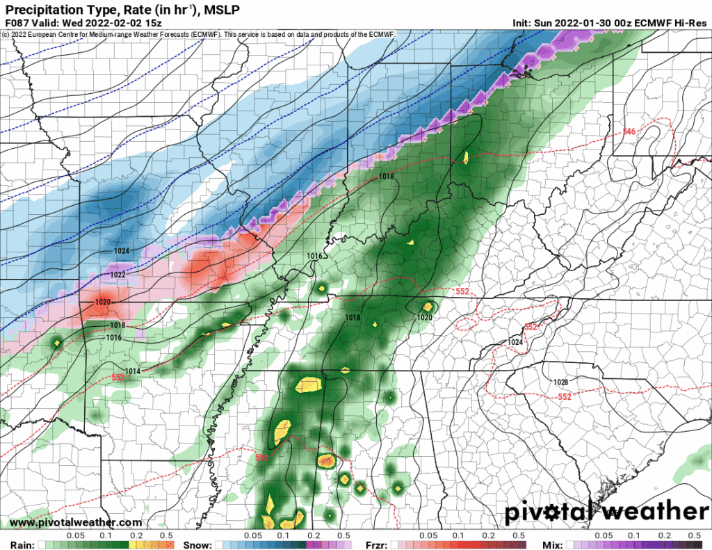
Models disagree. If the big red L goes further north it means only rain for us. If the big red L goes further south we’ll be on the cold side and can get some wintry precip or snow. Sunday model resolution for Thursday is poor, but the pattern puts travel interruption potential on the table late Thursday. Here’s a model comparison GIF of four models indicating the general pattern suggestive of a rain to sleet/snow event.
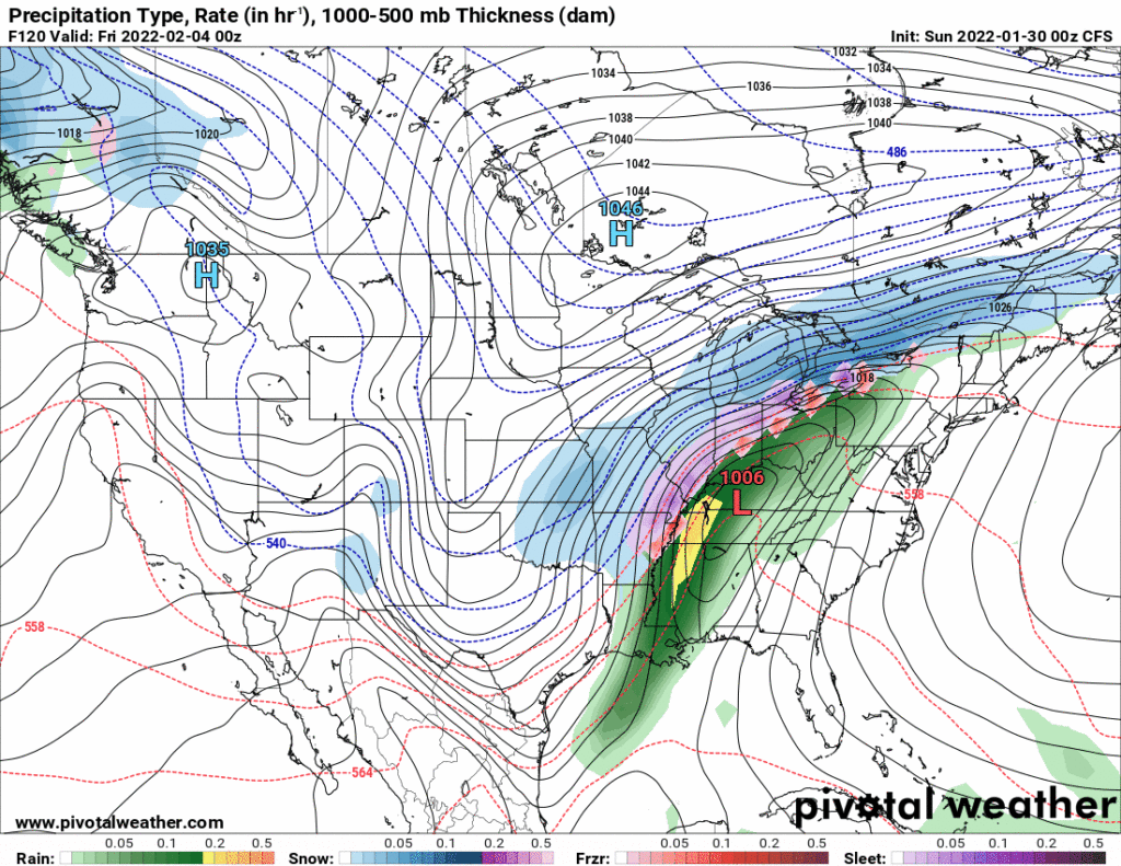
There is no sense of accumulation in this data. The earth will be warm and wet and the wind will be howling. Could see anything from a Just Rain or low-output wintry precip splat:melt event (low end) to an accumulating smorgasbord of ice/snow (high end). Typically snow fans end up disappointed but if we get a robust red L running to our south and southeast, yet another snowmess is possible. Three of the four models above have the low in the general area favorable for wintry precip, but these models have been inconsistent and have a poor track record predicting local events/timing.
More tomorrow.
Quick References:
Weather changes constantly.
Follow @NashSevereWx on Twitter for any changes to this forecast.
Live coverage during tornado and severe thunderstorm warnings:
Look good.
Support the mission.
We are 100% community supported. No ads. No subscription fees. Keep it free for everyone.
Quick References:
Weather changes constantly.
Follow @NashSevereWx on Twitter for any changes to this forecast.
Live coverage during tornado and severe thunderstorm warnings:
Look good.
Support the mission.
We are 100% community supported. No ads. No subscription fees. Keep it free for everyone.
Categories: Forecast Blogs (Legacy)
You must be logged in to post a comment.