
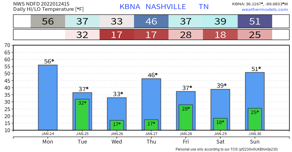
Today will be the warmest day we will see for a while.

After reaching the mid to upper 50’s today, we won’t see temps above the mid 40’s until Sunday. A cold front moves through early Tuesday morning bringing cooler temperatures. Overnight lows past Tuesday won’t get above freezing.
Flurries No-More Tomorrow Morning
Models don’t have precipitation from a frontal passage in our area anymore. Today’s 12z run of the HRRR model removed any rain, splat, or flurries from dipping down into middle Tennessee tomorrow morning. Euro and GFS have stuck with no moisture. NWS doubts a ton of moisture coming with this system. If anything pops up, we’ll let you know. .
Next Weather-Maker: Friday
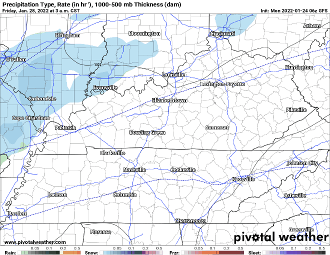
Next chance for any precipitation comes Friday morning. Euro and GFS have us getting a dusting of the “s-word” dun dun dun. Nothing to freak out about and raid the grocery stores. There is still uncertainty in the models as it is a ways out.
GFS below has our dusting coming in right before noon and out of our area by mid afternoon.
Euro model below has the light dusting skirting by early Friday morning and out of the area by mid morning.
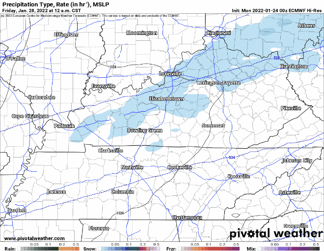
Both agree that any precipitation will be light and likely inconsequential. Stay up to date on the existence, timing, and intensity of this maybe event as we get closer to Friday.
Quick References:
Weather changes constantly.
Follow @NashSevereWx on Twitter for any changes to this forecast.
Live coverage during tornado and severe thunderstorm warnings:
Look good.
Support the mission.
We are 100% community supported. No ads. No subscription fees. Keep it free for everyone.
Categories: Forecast Blogs (Legacy)
You must be logged in to post a comment.