
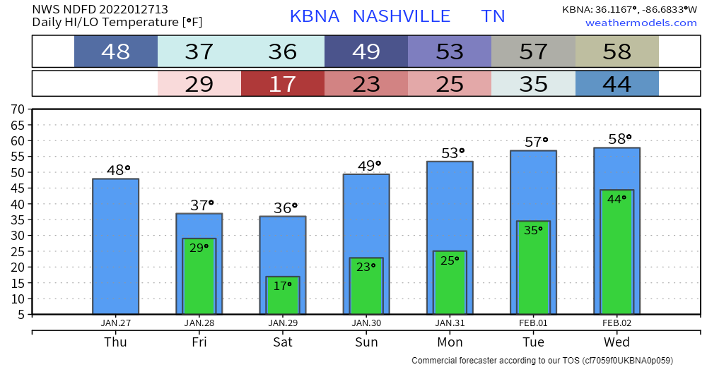
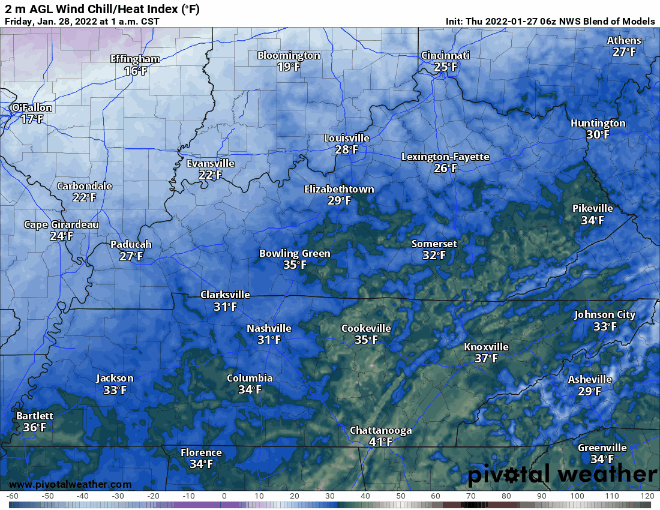
Pretty average day for January temp-wise with highs in the upper 40s. More cloudiness throughout the day ahead of tonight’s cold front. And then temps drop back down tomorrow. Wind chill looks no fun:
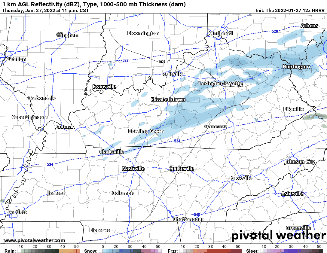
There’s a chance for light snow Friday. Not much accumulation is expected. A dusting is the best way to put it. Not the kind to put a kink in your plans.
HRRR thinks snow for us from midnight to sunrise tomorrow. Some isolated flurries possible throughout the rest of the day:
Brace for cold the next couple days. Much more mild next week with a warming trend kicking off on Sunday. Refer to twitter for any updates on the “dusting”.
Quick References:
Weather changes constantly.
Follow @NashSevereWx on Twitter for any changes to this forecast.
Live coverage during tornado and severe thunderstorm warnings:
Look good.
Support the mission.
We are 100% community supported. No ads. No subscription fees. Keep it free for everyone.
Categories: Forecast Blogs (Legacy)
You must be logged in to post a comment.