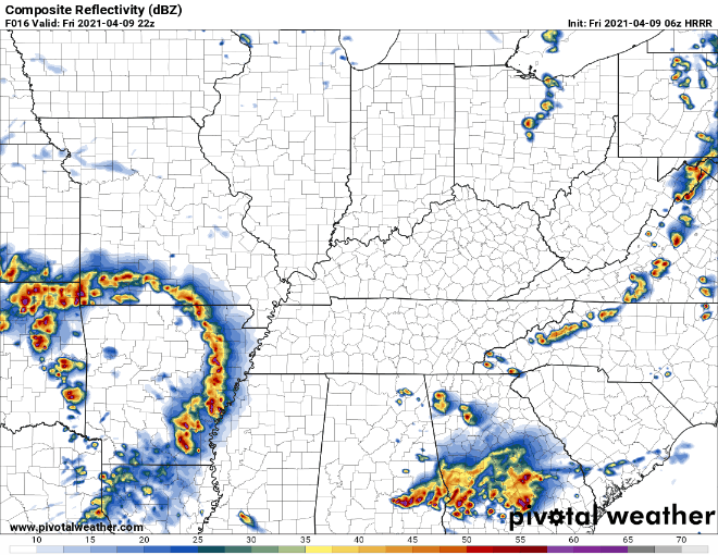
Storms last night weren’t as strong as we thought they could’ve been… be thankful.
Areas to our south weren’t as lucky…
Back to Tennessee
Rain that we experienced overnight and this morning has shifted east for the most part.
Perfect spring weather persists Tuesday.
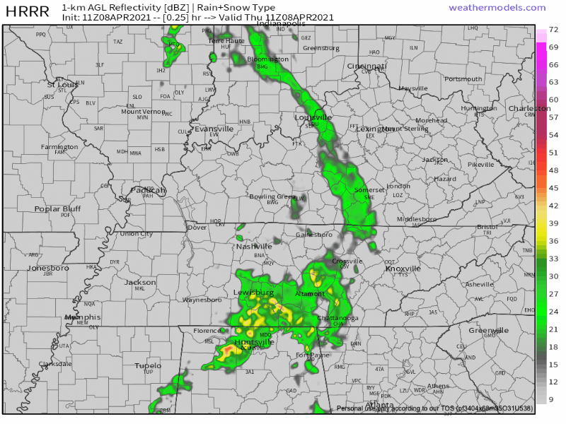
Most of the day Wednesday should be dry. The bulk of the activity will come during the overnight hours Wednesday Night -early Thursday Morning
HRRR Model shows a weakening line of showers moving entering our western communities around midnight Wednesday night, with most of the precip ending before sunrise Thursday.
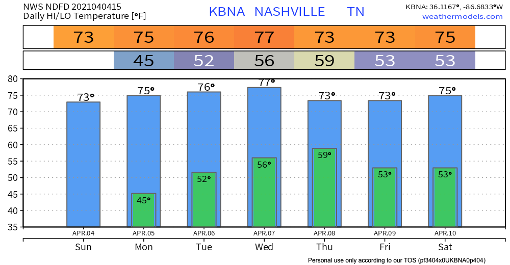
Sunshine and a warmup through the mid-week.
Our next chance of showers and thunderstorms arrives Wednesday night and continues Thursday.
The approaching storm system presents some severe risk for Arkansas and West Tennessee. Severe is unlikely for us. The system appears to weaken a bit and become just a rain event with low-powered thunderstorms by the time it gets here. ETA most likely very late Wednesday into Thursday morning. Timing remains iffy, though, because hi-res models are not yet in range.
Happy spr-winter, the weird in-between season that only Nashville experiences.
(Side note: When you write about the weather, you also have the ability to create fake seasons.)
We will be warmer than yesterday, but “warm” is a relative term. Our high temperature is expected to reach about 55º. The sun will be out shining all day!