“This is an evolving forecast that will likely change over the next 24-36 hours.” –NWS-Nashville.
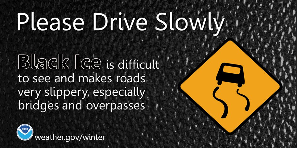
Saturday night – Sunday morning, there may still be lingering slick spots on bridges and overpasses. Drizzle on windshields means black ice on roads.
Bridges, overpasses, and elevated surfaces may be slick.
There is a lot of elevation variation throughout Williamson and Davidson counties, so it’s hard to say if your street specifically will have black ice. The safe thing is to assume that your street has slick spots. Then maybe you will be pleasantly surprised.
Rain ended after lunch. Instead of dry weather and a stiff wind, we got a steady drizzle for several hours.
Drizzle wet the streets.
Temps are dropping and should reach freezing everywhere in Davidson and Williamson Counties tonight. Black ice will form in spots, regardless of elevation. Many places will drop to 30°, some may get colder.
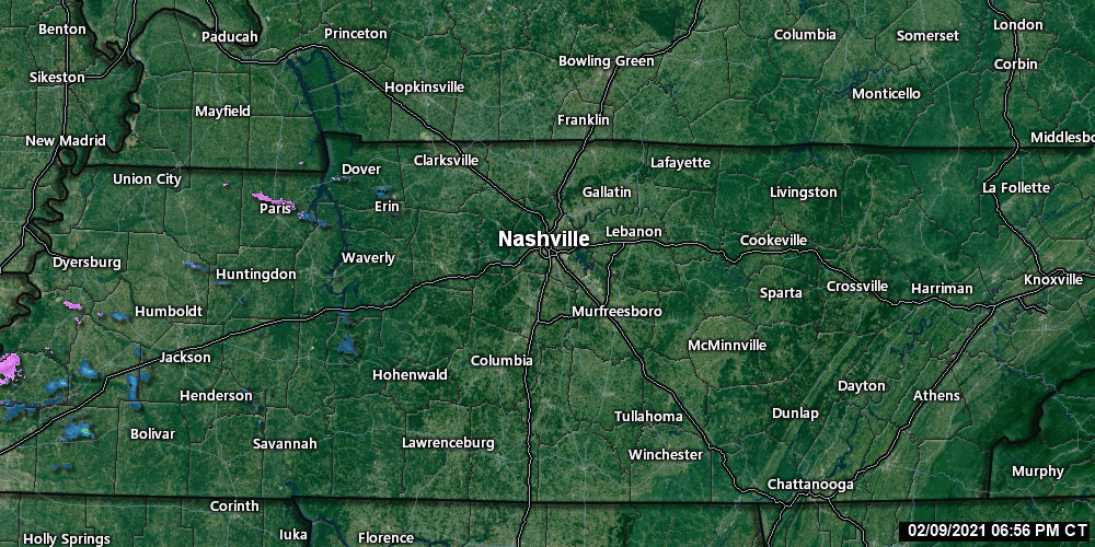
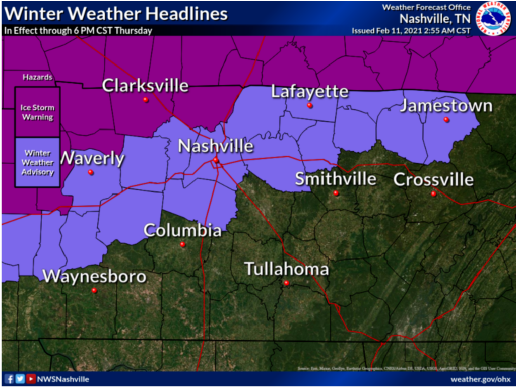
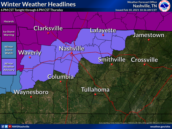
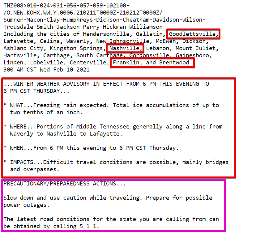
A Winter Weather Advisory is in effect from NOW until 6pm for the possibility of freezing rain accumulations.
Impacts so far have been on vegetation/elevated surfaces on the hills and ridges in both counties. The chance of seeing more widespread icing on outdoor objects increases once you go up into Fairview or Joelton.
Overnight, the National Weather Service issued a Winter Weather Advisory for both counties for the possibility of freezing rain. This will go into effect at 6pm tonight through 6 pm Thursday.
It is different from sleet. Sleet is defined as a partially melted snowflake that will freeze before reaching the surface in the form of an ice pellet.
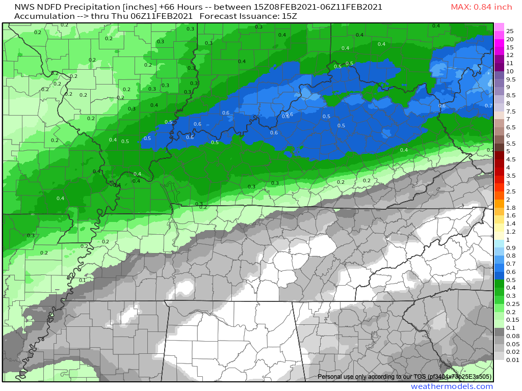
A drizzle or two is possible Tuesday and Wednesday but most of the precip should pass north and northwest of us. Below is the forecast for total rainfall Tuesday through Wednesday night at midnight:
A heavier, steady rain event is expected here Thursday, pushed along by a cold front. It’ll be a cold rain.