

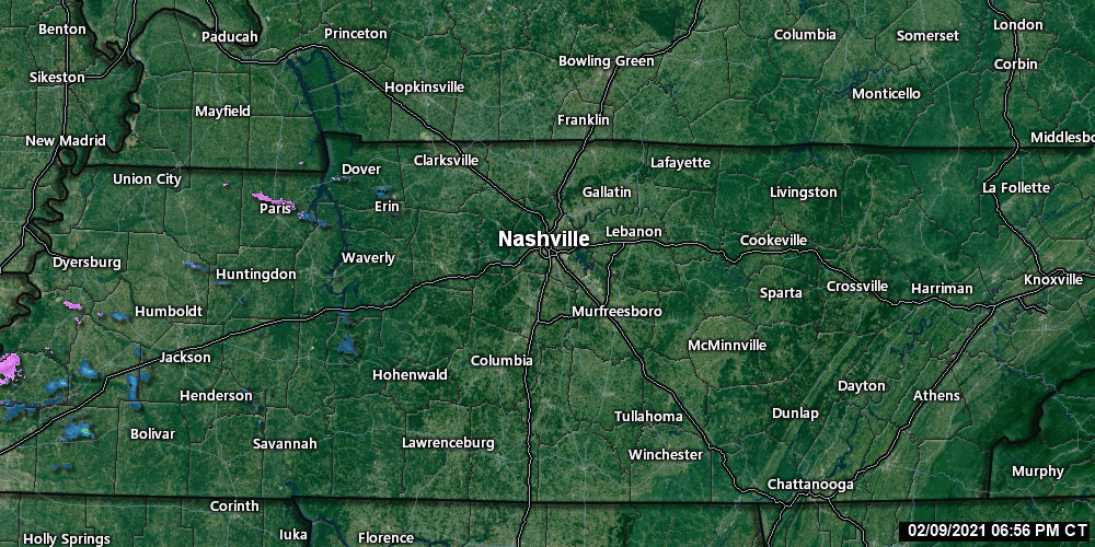
At 7:34 PM Tuesday night light precip crept into West Tennessee. That blue precip is rain, the pink is frozen precip.
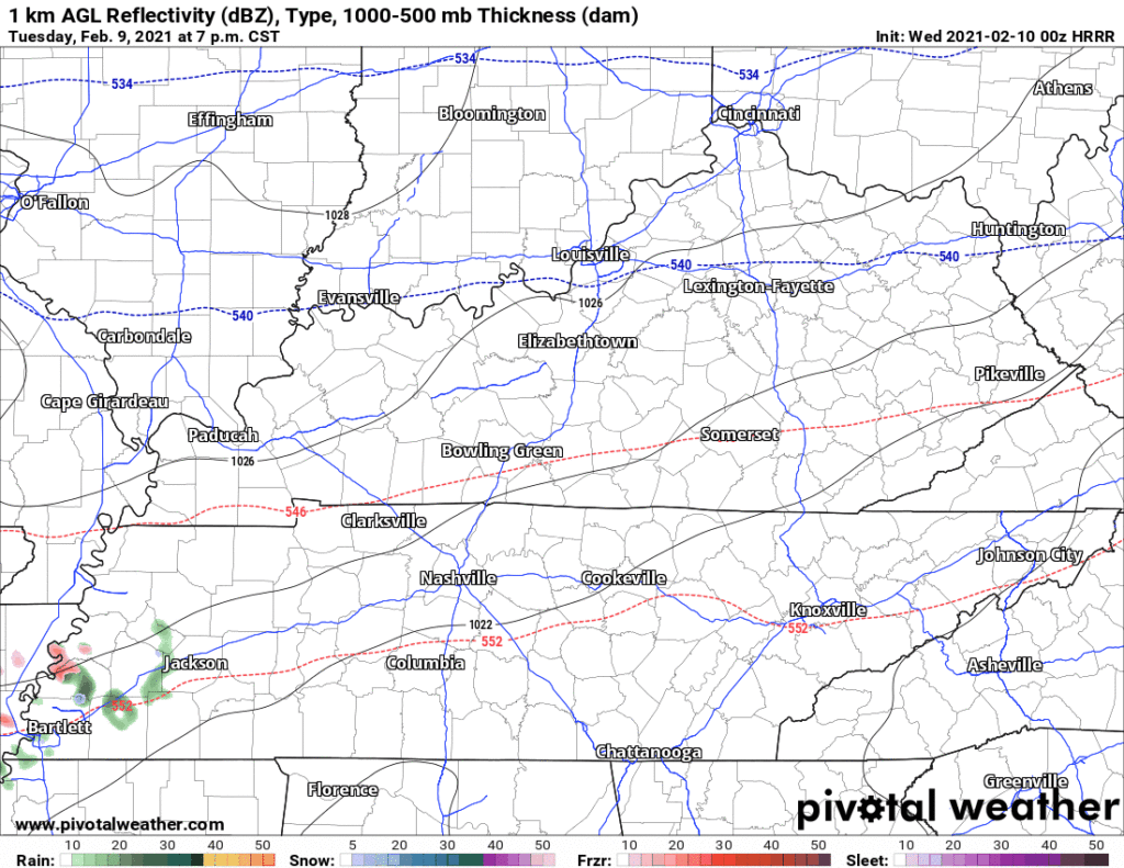
That rain will spread into west and middle Tennessee all day Wednesday. We should be in the “just rain” zone for most of the day Wednesday.
Those to our north and northwest will be dealing with an ice storm. There NWS posted a watch and a warning:

Freezing Rain event.
Expected to begin around or after midnight Wednesday night, and continue through the day Thursday. The area of freezing rain will creep slowly south, inching closer to us.
We not talking about snow. Not sleet (sleet is that Sonic ice looking stuff). We’re talking about good old fashioned rain that falls through warmer air and splats and sits on the ground. A shallow layer of subfreezing air covers the surface and freezes the rain, kinda like ice at a rink. It’s “freezing rain.”
Will the line between an ice event — impacting travel — cover us, or will it stop just short and give us a cold rain?
That. Is. The. Question.
The HRRR model thinks the rain and freezing rain line will straddle Nashville from just after midnight Wednesday night until 7 AM Thursday morning:
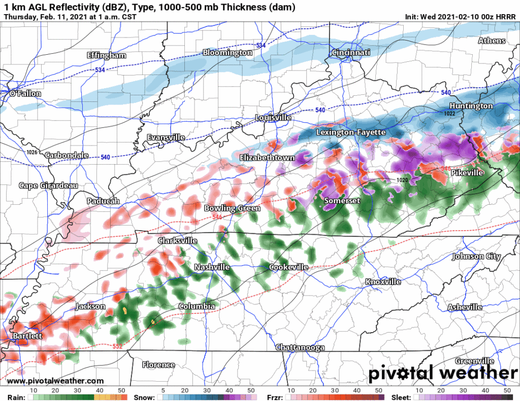
Notice the colors dancing from rain that freezes to rain that doesn’t.
By noon Thursday, various models think the line between icing and no-ice will cut across, or close to, Nashville. Here’s the Euro, GFS, HRRR, NAM, and NBM showing icing through noon Thursday:
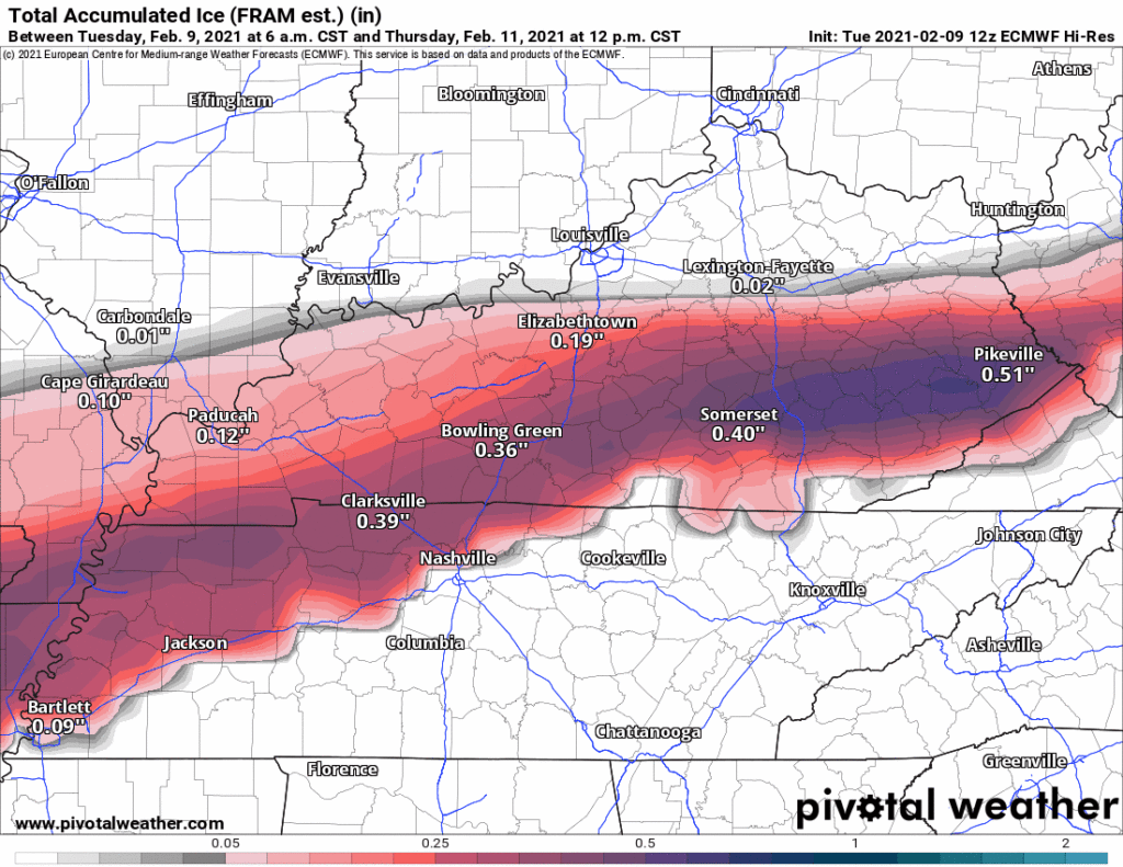
Notice there seems to be consensus the freezing line will move into Joelton.
There is some concern the GFS and Euro models are too warm at the surface, and it will actually be colder. however, the higher resolution NAM and HRRR model line up pretty well with the GFS and Euro. There is decent agreement here. Obviously there is concern the GFS verifies and a close to 1/4″ of ice hits Nashville Thursday morning. That would paralyze travel in the city. But the GFS is the outlier in this dataset.
Now for the “so what” part:
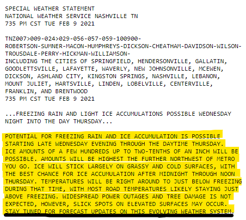
NWS Special Weather Statement
Consider these four things.
Location matters.
Those NW in Nashville are at a higher risk of ice, or a higher risk of more ice, than those southeast. Therefore Joelton is the most susceptible place for impacts. Nolensville less susceptible.
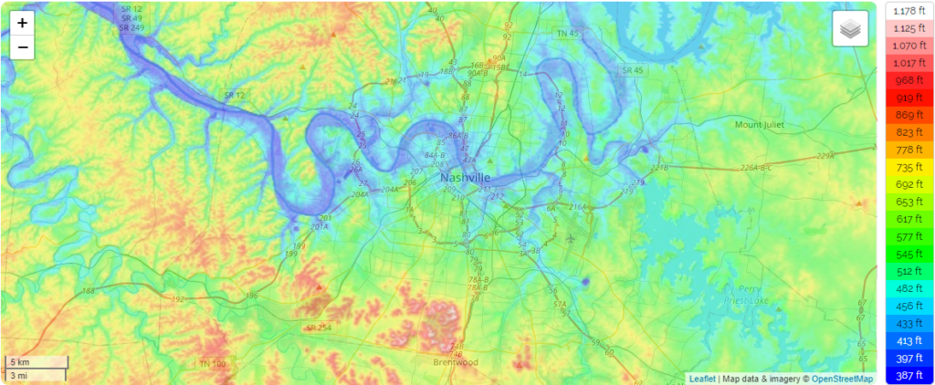
Elevation matters.
Low elevation places are in blue and green below. Low elevation areas are usually a bit warmer than the areas at higher elevation in yellow and red.
If you’re in the yellow and red areas, you are more likely to see ice, or see more ice, than those in blue and green, which are in the lower elevations.
Nashvillle/Davidson County:
Williamson County:
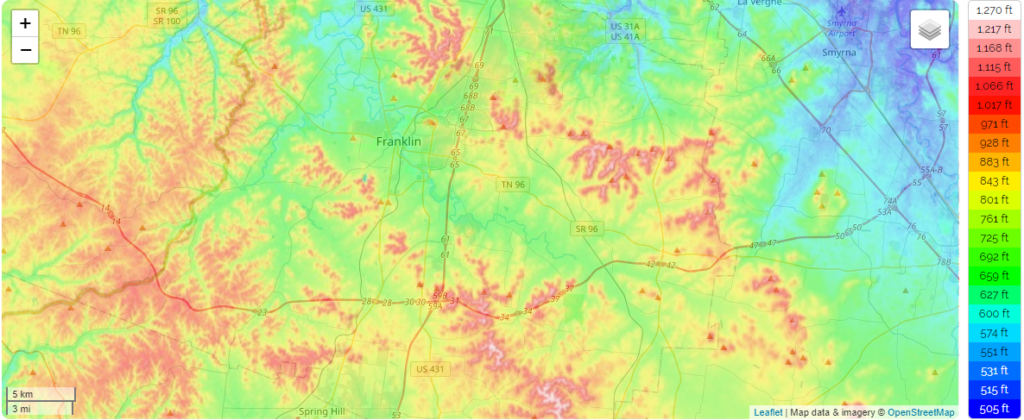
Joelton, Percy Warner, Brentwood/Radnor Lake, and the various hills in Will Co, all may see icing where others do not. My main concern is Joelton along I-24. Also Fairview, and along I-840 in Fairview. Those locations are already at high elevation, and with several exposed bridges and overpasses, an icing event in the dark in a low trafficked area is a disaster recipe. Travel will likely be discouraged there.
Road Type matters.
Most roads will be too warm to hold ice. But bridges, overpasses, and NW locations at elevation will freeze faster. Why? The cold air runs up underneath them. Cools them faster.
What’s Happening Thursday Afternoon
The high is expected to be 36°. We need to make it there to melt any ice. But if this event turns into an efficient icemaker, it’ll be because temps came in colder than forecast. Which means we won’t hit our high, and the ice event could linger into Thursday night. That’s not the forecast right now but you should plan for that possibility.
Also consider the wind, blowing 10-11 MPH from the north. Wind plus ice is a bad combination, because anything frozen will now sway a little. Branches break. It’s also going to be supercold with the wind chill. Doubt anyone will want to be outside Thursday.
More tomorrow.
Categories: Forecast Blogs (Legacy)
You must be logged in to post a comment.